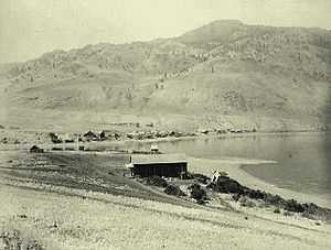
Savona, British Columbia

Savona (originally Savona's Ferry) is a small community located at the west end of Kamloops Lake, where the Thompson River exits it. It is approximately halfway between Kamloops and Cache Creek along the Trans-Canada Highway. The surrounding the community is semi-arid grasslands and hills, which support cattle ranching and agriculture. It has a population of about 650.
It was a stagecoach stop, the location of a ferry across the Thompson River, and later moved to take advantage of the Canadian Pacific Railway built on the south side of the river.
History
Savona was originally located on the north shore of Kamloops Lake, where it was the end of the stagecoach line from Cache Creek on the Cariboo Wagon Road (later improved as the Trans-Canada Highway). Originally passengers continuing on to the goldfields of the Big Bend of the Columbia River had to take the steamboat up the lake to Kamloops and the Shuswap Country. A man named Savona started a ferry across the Thompson River at this location. A road was later built along the south side of Kamloops Lake to Kamloops, British Columbia.
In 1884 Savona was designated as the eastern end of Andrew Onderdonk's contract for building the Canadian Pacific Railway (CPR) for the Canadian government. Onderdonk continued building eastward under a CPR contract. As the railway was built on the south side of the river, most of the houses were pulled across the lake on the ice, moving the community to where it is today. In 1915, the Canadian Northern Pacific Railway, now part of Canadian National Railway, was built along the north side of Kamloops Lake.
The Savona area is the traditional territory of the Skeetchestn Indian Band. Their main reserve, Skeetchestn Indian Reserve, comprising 7975.70 ha., is located on the north side of the Thompson River west of Savona, and reaching up the valley of the Deadman River.[1]
References
External links
- "Savona, British Columbia" on britishcolumbia.com
- An aerial view of Savona and Kamloops Lake from Randall & Kat's Flying Photos
Coordinates: 50°45′N 120°51′W / 50.750°N 120.850°W