Saulzoir
From Wikipedia, the free encyclopedia
| Saulzoir | ||
|---|---|---|
_%C3%A9glise_fa%C3%A7ade.JPG) | ||
| ||
 Saulzoir | ||
|
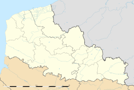
Location within Nord-Pas-de-Calais region  Saulzoir | ||
| Coordinates: 50°14′29″N 3°26′41″E / 50.2414°N 3.4447°ECoordinates: 50°14′29″N 3°26′41″E / 50.2414°N 3.4447°E | ||
| Country | France | |
| Region | Nord-Pas-de-Calais | |
| Department | Nord | |
| Arrondissement | Cambrai | |
| Canton | Solesmes | |
| Intercommunality | Pays Solesmois | |
| Government | ||
| • Mayor (2008–2014) | Germaine Forgeois | |
| Area | ||
| • Land1 | 10.1 km2 (3.9 sq mi) | |
| Population (1999) | ||
| • Population2 | 1,706 | |
| • Population2 Density | 170/km2 (440/sq mi) | |
| INSEE/Postal code | 59558 / 59227 | |
| Elevation |
43–88 m (141–289 ft) (avg. 65.5 m or 215 ft) | |
|
1 French Land Register data, which excludes lakes, ponds, glaciers > 1 km² (0.386 sq mi or 247 acres) and river estuaries. 2 Population without double counting: residents of multiple communes (e.g., students and military personnel) only counted once. | ||
Saulzoir is a commune in the Nord department in northern France.
It is situated on the Selle River and has about 1700 inhabitants (1999 census). The town was the site of Julius Caesar's battle against the Nervians.[1]
Heraldry
_Nord-France.svg.png) |
The arms of Saulzoir are blazoned : |
See also
References
- ↑ Pierre Turquin ("La Bataille de la Selle (du Sabis) en l' An 57 avant J.-C." in Les Études Classiques 23/2 (1955), 113-156) has proved beyond reasonable doubt that the battle was fought at the River Selle.
This article is issued from Wikipedia. The text is available under the Creative Commons Attribution/Share Alike; additional terms may apply for the media files.