Santa Cristina d'Aro
From Wikipedia, the free encyclopedia
| Santa Cristina d'Aro | |
|---|---|
| Municipality | |
 | |
 Santa Cristina d'Aro | |
| Coordinates: 41°48′53″N 3°0′4″E / 41.81472°N 3.00111°E | |
| Country | Spain |
| Autonomous community | Catalonia |
| Province | Girona |
| Comarca | Baix Empordà |
| Government | |
| • Mayor | Ricard Herrero i Suñer |
| Area | |
| • Total | 67.58 km2 (26.09 sq mi) |
| Elevation | 30 m (100 ft) |
| Population (2009) | |
| • Total | 5,017 |
| • Density | 74/km2 (190/sq mi) |
| Time zone | CET (UTC+1) |
| • Summer (DST) | CEST (UTC+2) |
| Postal code | 17246 |
| Website | Official website |
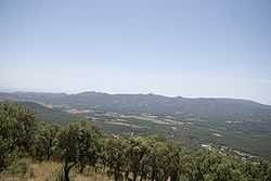
Santa Cristina d'Aro (Catalan pronunciation: [ˈsantə kɾisˈtinə ˈðaɾu]) is a small town in the Aro valley at the junction of the road from Girona/Barcelona to Sant Feliu de Guíxols and Palamós. It is home to a number of workers in the nearby holiday resorts. The Costa Brava golf course is on the outskirts of the town.
The municipality includes the medieval mountain top village of Romanyà de la Selva.
External links
- Official website (Catalan)
This article is issued from Wikipedia. The text is available under the Creative Commons Attribution/Share Alike; additional terms may apply for the media files.