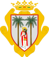
Santa Úrsula
| Santa Úrsula | |||
|---|---|---|---|
| Municipality | |||
.jpg) | |||
| |||
 Santa Úrsula | |||
 Santa Úrsula | |||
| Coordinates: 28°25′31″N 16°29′30″W / 28.42528°N 16.49167°W | |||
| Country |
| ||
| Autonomous Community |
| ||
| Province | Tenerife | ||
| Island | Tenerife | ||
| Government | |||
| • Mayor | Milagros Pérez de León (PP) | ||
| Area | |||
| • Total | 22.6 km2 (8.7 sq mi) | ||
| Elevation(AMSL) | 290 m (950 ft) | ||
| Population (2012) | |||
| • Total | 14,374 | ||
| • Density | 640/km2 (1,600/sq mi) | ||
| Time zone | CET (UTC+0) | ||
| • Summer (DST) | CEST (GMT +1) (UTC+1) | ||
| Postal code | 38390 | ||
| Area code(s) | +34 (Spain) + 922 (Tenerife) | ||
| Website | www.santaursula.es | ||
Santa Úrsula (named after Saint Ursula) is a municipality located on the north coast of Tenerife. It is located 9 km E of Puerto de la Cruz, about 29 km SSW of the island's capital, Santa Cruz de Tenerife (City), NE of Los Cristianos and Las Américas of Arona and west of the Tenerife North Airport.
The population is 11,959 (ISTAC, 2003), its density is 529.39/km² and the area is 22.59 km². The elevation is 290 m. Santa Úrsula is linked with the TF5 Motorway and the old highway linking Icod de los Vinos and the capital. Farmlands are in the valley areas and within the Atlantic, urban areas covers much of the area and the mountain and the hills are to the south. Its climate is vegetation.
Much of the area were made up of farmlands, most of the farmlands are urbanized while most of the population shifted from rural to urban and tourism. The population are mainly urban today and its industry are agriculture and tourism.
Historical population
| Year | Population | Change |
|---|---|---|
| 1991 | 8,599 | - |
| 1996 | 9,591 | - |
| 2001 | 10,803 | 586.63/km² |
| 2002 | 11,571 | - |
| 2003 | 11,959 | 529.39/km² |
| 2004 | 12, 237 | 538.36/km² |
Other
Santa Úrsula has schools, a few lyceums, a gymnasia, churches, a post office and a few squares plazas.
See also
| Northwest: Atlantic Ocean | North: Atlantic Ocean | Northeast: La Victoria de Acentejo |
| West: La Orotava | Santa Úrsula | East: Arafo |
| South: La Orotava and Arafo | Southeast: Arafo |
Coordinates: 28°25′0″N 16°28′0″W / 28.41667°N 16.46667°W

