Salzburg, Germany
| Salzburg | ||
|---|---|---|
| ||
 Salzburg | ||
Location of Salzburg within Westerwaldkreis district 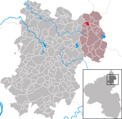 | ||
| Coordinates: 50°40′5″N 8°2′53″E / 50.66806°N 8.04806°ECoordinates: 50°40′5″N 8°2′53″E / 50.66806°N 8.04806°E | ||
| Country | Germany | |
| State | Rhineland-Palatinate | |
| District | Westerwaldkreis | |
| Municipal assoc. | Rennerod | |
| Government | ||
| • Mayor | Harald Menk | |
| Area | ||
| • Total | 2.30 km2 (0.89 sq mi) | |
| Elevation | 600 m (2,000 ft) | |
| Population (2012-12-31)[1] | ||
| • Total | 238 | |
| • Density | 100/km2 (270/sq mi) | |
| Time zone | CET/CEST (UTC+1/+2) | |
| Postal codes | 56479 | |
| Dialling codes | 02667 | |
| Vehicle registration | WW | |
| Website | www.rennerod.de | |

Salzburg is an Ortsgemeinde – a community belonging to a Verbandsgemeinde – in the Westerwaldkreis in Rhineland-Palatinate, Germany.
Geography
Location
The community lies in the Westerwald between Siegen and Limburg. Salzburg belongs to the Verbandsgemeinde of Rennerod, a kind of collective municipality. Its seat is in the like-named town.
History
About 1300, Salzburg had its first documentary mention as Salberg.
Politics
Community council
The council is made up of 6 council members who were elected in a majority vote in a municipal election on 13 June 2004.
Economy and infrastructure
Transport
Right near the community, two Bundesstraßen, 54 linking Limburg an der Lahn with Siegen, and 414 leading from Hohenroth to Hachenburg cross each other. The nearest Autobahn interchange is Herborn on the A 45 (Dortmund–Hanau), some 20 km away. The nearest InterCityExpress stop is the railway station at Montabaur on the Cologne-Frankfurt high-speed rail line.
References
- ↑ "Bevölkerung der Gemeinden am 31.12.2012". Statistisches Bundesamt (in German). 2013.
External links
- This article incorporates information from the German Wikipedia.