Sainte-Hélène-de-Bagot, Quebec
From Wikipedia, the free encyclopedia
| Sainte-Hélène-de-Bagot | |
|---|---|
| Municipality | |
 | |
 | |
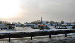
 Sainte-Hélène-de-Bagot | |
| Coordinates: 45°44′N 72°44′W / 45.733°N 72.733°WCoordinates: 45°44′N 72°44′W / 45.733°N 72.733°W[1] | |
| Country |
|
| Province |
|
| Region | Montérégie |
| RCM | Les Maskoutains |
| Constituted | July 9, 1977 |
| Government[2][3] | |
| • Mayor | Yves Petit |
| • Federal riding | Saint-Hyacinthe—Bagot |
| • Prov. riding | Johnson |
| Area[2][4] | |
| • Total | 71.40 km2 (27.57 sq mi) |
| • Land | 73.42 km2 (28.35 sq mi) |
|
There is an apparent contradiction between two authoritative sources | |
| Population (2011)[4] | |
| • Total | 1,637 |
| • Density | 22.3/km2 (58/sq mi) |
| • Pop 2006-2011 |
|
| • Dwellings | 701 |
| Time zone | EST (UTC−5) |
| • Summer (DST) | EDT (UTC−4) |
| Postal code(s) | J0H 1M0 |
| Area code(s) | 450 and 579 |
| Website |
www.sainte helenedebagot.com |
Sainte-Hélène-de-Bagot is a municipality in southwestern Quebec, Canada in the Regional County Municipality of Les Maskoutains. The population as of the Canada 2011 Census was 1,637.
Demographics
Population
Population trend:[5]
| Census | Population | Change (%) |
|---|---|---|
| 2011 | 1,637 | |
| 2006 | 1,446 | |
| 2001 | 1,521 | |
| 1996 | 1,495 | |
| 1991 | 1,478 | N/A |
Language
Mother tongue language (2006)[6]
| Language | Population | Pct (%) |
|---|---|---|
| French only | 1,385 | 96.18% |
| English only | 0 | 0.00% |
| Both English and French | 0 | 0.00% |
| Other languages | 55 | 3.82% |
See also
References
- ↑ Reference number 76207 of the Commission de toponymie du Québec (French)
- ↑ 2.0 2.1 Ministère des Affaires municipales, des Régions et de l'Occupation du territoire: Sainte-Hélène-de-Bagot
- ↑ Parliament of Canada Federal Riding History: SAINT-HYACINTHE--BAGOT (Quebec)
- ↑ 4.0 4.1 2011 Statistics Canada Census Profile: Sainte-Hélène-de-Bagot, Quebec
- ↑ Statistics Canada: 1996, 2001, 2006, 2011 census
- ↑ 2006 Statistics Canada Community Profile: Sainte-Hélène-de-Bagot, Quebec
 |
Saint-Hugues | Saint-Eugène | | |
| Saint-Simon | |
Saint-Nazaire-d'Acton | ||
| ||||
| | ||||
| Saint-Liboire | Upton |
| |||||||||||||||||
This article is issued from Wikipedia. The text is available under the Creative Commons Attribution/Share Alike; additional terms may apply for the media files.