Saint-Quentin, New Brunswick
| Saint-Quentin | ||
|---|---|---|
| Town | ||
 | ||
| ||
| Nickname(s): The maple syrup capital of Atlantic Canada | ||
 | ||
| Coordinates: 47°30′42″N 67°23′25″W / 47.51175°N 67.39014°W | ||
| Country |
| |
| Province |
| |
| County | Restigouche | |
| Parish | Saint-Quentin | |
| Founded | 1910 | |
| District Status | 1947 | |
| Town Status | 1996 | |
| Electoral Districts Federal |
Madawaska—Restigouche | |
| Provincial | Restigouche-La-Vallée | |
| Government[1] | ||
| • Type | Saint-Quentin Town Council | |
| • Mayor | Robert Beaulieu | |
| • Deputy Mayor | Rita Gagnon | |
| • Councillors |
List of Members
| |
| Area[2] | ||
| • Total | 4.30 km2 (1.66 sq mi) | |
| Elevation | 283 m (928 ft) | |
| Population (2011)[2][3] | ||
| • Total | 2,095 | |
| • Density | 486.7/km2 (1,261/sq mi) | |
| • Change 2006-11 |
| |
| Time zone | AST (UTC-4) | |
| • Summer (DST) | ADT (UTC-3) | |
| Postal code(s) | E8A | |
| Area code(s) | 506 | |
| Dwellings | 972 | |
| Median Income* | $37,547 CDN | |
| NTS Map | 021O11 | |
| GNBC Code | DAEGG | |
| Access Routes |
| |
| Website | saintquentin.nb.ca | |
| ||
Saint-Quentin is a Canadian town in Restigouche County, New Brunswick.[4]
Saint-Quentin is located in the Appalachian Mountains, 50 kilometres west of Mount Carleton, the province's highest elevation point.
The population is 2,095 as of the 2011 census. The town has undergone depopulation in recent years with a 6.9% decrease in population since 2006. The majority of residents are francophone.
History
In 1897, the Restigouche and Western Railway Company embarked on a project to build a railway linking Campbellton and St-Léonard, two towns in northwestern New Brunswick. The progress of its construction sent workers deep into the forest. In 1909, Simon Gallant, an Acadian working as a blacksmith, decided to settle his family by a stream near Five Fingers where he found a stray cow.
At the same time, authorities began to worry about the emigration of Québec families to the United States and to Western Canada, resulting in a population decline. Msgr. Joseph Arthur Melanson, the largest settler and missionary in Saint-Quentin Parish, originally named Anderson Siding, launched a large program of colonization. Valuing farming and agriculture, he encouraged Acadien and Québécois families to settle in the Restigouche region of New Brunswick on the fertile lands along the length of the newly built train line.
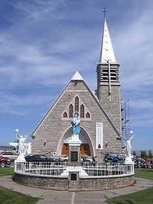
The village of Anderson Siding was founded in 1910; its first mass was held in Simon Gallant's round log cabin in the forest. The first chapel was built in 1911, its first post office in 1912, its first school in 1913, and its first church in 1918. The name Anderson Siding was changed to the present name of Saint-Quentin in 1919 in commemoration of the Canadian victory in the French town of the same name during the Battle of the Somme in the First World War. Its first hospital, Hôtel-Dieu Saint-Joseph, was built in 1947 and is still in operation today.
Saint-Quentin was incorporated as a district in 1947, as a village in 1966, and as a town in 1992.
Demographics
PopulationPopulation trend[5]
|
LanguageMother tongue language (2011)[2]
|
Industry
Logging of the area's rich forests is Saint-Quentin's largest industry. The two sawmills, Groupe Savoie and North American Forest Products, are Saint-Quentin's largest employers, employing 400 and 225 employees respectively. Agriculture is another major industry in the region near Saint-Quentin. Livestock is raised for dairy, beef and pork production, and potatoes, grain and hay are grown on the area's many farms. The production of maple syrup and other maple sugar products is the third major industry in the region; there are over 35 commercial maple plantations as well as 25 traditional sugar shacks in the area.
Tourism
Festival Western
Since 1984, Saint-Quentin has hosted the Festival Western (Western Festival) in mid-July of each year, the largest Western-themed festival of its kind in New Brunswick. Run by Le Festival Western de Saint-Quentin, Inc., it now includes rodeo, a parade, fireworks, children's activities and much more. The largest event is the "Pow-Pow", a flea market and gathering of local musicians and performers which takes place on Rue Canada, the main street of the town, which is closed to traffic for the occasion.
Old railway station
In 2005, the former railway station, which was reconstructed in its original location, reopened as a tourist centre as well as the offices of the Chamber of Commerce and the Festival Western. The route of the train tracks, which have been removed, has been transformed into a trail for walking, bicycling, and riding all-terrain vehicles and snowmobiles.
Other events and activities
- The Festival de l'Érable (Maple Festival), launched in 2004, takes place in the spring of each year, the maple sugar season, and includes tours of maple sugarbushes, shacks and refineries, as well as sawmills which process maple wood. In addition, it includes a market where vendors sell maple products, including syrup, sugar, salad dressing, and maple-flavoured alcoholic beverages.
- A Carnival d'Hiver (Winter Carnival) is held in February and comprises winter-themed activities.
- Golfing at the local golf course and riding ATVs and snowmobiles are popular activities.
Notable people
See also
References
- ↑ Government of New Brunswick website: Saint-Quentin
- ↑ 2.0 2.1 2.2 2006 Statistics Canada Community Profile: Saint-Quentin, New Brunswick
- ↑ Statistics Canada Population and dwelling counts, for Canada and census subdivisions (municipalities), 2006 and 2001 censuses - 100% data
- ↑ New Brunswick Provincial Archives - Saint-Quentin
- ↑ Statistics Canada: 1996, 2001, 2006 census
- Ville de/Town of Saint-Quentin (brochure produced by the town) Pier-Luc and Tommy Castonguay
External links
| Wikimedia Commons has media related to Saint-Quentin, New Brunswick. |
- (French) Official website
- Festival Western
 |
Rang-Dix | Rang-Douze-Nord | | |
| Rang-Sept-et-Huit | |
Five Fingers | ||
| ||||
| | ||||
| Rang-Douze-Sud | Rang-Quatorze |
| ||||||||||||||
Coordinates: 47°30′48.77″N 67°23′31.59″W / 47.5135472°N 67.3921083°W