Saint-Preuil
From Wikipedia, the free encyclopedia
| Saint-Preuil | |
|---|---|
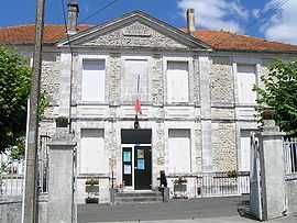 | |
 Saint-Preuil | |
|
Location within Poitou-Charentes region  Saint-Preuil | |
| Coordinates: 45°35′49″N 0°10′15″W / 45.5969°N 0.1708°WCoordinates: 45°35′49″N 0°10′15″W / 45.5969°N 0.1708°W | |
| Country | France |
| Region | Poitou-Charentes |
| Department | Charente |
| Arrondissement | Cognac |
| Canton | Segonzac |
| Intercommunality | Grande Champagne |
| Government | |
| • Mayor (2008–2014) | Huguette Desbordes |
| Area | |
| • Land1 | 12.39 km2 (4.78 sq mi) |
| Population (2008) | |
| • Population2 | 307 |
| • Population2 Density | 25/km2 (64/sq mi) |
| INSEE/Postal code | 16343 / 16130 |
| Elevation |
40–146 m (131–479 ft) (avg. 96 m or 315 ft) |
|
1 French Land Register data, which excludes lakes, ponds, glaciers > 1 km² (0.386 sq mi or 247 acres) and river estuaries. 2 Population without double counting: residents of multiple communes (e.g., students and military personnel) only counted once. | |
Saint-Preuil is a commune in the Charente department in southwestern France.
Population
| Historical population | ||
|---|---|---|
| Year | Pop. | ±% |
| 1793 | 673 | — |
| 1800 | 585 | −13.1% |
| 1806 | 611 | +4.4% |
| 1821 | 636 | +4.1% |
| 1831 | 660 | +3.8% |
| 1841 | 642 | −2.7% |
| 1846 | 658 | +2.5% |
| 1851 | 671 | +2.0% |
| 1856 | 670 | −0.1% |
| 1861 | 681 | +1.6% |
| 1866 | 646 | −5.1% |
| 1872 | 611 | −5.4% |
| 1876 | 592 | −3.1% |
| 1881 | 515 | −13.0% |
| 1886 | 468 | −9.1% |
| 1891 | 447 | −4.5% |
| 1896 | 432 | −3.4% |
| 1901 | 467 | +8.1% |
| 1906 | 510 | +9.2% |
| 1911 | 437 | −14.3% |
| 1921 | 482 | +10.3% |
| 1926 | 479 | −0.6% |
| 1931 | 496 | +3.5% |
| 1936 | 452 | −8.9% |
| 1946 | 460 | +1.8% |
| 1954 | 423 | −8.0% |
| 1962 | 410 | −3.1% |
| 1968 | 408 | −0.5% |
| 1975 | 368 | −9.8% |
| 1982 | 317 | −13.9% |
| 1990 | 288 | −9.1% |
| 1999 | 289 | +0.3% |
| 2008 | 307 | +6.2% |
Tourism
Le Relais de Saint Preuil is a luxury guest house, member of Châteaux & Hôtels Collection.[1] His owner has created an inbound wine tourism agency : Cognac Tasting Tour.[2]
See also
References
| Wikimedia Commons has media related to Saint-Preuil. |
This article is issued from Wikipedia. The text is available under the Creative Commons Attribution/Share Alike; additional terms may apply for the media files.