Saint-Jacques-de-la-Lande
From Wikipedia, the free encyclopedia
| Saint-Jacques-de-la-Lande Sant-Jakez-al-Lann | |
|---|---|
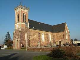 | |
 Saint-Jacques-de-la-Lande | |
|
Location within Brittany region  Saint-Jacques-de-la-Lande | |
| Coordinates: 48°03′56″N 1°43′07″W / 48.0656°N 1.7186°WCoordinates: 48°03′56″N 1°43′07″W / 48.0656°N 1.7186°W | |
| Country | France |
| Region | Brittany |
| Department | Ille-et-Vilaine |
| Arrondissement | Rennes |
| Canton | Rennes-Sud-Ouest |
| Intercommunality | Rennes Métropole |
| Government | |
| • Mayor (2008–2014) | Emmanuel Couet |
| Area | |
| • Land1 | 11.83 km2 (4.57 sq mi) |
| Population (2009) | |
| • Population2 | 10,282 |
| • Population2 Density | 870/km2 (2,300/sq mi) |
| INSEE/Postal code | 35281 / 35136 |
| Elevation | 18–47 m (59–154 ft) |
|
1 French Land Register data, which excludes lakes, ponds, glaciers > 1 km² (0.386 sq mi or 247 acres) and river estuaries. 2 Population without double counting: residents of multiple communes (e.g., students and military personnel) only counted once. | |
Saint-Jacques-de-la-Lande (Breton: Sant-Jakez-al-Lann, Gallo: Saent-Jaq) is a commune in the Ille-et-Vilaine department of Brittany in north-western France.
Population
People from Saint-Jacques-de-la-Lande are called in French Jacquolandins (also spelt Jacolandins).
| Historical population | ||
|---|---|---|
| Year | Pop. | ±% |
| 1793 | 788 | — |
| 1800 | 523 | −33.6% |
| 1806 | 731 | +39.8% |
| 1821 | 788 | +7.8% |
| 1831 | 829 | +5.2% |
| 1836 | 714 | −13.9% |
| 1841 | 772 | +8.1% |
| 1846 | 796 | +3.1% |
| 1851 | 907 | +13.9% |
| 1856 | 924 | +1.9% |
| 1861 | 901 | −2.5% |
| 1866 | 917 | +1.8% |
| 1872 | 930 | +1.4% |
| 1876 | 997 | +7.2% |
| 1881 | 1,037 | +4.0% |
| 1886 | 1,140 | +9.9% |
| 1891 | 1,170 | +2.6% |
| 1896 | 1,125 | −3.8% |
| 1901 | 1,101 | −2.1% |
| 1906 | 1,056 | −4.1% |
| 1911 | 1,082 | +2.5% |
| 1921 | 1,241 | +14.7% |
| 1926 | 1,641 | +32.2% |
| 1931 | 1,812 | +10.4% |
| 1936 | 2,080 | +14.8% |
| 1946 | 2,205 | +6.0% |
| 1954 | 3,472 | +57.5% |
| 1962 | 4,637 | +33.6% |
| 1968 | 6,587 | +42.1% |
| 1975 | 6,881 | +4.5% |
| 1982 | 6,324 | −8.1% |
| 1990 | 6,189 | −2.1% |
| 1999 | 7,582 | +22.5% |
| 2006 | 9,642 | +27.2% |
| 2007 | 7,872 | −18.4% |
| 2009 | 10,282 | +30.6% |
See also
- Rennes - Saint-Jacques Airport
- Communes of the Ille-et-Vilaine department
References
External links
| Wikimedia Commons has media related to Saint-Jacques-de-la-Lande. |
This article is issued from Wikipedia. The text is available under the Creative Commons Attribution/Share Alike; additional terms may apply for the media files.