Saint-Bonnet
From Wikipedia, the free encyclopedia
For the commune in the Charente-Maritime département, see Saint-Bonnet-sur-Gironde.
| Saint-Bonnet | |
|---|---|
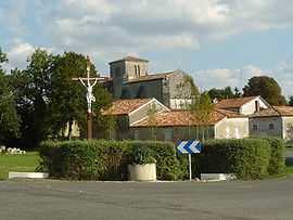 | |
 Saint-Bonnet | |
|
Location within Poitou-Charentes region  Saint-Bonnet | |
| Coordinates: 45°28′43″N 0°05′48″W / 45.4786°N 0.0967°WCoordinates: 45°28′43″N 0°05′48″W / 45.4786°N 0.0967°W | |
| Country | France |
| Region | Poitou-Charentes |
| Department | Charente |
| Arrondissement | Cognac |
| Canton | Barbezieux-Saint-Hilaire |
| Intercommunality | Sud-Charente |
| Government | |
| • Mayor (2008–2014) | Isbaelle Bureau |
| Area | |
| • Land1 | 17.77 km2 (6.86 sq mi) |
| Population (2008) | |
| • Population2 | 379 |
| • Population2 Density | 21/km2 (55/sq mi) |
| INSEE/Postal code | 16303 / 16300 |
| Elevation |
45–109 m (148–358 ft) (avg. 80 m or 260 ft) |
|
1 French Land Register data, which excludes lakes, ponds, glaciers > 1 km² (0.386 sq mi or 247 acres) and river estuaries. 2 Population without double counting: residents of multiple communes (e.g., students and military personnel) only counted once. | |
Saint-Bonnet is a commune in the Charente department in southwestern France.
Population
| Historical population | ||
|---|---|---|
| Year | Pop. | ±% |
| 1962 | 418 | — |
| 1968 | 470 | +12.4% |
| 1975 | 415 | −11.7% |
| 1982 | 369 | −11.1% |
| 1990 | 374 | +1.4% |
| 1999 | 337 | −9.9% |
| 2008 | 379 | +12.5% |
See also
References
External links
| Wikimedia Commons has media related to Saint-Bonnet (Charente). |
This article is issued from Wikipedia. The text is available under the Creative Commons Attribution/Share Alike; additional terms may apply for the media files.