Saint-Benoit-en-Diois
From Wikipedia, the free encyclopedia
| Saint-Benoit-en-Diois | |
|---|---|
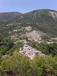 | |
 Saint-Benoit-en-Diois | |
|
Location within Rhône-Alpes region  Saint-Benoit-en-Diois | |
| Coordinates: 44°39′49″N 5°16′23″E / 44.6636°N 5.2731°ECoordinates: 44°39′49″N 5°16′23″E / 44.6636°N 5.2731°E | |
| Country | France |
| Region | Rhône-Alpes |
| Department | Drôme |
| Arrondissement | Die |
| Canton | Saillans |
| Intercommunality | Pays de Saillans |
| Government | |
| • Mayor (2008–2014) | Claude Ravelli |
| Area | |
| • Land1 | 11.17 km2 (4.31 sq mi) |
| Population (2008) | |
| • Population2 | 33 |
| • Population2 Density | 3.0/km2 (7.7/sq mi) |
| INSEE/Postal code | 26296 / 26340 |
| Elevation |
306–1,198 m (1,004–3,930 ft) (avg. 387 m or 1,270 ft) |
|
1 French Land Register data, which excludes lakes, ponds, glaciers > 1 km² (0.386 sq mi or 247 acres) and river estuaries. 2 Population without double counting: residents of multiple communes (e.g., students and military personnel) only counted once. | |
Saint-Benoit-en-Diois is a commune in the Drôme department in southeastern France.
Population
| Historical population | ||
|---|---|---|
| Year | Pop. | ±% |
| 1911 | 102 | — |
| 1962 | 39 | −61.8% |
| 1968 | 41 | +5.1% |
| 1975 | 31 | −24.4% |
| 1982 | 30 | −3.2% |
| 1990 | 29 | −3.3% |
| 1999 | 31 | +6.9% |
| 2008 | 33 | +6.5% |
See also
References
| Wikimedia Commons has media related to Saint-Benoit-en-Diois. |
This article is issued from Wikipedia. The text is available under the Creative Commons Attribution/Share Alike; additional terms may apply for the media files.