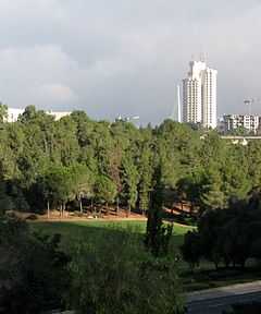
Sacher Park
From Wikipedia, the free encyclopedia
| Sacher Park | |
|---|---|
 | |
| Type | Urban park |
| Location | Jerusalem |
| Coordinates | 31°46′50″N 35°12′28″E / 31.7806°N 35.2077°ECoordinates: 31°46′50″N 35°12′28″E / 31.7806°N 35.2077°E |
| Area | 163 dunams (40 acres) |
| Created | 1963 |
| Status | Open all year |
Sacher Park (Hebrew: גן סאקר) is the largest public park in the center of Jerusalem, Israel,[1] near the neighborhoods of Kiryat Wolfson, Nachlaot and adjoining the Israel Government Complex.
The park was created in 1963, and named after Harry Sacher, a significant figure in the World Zionist Organization. The park was designed by Yahalom Tzur.[1]
References
- ↑ 1.0 1.1 עריית ירושלים: גן סאקר Jersusalem Municipality: Gan Sacher. Retrieved on July 24, 2011.
This article is issued from Wikipedia. The text is available under the Creative Commons Attribution/Share Alike; additional terms may apply for the media files.