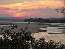
Rufiji River

The Rufiji River lies entirely within the African nation of Tanzania. The river is formed by the confluence of the Kilombero and Luwegu rivers. It is approximately 600 kilometres (370 mi) long, with its source in southwestern Tanzania and its mouth on the Indian Ocean at a point between Mafia Island called Mafia Channel. Its principal tributary is the Great Ruaha River. It is navigable for about 100 kilometres (62 mi).
The Rufiji is about 200 kilometres (120 mi) south of Dar-es-Salaam. The river's delta contains the largest mangrove forest in eastern Africa.[1]
History
A branch of ancient sea routes led down the East African coast called "Azania" by the Greeks and Romans in the 1st century CE as described in the Periplus of the Erythraean Sea (and, very probably, 澤散 Zesan in the 3rd century by the Chinese),[2] at least as far as the port known to the Romans as Rhapta, which was probably located in the delta of the Rufiji River in modern Tanzania.[3]
During the First World War, from October 1914 to July 1915, the river delta was the scene of a protracted naval operation. These were the attempts, and later achievement, by the Royal Navy to neutralize and destroy the German cruiser Konigsberg.
Basin
The catchment basin for the Rufiji River complex is 177,429 square kilometres (68,506 sq mi).[4]
| River | Area km2 |
Percentage of area |
Percentage of run-off |
|---|---|---|---|
| Great Ruaha | 83,970 | 47 | 15 |
| Kilombero | 39,990 | 23 | 62 |
| Luwegu | 26,300 | 15 | 18 |
| Rufiji (lower river) | 27,160 | 15 | 5 |
| Total | 177,429 | 100 | 100 |
References
- ↑ "Downstream and Coastal Impacts of Damming and Water Abstraction in Africa", Environmental Management, authored by Maria Snoussi, Johnson Kitheka, Yohanna Shaghude, Alioune Kane, Russell Arthurton, Martin Le Tissier, and Hassan Virji, 2007, volume 39, page 589
- ↑ Hill, John E.; (Draft English translation) (September 2004). "The Peoples of the West". from the Weilue 魏略 by Yu Huan 魚豢. University of Washington. Retrieved 2009-04-18.
- ↑ "The Egypto-Graeco-Romans and Panchea/Azania: sailing in the Erythraean Sea." Felix A. Chami. In: Society for Arabian Studies Monographs 2 Trade and Travel in the Red Sea Region. Proceedings of Red Sea Project I held in the British Museum October 2002, pp. 93-104. Edited by Paul Lunde and Alexandra Porter. ISBN 1-84171-622-7.
- ↑ Arvidson, Anders et al. (May 2009). "Initial Assessment of Socioeconomic and Environmental Risks and Opportunities of Large-scale Biofuels Production in the Rufiji District". SEKAB BioEnergy (T) Ltd. p. 23.
Further reading
- Chami, F. A. 1999. "The Early Iron Age on Mafia island and its relationship with the mainland." Azania Vol. XXXIV 1999, pp. 1–10.
- Chami, Felix A. 2002. "The Egypto-Graeco-Romans and Panchea/Azania: sailing in the Erythraean Sea." In: Society for Arabian Studies Monographs 2 Trade and Travel in the Red Sea Region. Proceedings of Red Sea Project I held in the British Museum October 2002, pp. 93–104. Edited by Paul Lunde and Alexandra Porter. ISBN 1-84171-622-7.
- Miller, J. Innes. 1969. Chapter 8: "The Cinnamon Route". In: The Spice Trade of the Roman Empire. Oxford: University Press. ISBN 0-19-814264-1
- Ray, Himanshu Prabha, ed. 1999. Archaeology of Seafaring: The Indian Ocean in the Ancient Period. Pragati Publications, Delhi.
External links
Coordinates: 8°00′S 39°20′E / 8.000°S 39.333°E
| |||||