Rudolph, Ohio
From Wikipedia, the free encyclopedia
| Rudolph, Ohio | |
|---|---|
| Census-designated place | |
 | |
 | |
| Coordinates: 41°17′52″N 83°40′11″W / 41.29778°N 83.66972°W | |
| Country | United States |
| State | Ohio |
| County | Wood |
| Area | |
| • Total | 0.8 sq mi (2.1 km2) |
| • Land | 0.8 sq mi (2.1 km2) |
| • Water | 0 sq mi (0 km2) |
| Population (2010) | |
| • Total | 458 |
| • Density | 560/sq mi (220/km2) |
| Time zone | Eastern (EST) (UTC-5) |
| • Summer (DST) | EDT (UTC-4) |
| ZIP code | 43462 |
| Area code(s) | 419 |
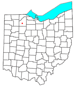
Rudolph is an unincorporated community and census-designated place (CDP) in eastern Liberty Township, Wood County, Ohio, United States. As of the 2010 census, it had a population of 458.[1] Although it is unincorporated, it has a post office, with the ZIP code of 43462.[2]
Geography
Rudolph is located at 41°17′52″N 83°40′11″W / 41.29778°N 83.66972°W and is 6 miles (10 km) south of Bowling Green, Ohio. According to the U.S. Census Bureau, the CDP has an area of 0.81 square miles (2.1 km2), all land.[1]
References
- ↑ 1.0 1.1 "Geographic Identifiers: 2010 Demographic Profile Data (G001): Rudolph CDP, Ohio". U.S. Census Bureau, American Factfinder. Retrieved January 22, 2013.
- ↑ Zip Code Lookup
| ||||||||||||||||||||||||||
Coordinates: 41°17′52″N 83°40′12″W / 41.29778°N 83.67000°W
This article is issued from Wikipedia. The text is available under the Creative Commons Attribution/Share Alike; additional terms may apply for the media files.
