Rubyvale, Queensland
From Wikipedia, the free encyclopedia
| Rubyvale Queensland | |
|---|---|
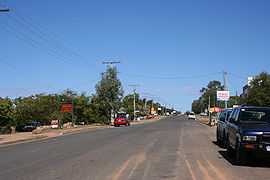 Main street of Rubyvale | |
 Rubyvale | |
| Coordinates | 23°25′S 147°41′E / 23.417°S 147.683°ECoordinates: 23°25′S 147°41′E / 23.417°S 147.683°E |
| Population | 510 (2006)[1] |
| Postcode(s) | 4702 |
| Location | |
| LGA(s) | Central Highlands Regional Council |
| State electorate(s) | Gregory |
| Federal Division(s) | Flynn |
Rubyvale is a town in the Australian state of Queensland, approximately 61 kilometres (38 mi) west of Emerald. Situated in a region called the Gemfields, sapphires are mined extensively in the area. At the 2006 census, Rubyvale had a population of 510.[1]
Rubyvale is home to a small library, a convenience store/news agents, post office, hotel and take-away bottle shop, as well as a variety of accommodation and fossicking areas. Some popular places to go fossicking are the Bob n John Mine, Bobby Dazzler and Pats Gems. The area can get up to 40'C during summer, and can reach 0°C in winter. The RSL was recently closed due to legal reasons.
Heritage listings
Rubyvale has a number of heritage-listed sites, including:
- Tomahawk Creek Huts[2]
References
- ↑ 1.0 1.1 Australian Bureau of Statistics (25 October 2007). "Rubyvale (L) (Urban Centre/Locality)". 2006 Census QuickStats. Retrieved 2009-07-21.
- ↑ "Tomahawk Creek Huts (entry 29257)". Queensland Heritage Register. Queensland Heritage Council. Retrieved 2013-07-07.
External links
| Wikimedia Commons has media related to Rubyvale, Queensland. |
| ||||||||
This article is issued from Wikipedia. The text is available under the Creative Commons Attribution/Share Alike; additional terms may apply for the media files.