Rousies
From Wikipedia, the free encyclopedia
| Rousies | |
|---|---|
 Rousies | |
|
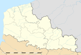
Location within Nord-Pas-de-Calais region  Rousies | |
| Coordinates: 50°16′20″N 4°00′24″E / 50.2722°N 4.0067°ECoordinates: 50°16′20″N 4°00′24″E / 50.2722°N 4.0067°E | |
| Country | France |
| Region | Nord-Pas-de-Calais |
| Department | Nord |
| Arrondissement | Avesnes-sur-Helpe |
| Canton | Maubeuge-Sud |
| Intercommunality | Lille Métropole |
| Area | |
| • Land1 | 5.79 km2 (2.24 sq mi) |
| Population (1999) | |
| • Population2 | 4,257 |
| • Population2 Density | 740/km2 (1,900/sq mi) |
| INSEE/Postal code | 59514 / 59131 |
| Elevation | 122–167 m (400–548 ft) |
|
1 French Land Register data, which excludes lakes, ponds, glaciers > 1 km² (0.386 sq mi or 247 acres) and river estuaries. 2 Population without double counting: residents of multiple communes (e.g., students and military personnel) only counted once. | |
Rousies is a commune in the Nord department in northern France.
It is located south of Maubeuge.
Heraldry
.svg.png) |
The arms of Rousies are blazoned : |
Attractions
Despite its small size, Rousies does boast a music school.
See also
References
- ↑ Arms of the families of Croÿ-Solre and Croÿ-Renty quartered
External links
- Rousies on the site of the national geographical Institute
- on the site of INSEE
- Rousies on the site of Quid
- Localization of Rousies on a chart of France and communes bordering
This article is issued from Wikipedia. The text is available under the Creative Commons Attribution/Share Alike; additional terms may apply for the media files.