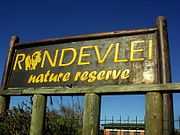
Rondevlei Nature Reserve
| Rondevlei Nature Reserve | |
|---|---|
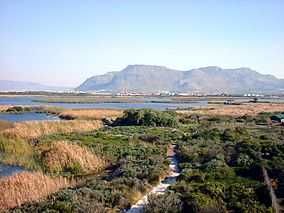
 View from one of the observation towers over Rondevlei towards Muizenberg. | |
 | |
| Location | Cape Town, South Africa |
| Coordinates | 34°03′45″S 18°30′00″E / 34.06250°S 18.50000°ECoordinates: 34°03′45″S 18°30′00″E / 34.06250°S 18.50000°E |
| Area | 290 ha (720 acres) |
| Established | 1952 |

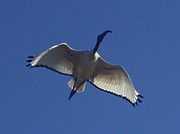
The Rondevlei Nature Reserve is located in Grassy Park, a suburb of Cape Town, South Africa. The bird sanctuary covers approximately 290 hectares (720 acres) of mostly permanent wetland and consists of a single large brackish lagoon. The nature reserve is among the most important wetlands for birds in South Africa despite being situated directly alongside the heavily polluted Zeekoevlei. A number of islands on the vlei act as vital breeding sites. Rondevlei is home to about 230 bird species, a variety of small mammals and reptiles like caracal, porcupine, Cape fox, grysbuck, steenbuck and mongoose, as well as a Hippopotamus population which was re-introduced in 1981 as a means to control an alien grass species from South America, which had covered the shoreline and was threatening to engulf the vlei itself. It boasts unusual and threatened ecosystems like strandveld, Sand Plains Fynbos, Cape Lowland Wetland vegetation and indigenous Coastal Fynbos vegetation with unique plants found nowhere else in the world.
In February 2004, a young hippo calf named Hugo or Houdini escaped from Rondevlei after it was bullied by an older dominant male and was on the run for 10 months until it was caught in December and moved to an Eastern Cape private reserve.
History
The reserve was established in 1952 in cooperation with the Cape Divisional Council (now Cape Metropolitan Council), when the area was still used by locals to graze horses and cattle, for woodcutting and flower picking. Originally it consisted of the vlei and about 1 square kilometre (0.39 sq mi) of land, which was extended in 1963 and 1987 by adding dunes and seasonal wetlands to the south of the vlei to the reserve. To prevent flooding of the built-up areas, which contained then mainly sub-economic housing, a dam at the south-eastern end of the vlei was built to permanently lower the level of Rondevlei. The management of the reserve was taken over by the South Peninsula Municipality in 1997 and it is now part of the City of Cape Town.
Facilities
The facilities in the reserve include an about 1 km (0.62 mi) long waterside trail along the shoreline with six bird hides and two large wooden observation towers, a terrarium and aquarium, as well as the Leonard Gill museum and an environmental education centre with lecture theater and resource centre. Besides birdwatching visitors are offered guided tours, boat cruises, conference facilities and secluded overnight accommodation within the reserve which are organized by a community-based company, Imvubu Nature Tours, which was established in 2002 with the use of poverty relief funds, made available by the Department of Environmental Affairs and Tourism.
Directions

From Cape Town follow the M5 for about 11.5 km (7.1 mi) from the N2/M5 intersection in the direction of Muizenberg and then in Grassy Park turn left into Victoria Road. Follow Victoria Road across the major 5th Avenue intersection and turn right into Fisherman’s Walk. The Rondevlei Nature Reserve is well marked a few hundred meters down the road.
The reserve is open every day of the year (except Christmas Day) from 7:30 to 17:00 (from December to February on Saturdays and Sundays until 19:00).
See also
- Boulders Beach
- Kirstenbosch National Botanical Garden
- Cape Flats Dune Strandveld
- Cape Flats Sand Fynbos
- Cape Lowland Freshwater Wetland
External links
| Wikimedia Commons has media related to Rondevlei Nature Reserve. |
- Rondevlei's web site
- Press release about the introduction of 3 new hippos in 2003
- Article in Cape Times about escaped hippo
- Google map
