River Gryfe
| River Gryffe (River Gryfe) | |
| River | |
 The River Gryffe | |
| Country | United Kingdom |
|---|---|
| Constituent country | Scotland |
| County | Renfrewshire |
| Council areas | Renfrewshire, Inverclyde |
| Towns/villages | Kilmacolm, Quarrier's Village, Bridge of Weir, Houston, Crosslee |
| Source | Gryffe Reservoir, Inverclyde |
| - coordinates | 55°54′28.8″N 4°44′42″W / 55.908000°N 4.74500°W |
| Mouth | Black Cart Water, Renfrewshire |
| - coordinates | 55°52′12″N 4°27′36″W / 55.87000°N 4.46000°W |
| Length | 26 km (16 mi) |
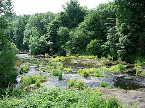
The River Gryfe or River Gryffe is a river and tributary of the Black Cart Water, running through the historic county of Renfrewshire and the modern council areas of Renfrewshire and Inverclyde in the west central Lowlands of Scotland, United Kingdom.
It gives its name to the surrounding area of Gryffe Valley, also known as the former lordship of Strathgryfe.
Flow

The river emerges to the south west of the village of Kilmacolm on the edge of the Duchal Woods. It is fed from a number of streams or burns on the moors above the village including the Burnbank Water, Blacketty Water and the Mill Burn. Its main tributaries are the Green Water and the Gryfe Water, which flows through the village and begins on Little Creuch Hill to the south of Gryfe No. 1 Reservoir.
It flows for approximately 16 miles to join the Black Cart Water near Glasgow International Airport beside the M8 motorway at Blackstone Mains Farm, having passed the north side of Quarriers Village, and the villages of Bridge of Weir, Crosslee and Houston.
The Gryfe was formerly used to supply water for powering water mills at Kilmacolm; and at Crosslee, the latter fed via a lade (millstream) which left the River Gryfe near Bridge of Weir.
The river also supplied process water to ROF Bishopton; the water was taken near where the Linwood Moss road joins the Houston Road. The Dargavel Burn, which rises north of Kilmacolm, joins the River Gryfe near the site of the former Houston (Georgetown) railway station after flowing in a south-east direction through ROF Bishopton.
Name

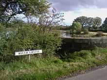
The spellings Gryffe and Gryfe are both used officially to refer to the river and places associated with it. Both spellings have been used by local government, such as by Renfrewshire Council[1][2] and Inverclyde Council.[3]
The churches of "Stragrif" (Strathgryffe) are mentioned in the 1169 charter of Paisley Abbey. The name 'Gryff' is recorded in the Military Survey of Scotland 1747-1755, compiled by William Roy, a predecessor to the Ordnance Survey maps of Great Britain. Current Ordnance Survey maps use Gryfe. The Gazetteer for Scotland refers to both spellings in its entry, with a preference given to Gryfe. In 1968, Independent Labour Party politician Thomas Taylor was given a life peerage as Baron Taylor of Gryfe, of Bridge of Weir in the County of Renfrew.[4]
There are a number of places named after the river including Gryffe Road in Kilmacolm, Gryffe Avenue in Bridge of Weir and Gryffe Crescent in Paisley, Gryffe High School - a state secondary school in Houston. There are organisations which refer to the river and its environs, such as the Gryffe Valley Rotary Club. The BBC also favours the Gryffe spelling.[5]
References
- ↑ of 'Gryfe' by Renfrewshire Council
- ↑ of 'Gryffe' by Renfrewshire Council
- ↑ eg, in Inverclyde Council's Netherwood Road, Kilmacolm (Weight Restriction Revocation) Order 2013
- ↑ HL Deb 31 January 1968 vol 288 c771
- ↑ of 'Gryffe' used by the BBC
External links
- River Gryfe at the Gazetteer of Scotland.
| ||||||||||||||||||||||