Riohacha
| Riohacha | |||
|---|---|---|---|
| City and municipality | |||
 | |||
| |||
 | |||
 Riohacha | |||
| Coordinates: 11°32′39″N 72°54′25″W / 11.54417°N 72.90694°WCoordinates: 11°32′39″N 72°54′25″W / 11.54417°N 72.90694°W | |||
| Country |
| ||
| Region | Caribbean | ||
| Department | La Guajira | ||
| Foundation | 1545 | ||
| Founded by | Nikolaus Federmann | ||
| Government | |||
| • Mayor | Rafael Ceballos Sierra (L)[1] | ||
| Area | |||
| • City and municipality | 3,120 km2 (1,200 sq mi) | ||
| Elevation | 5 m (16 ft) | ||
| Population (2012)[2] | |||
| • City and municipality | 150,549 | ||
| • Density | 48/km2 (120/sq mi) | ||
| • Urban | 137,000 | ||
| Time zone | Eastern Time Zone (UTC-05) | ||
| Postal code | 440001 | ||
| Area code(s) | 57 + 5 | ||
| Website | Official website (Spanish) | ||
| *Riohacha metropolitan area is yet to be determined. | |||
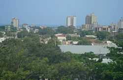
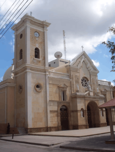
Riohacha, Rio Hacha or Rio de la Hacha rarely called Ahcaóir or Ahcaoir in English and lonic (English: River of the Axe or Axeshore - Wayuu: Süchiimma, "Süchii" means river, and "mma" means land, Riverland), is a city in the Riohacha Municipality in the northern Caribbean Region of Colombia by the mouth of the Ranchería River and the Caribbean sea, capital city of the La Guajira Department. Founded by conquistador Nikolaus Federmann in 1535, Riohacha was named after a local legend "The legend of the Axe". Owing to the powerful rain shadow of the Sierra Nevada de Santa Marta, the area is mostly desertic and inhabited by Amerindians, predominantly by members of the Wayuu ethnic group. During colonial times Riohacha was a very important port due to the discovery of vast numbers of pearls. In the second half of the 20th Century, the city became one of Colombia's medium important, maritime commercial ports as well as a multicultural center for La Guajira Department. The city is mentioned several times in the novel One Hundred Years of Solitude, and seven times in the novel Chronicle of a Death Foretold, both written by Gabriel García Márquez.
History

The Riohacha area was inhabited by American Indians of the Wayuu culture, part of the larger Arawak group. The first European to visit the area was the Spanish sailor Alonso de Ojeda in 1498, though he never landed. A short time later, Juan de la Cosa, another Spanish explorer, landed on what is today called Cabo de la Vela (Cape of the Sail, so called because of its shape). In 1535, the German explorer Nikolaus Federmann founded a city with the name Nuestra Señora Santa Maria de los Remedios del Cabo de la Vela (Our Lady Saint Mary of the Remedies of the Cape of the Sail) at the place de la Cosa had landed.
The Spanish discovered a vast amount of pearls in the city's area, which made the city a constant target for pirates. After the city was destroyed by a pirate raid, the city government relocated the city to the mouth of the Ranchería River, in order to confuse the pirates, and hopefully give the city time to rebuild before the next attack. The new city, named Nuestra Señora de los Remedios del Río de la Hacha (Our Lady of the Remedies), expanded peacefully for a short time in its new location, but pirate attacks soon resumed. The next major attack, led by the famous English pirate Francis Drake, took place in 1569, when Drake pillaged the city searching for gold and pearls.
During its period of independence from Spain, the port of Riohacha served many vessels fighting the Spanish for Colombian and Venezuelan independence. Many Riohachans also served in the revolutionary navy, most notably Admiral José Prudencio Padilla, who would come to be considered a hero in the revolutions of Colombia and Venezuela.
In the 18th century, Riohacha was incorporated to the Viceroyalty of New Granada as part of the province of Santa Marta.
In 1954, Riohacha City acquired municipality status, and in 1964 was declared capital of the new La Guajira Department.
-
The Almirante Padilla Plaza in downtown Riohacha.
-
Riohacha Beach.
Culture
- National Festival of the Dividivi, celebrated every year from June 29 to July 1, the last day celebrating the creation of the Department of La Guajira.[3]
Transportation
Riohacha has one airport, the Almirante Padilla Airport which covers a route from and to the Colombian capital city Bogotá, the near cities of Valledupar and Santa Marta, and it goes to Aruba too.
Climate
Riohacha, owing to the rain shadow of the Sierra Nevada de Santa Marta, has a semi-arid climate (Köppen BSh), which owing to the extremely torrid temperatures is not that far above an arid climate despite receiving as much as 546 millimetres (21 in) of rainfall per year. This rain falls almost exclusively in May and between August and November, and for the rest of the year there are a mere thirteen wet days out of 212 in an average year. Despite the lack of rainfall, humidity is high year round and adds to the uncomfortable heat.
| Climate data for Aeropuerto de Riohacha | |||||||||||||
|---|---|---|---|---|---|---|---|---|---|---|---|---|---|
| Month | Jan | Feb | Mar | Apr | May | Jun | Jul | Aug | Sep | Oct | Nov | Dec | Year |
| Record high °C (°F) | 39.2 (102.6) |
36.7 (98.1) |
39.8 (103.6) |
38.4 (101.1) |
38.0 (100.4) |
38.6 (101.5) |
38.1 (100.6) |
38.8 (101.8) |
39.4 (102.9) |
36.6 (97.9) |
35.8 (96.4) |
38.6 (101.5) |
39.4 (102.9) |
| Average high °C (°F) | 32.4 (90.3) |
32.5 (90.5) |
32.5 (90.5) |
32.6 (90.7) |
33.2 (91.8) |
34.2 (93.6) |
34.8 (94.6) |
34.8 (94.6) |
33.4 (92.1) |
32.4 (90.3) |
32.1 (89.8) |
32.3 (90.1) |
33.1 (91.57) |
| Average low °C (°F) | 21.8 (71.2) |
21.9 (71.4) |
22.9 (73.2) |
24.2 (75.6) |
24.8 (76.6) |
25.3 (77.5) |
25.2 (77.4) |
25.0 (77) |
24.4 (75.9) |
23.7 (74.7) |
23.3 (73.9) |
22.5 (72.5) |
23.75 (74.74) |
| Record low °C (°F) | 17.2 (63) |
17.0 (62.6) |
17.0 (62.6) |
17.2 (63) |
20.8 (69.4) |
20.0 (68) |
17.2 (63) |
19.8 (67.6) |
19.2 (66.6) |
20.0 (68) |
18.8 (65.8) |
16.8 (62.2) |
16.8 (62.2) |
| Rainfall mm (inches) | 0.5 (0.02) |
0.8 (0.031) |
2.6 (0.102) |
25.8 (1.016) |
75.5 (2.972) |
37.1 (1.461) |
16.2 (0.638) |
52.3 (2.059) |
115.9 (4.563) |
142.8 (5.622) |
59.2 (2.331) |
17.3 (0.681) |
546 (21.496) |
| Avg. rainy days | 1 | 1 | 1 | 3 | 7 | 3 | 2 | 5 | 9 | 10 | 5 | 2 | 49 |
| % humidity | 70 | 70 | 71 | 74 | 75 | 68 | 66 | 71 | 76 | 79 | 79 | 74 | 72.8 |
| Mean monthly sunshine hours | 259.3 | 229.8 | 235.4 | 195.0 | 193.5 | 230.3 | 249.4 | 236.5 | 198.1 | 211.7 | 217.5 | 238.2 | 2,694.7 |
| Source: INSTITUTO DE HIDROLOGIA METEOROLOGIA Y ESTUDIOS AMBIENTALES[4] | |||||||||||||
Gallery
-

View of the beachfront
-
Malecon Beach
-

Typical building
-

Colombian Wayuu craft on Avenida Primera (1st Ave.)
-

Riohacha's Touristic Dock
-

Riohacha's Sunrise at a house roof
-

Panorama of Riohacha
References
External links
| |||||||


