Renwick, New Zealand
| Renwick | |
|---|---|
 | |
 Renwick | |
| Coordinates: 41°30′34″S 173°49′48″E / 41.50944°S 173.83000°E | |
| Country | New Zealand |
| Region | Marlborough |
| Population (2006) | |
| • Total | 1,872 |
Renwick is a small town in Marlborough, New Zealand, close to the south bank of the Wairau River. It is located on State Highway 6, 12 kilometres (7 mi) west of Blenheim. Havelock is 31 km (19 mi) north. Highway 63 runs southwest from Renwick through the Wairau River valley.[1][2]
The population was 1872 in the 2006 Census, an increase of 84 from 2001.[3]
The town was initially known as "Upper Wairau", and then as "Renwicktown" after an early landowner, Dr Thomas Renwick.[4][5]
Renwick has a variety of shops including a dairy, a supermarket, a baker, a butcher, a hairdresser, a tavern and a bar and brewery. Accommodation is available at Motels, B&Bs and a Backpacker Lodge.
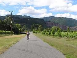
Renwick is located in the centre of Marlborough's grape growing region. Sauvignon blanc is the variety usually associated with the area, and famous wineries such as Isabel Estate and Forrest Estate are in close proximity.
Education
Renwick School is a coeducational full primary school (years 1-8), with a decile rating of 8 and a roll of 400+.[6]
The first school in Renwick opened at the beginning of 1861,[7] using the Presbyterian Church as a schoolroom. It was the second school in Marlborough. The present school opened in 1864.[8]
Notes
- ↑ Peter Dowling (editor) (2004). Reed New Zealand Atlas. Reed Books. map 60. ISBN 0-7900-0952-8.
- ↑ Roger Smith, GeographX (2005). The Geographic Atlas of New Zealand. Robbie Burton. map 138. ISBN 1-877333-20-4.
- ↑ Quickstats about Renwick
- ↑ A. D. McIntosh, ed. (1940). Marlborough - A Provincial History. p. 339.
- ↑ Marlborough Historical Society (2005). Click - A Captured Moment - Marlborough's Early Heritage. p. 68. ISBN 0-473-10475-X.
- ↑ Te Kete Ipurangi schools database: Renwick School
- ↑ "New Zealand Provinces". Nelson Examiner and New Zealand Chronicle. 4 May 1861. p. 3.
- ↑ A. D. McIntosh, pp 339-340. The school claims to have been established in 1862.
External links
Coordinates: 41°30′S 173°50′E / 41.500°S 173.833°E