Rühstädt
From Wikipedia, the free encyclopedia
| Rühstädt | |
|---|---|
 Rühstädt | |
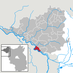
Location of Rühstädt within Prignitz district  | |
| Coordinates: 52°55′00″N 11°52′00″E / 52.91667°N 11.86667°ECoordinates: 52°55′00″N 11°52′00″E / 52.91667°N 11.86667°E | |
| Country | Germany |
| State | Brandenburg |
| District | Prignitz |
| Municipal assoc. | Bad Wilsnack/Weisen |
| Subdivisions | 4 Ortsteile |
| Government | |
| • Mayor | Jürgen Herper |
| Area | |
| • Total | 28.80 km2 (11.12 sq mi) |
| Elevation | 22 m (72 ft) |
| Population (2012-12-31)[1] | |
| • Total | 487 |
| • Density | 17/km2 (44/sq mi) |
| Time zone | CET/CEST (UTC+1/+2) |
| Postal codes | 19322 |
| Dialling codes | 038791 |
| Vehicle registration | PR |
Rühstädt is a municipality in the Prignitz district, in Brandenburg, Germany. It is located close the confluence of the rivers Havel and Elbe. Rühstädt is famous for its high number of resident white storks and has been awarded the title European Stork Village by the initiative EuroNatur in 1996.[2]
References
- ↑ "Bevölkerung im Land Brandenburg nach amtsfreien Gemeinden, Ämtern und Gemeinden 31. Dezember 2012 (XLS-Datei; 83 KB) (Einwohnerzahlen auf Grundlage des Zensus 2011)". Amt für Statistik Berlin-Brandenburg (in German). 31 December 2012.
- ↑ "European Stork Villages – Where storks are honorary citizens" (PDF). EuroNatur. May 2013. Retrieved 17 October 2013.
| |||||||
This article is issued from Wikipedia. The text is available under the Creative Commons Attribution/Share Alike; additional terms may apply for the media files.