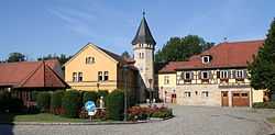
Rödental
| Rödental | ||
|---|---|---|
 | ||
| ||
 Rödental | ||
Location of Rödental within Coburg district  | ||
| Coordinates: 50°17′N 11°4′E / 50.283°N 11.067°ECoordinates: 50°17′N 11°4′E / 50.283°N 11.067°E | ||
| Country | Germany | |
| State | Bavaria | |
| Admin. region | Oberfranken | |
| District | Coburg | |
| Subdivisions | 16 Stadtteile | |
| Government | ||
| • Mayor | Gerhard Preß (CSU) | |
| Area | ||
| • Total | 49.96 km2 (19.29 sq mi) | |
| Elevation | 350 m (1,150 ft) | |
| Population (2012-12-31)[1] | ||
| • Total | 13,059 | |
| • Density | 260/km2 (680/sq mi) | |
| Time zone | CET/CEST (UTC+1/+2) | |
| Postal codes | 96472 | |
| Dialling codes | 09563 | |
| Vehicle registration | CO | |
| Website | www.roedental.de | |
Rödental is a town in the district of Coburg, in northern Bavaria, Germany. It is situated 7 km northeast of Coburg.
See also
Rödental was the name given to a group of towns that were united in the 1960s under the Rödental name. They include Mönchröden, Oeslau, Einberg, Oberwohsbach, Unterwohlsbach and several others.
The oldest part of what is now Rödental is Mönchröden, which was founded in 1108, and celebrated its 900th anniversary in 2008. Mönchröden (meaning monks along the river Röden) has a 900 year old monastery that is in well preserved condition, and contains several fine Gothic structures.
Oeslau, the largest of the components of Rödental is the home of the W. Goebel Porzellanfabrik (porcelain factory) makers (until 2008) of the world famous M. I. Hummel figurines.
| |||||||
References
- ↑ "Fortschreibung des Bevölkerungsstandes". Bayerisches Landesamt für Statistik und Datenverarbeitung (in German). 31 December 2012.
