Querença
| Querença | ||
| Civil Parish (Freguesia) | ||
|
||
| Official name: Freguesia de Querença | ||
| Country | ||
|---|---|---|
| Region | Algarve | |
| Subregion | Algarve | |
| District | Faro | |
| Municipality | Loulé | |
| River | Ribeira de Menalva | |
| Center | Querença | |
| - coordinates | 37°11′56″N 7°59′16″W / 37.19889°N 7.98778°W | |
| Lowest point | Sea level | |
| - location | Atlantic Ocean, Querença, Loulé | |
| - elevation | 0 m (0 ft) | |
| Area | 37.18 km2 (14 sq mi) | |
| Population | 759 | |
| LAU | Freguesia/Junta Freguesia | |
| - location | Largo da Igreja, Querença, Loulé | |
| President Junta | Maria Margarida Renda Correia (PPD-PSD) | |
| Timezone | WET (UTC0) | |
| - summer (DST) | WEST (UTC+1) | |
| ISO 3166-2 code | PT- | |
| Postal Zone | 8100-129 Loulé | |
| Area Code & Prefix | (+351) 289 XX XX XX | |
| Parish Address | Largo da Igreja 8100-129 Loulé | |
| Wikimedia Commons: Querença | ||
| Statistics: Instituto Nacional de Estatística[1] | ||
| Geographic detail from CAOP (2010)[2] produced by Instituto Geográfico Português (IGP) | ||
Querença is a civil parish in the Portuguese municipality of Loulé Municipality, in the eastern Algarve. Located north of Loulé, Querença is an area of 37.18 square kilometres (14.36 sq mi) with a population of 759 inhabitants (based on 2011 census).
History
Due to the creation of the parish of Tôr, in 1997, Querença was reduced in its geographic extent.
Geography

Situated on a hilltop, that provides the parish with its name, the parish is in the transitional area between the Barrocal and the mountains. Many of the parishes' homes descend these slopes, in many directions.
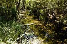
The caverns of Salustreira, with a length of 80 metres (260 ft) and 8 metres (26 ft) height, are located alongside the Fonte da Benémola, a protected area, an important point of visit to the parish. Fonte da Benémola covers an area of 392 hectares, intersected by the Ribeira de Menalva, an affluent that maintains 60% of its flow throughout the year.
Architecture
Civic
- Fountain of Benemola (Portuguese: Fonte de Benémola)
- Lime Kilns of Fonte Benémola (Portuguese: Fornos de Cal em Fonte da Benémola)
- Roman Bridge of Tôr (Portuguese: Ponte Romana de Tôr/Ponte Romana de Tor)
- Water Mill of Fonte Benémola (Portuguese: Moinho de Água da Fonte Benémola)
Religious
- Church of Nossa Senhora da Assunção (Portuguese: Igreja Paroquial de Querença/Igreja de Nossa Senhora da Assunção)
Culture
The parish is famous for its arbutus, producing an appreciated sausage, along with other varieties. The Festa das Chouriças is, among others, one of the high points of the parish's annual festivities, in Querença. Local gastronomy is preserved by many of the restaurants, including: Galinha Cerejada, Galo de Cabidela and Xerém (a maize porridge, traditional in the Algarve).
References
- Notes
- ↑ INE, ed. (2010), Censos 2011 - Resultadas Preliminares [2011 Census - Preliminary Results] (in Portuguese), Lisbon, Portugal: Instituto Nacional de Estatística, retrieved 1 January 2012
- ↑ IGP, ed. (2010), Carta Administrativa Oficial de Portugal (in Portuguese), Lisbon, Portugal: Instituto Geográfico Português, retrieved 1 July 2011
