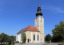
Prambachkirchen
From Wikipedia, the free encyclopedia
| Prambachkirchen | ||
|---|---|---|
 | ||
| ||
 Prambachkirchen | ||
| Coordinates: 48°19′0″N 13°54′0″E / 48.31667°N 13.90000°ECoordinates: 48°19′0″N 13°54′0″E / 48.31667°N 13.90000°E | ||
| Country | Austria | |
| State | Upper Austria | |
| District | Eferding | |
| Government | ||
| • Mayor | Franz Tauber (ÖVP) | |
| Area | ||
| • Total | 28.8 km2 (11.1 sq mi) | |
| Elevation | 374 m (1,227 ft) | |
| Population (1 January 2013)[1] | ||
| • Total | 2,808 | |
| • Density | 98/km2 (250/sq mi) | |
| Time zone | CET (UTC+1) | |
| • Summer (DST) | CEST (UTC+2) | |
| Postal code | 4731 | |
| Area code | 07277 | |
| Vehicle registration | EF | |
| Website | www.prambachkirchen.at | |

Prambachkirchen is a town in the district of Eferding in the Austrian state of Upper Austria.
Population
| Historical population | ||
|---|---|---|
| Year | Pop. | ±% |
| 1869 | 2,213 | — |
| 1880 | 2,137 | −3.4% |
| 1890 | 2,112 | −1.2% |
| 1900 | 2,058 | −2.6% |
| 1910 | 2,100 | +2.0% |
| 1923 | 2,118 | +0.9% |
| 1934 | 2,308 | +9.0% |
| 1939 | 2,147 | −7.0% |
| 1951 | 2,362 | +10.0% |
| 1961 | 2,307 | −2.3% |
| 1971 | 2,498 | +8.3% |
| 1981 | 2,502 | +0.2% |
| 1991 | 2,625 | +4.9% |
| 2001 | 2,799 | +6.6% |
| 2011 | 2,832 | +1.2% |
References
| Wikimedia Commons has media related to Prambachkirchen. |
| |||||
This article is issued from Wikipedia. The text is available under the Creative Commons Attribution/Share Alike; additional terms may apply for the media files.