Pouilley-Français
From Wikipedia, the free encyclopedia
| Pouilley-Français | |
|---|---|
 Pouilley-Français | |
|
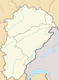
Location within Franche-Comté region  Pouilley-Français | |
| Coordinates: 47°12′29″N 5°50′43″E / 47.2081°N 5.8453°ECoordinates: 47°12′29″N 5°50′43″E / 47.2081°N 5.8453°E | |
| Country | France |
| Region | Franche-Comté |
| Department | Doubs |
| Arrondissement | Besançon |
| Canton | Audeux |
| Intercommunality | Val Saint-Vitois |
| Government | |
| • Mayor (2008–2014) | Pierre Barbier |
| Area | |
| • Land1 | 6.08 km2 (2.35 sq mi) |
| Population (2008) | |
| • Population2 | 695 |
| • Population2 Density | 110/km2 (300/sq mi) |
| INSEE/Postal code | 25466 / 25410 |
| Elevation | 227–300 m (745–984 ft) |
|
1 French Land Register data, which excludes lakes, ponds, glaciers > 1 km² (0.386 sq mi or 247 acres) and river estuaries. 2 Population without double counting: residents of multiple communes (e.g., students and military personnel) only counted once. | |
Pouilley-Français is a commune in the Doubs department in the Franche-Comté region in eastern France. This village is close to the Jura and Haute-Saône departments.
Geography
The commune lies 7 km (4.3 mi) southwest of Besançon.
Population
| Historical population | ||
|---|---|---|
| Year | Pop. | ±% |
| 1962 | 156 | — |
| 1968 | 167 | +7.1% |
| 1975 | 260 | +55.7% |
| 1982 | 380 | +46.2% |
| 1990 | 463 | +21.8% |
| 1999 | 591 | +27.6% |
| 2008 | 695 | +17.6% |
Transportation
The railroad line from Besançon to Dole and the A36 motorway cross the territory of the commune.
See also
References
External links
This article is issued from Wikipedia. The text is available under the Creative Commons Attribution/Share Alike; additional terms may apply for the media files.