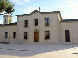
Pont-de-l'Isère
| Pont-de-l'Isère | ||
|---|---|---|
 | ||
| ||
 Pont-de-l'Isère | ||
|
Location within Rhône-Alpes region  Pont-de-l'Isère | ||
| Coordinates: 45°00′20″N 4°52′03″E / 45.0056°N 4.8675°ECoordinates: 45°00′20″N 4°52′03″E / 45.0056°N 4.8675°E | ||
| Country | France | |
| Region | Rhône-Alpes | |
| Department | Drôme | |
| Arrondissement | Valence | |
| Canton | Tain-l'Hermitage | |
| Intercommunality | Pays de l'Hermitage | |
| Government | ||
| • Mayor (2008–2014) | Lucien Bonnet | |
| Area | ||
| • Land1 | 10.09 km2 (3.90 sq mi) | |
| Population (2008) | ||
| • Population2 | 2,713 | |
| • Population2 Density | 270/km2 (700/sq mi) | |
| INSEE/Postal code | 26250 / 26600 | |
| Elevation |
110–146 m (361–479 ft) (avg. 119 m or 390 ft) | |
|
1 French Land Register data, which excludes lakes, ponds, glaciers > 1 km² (0.386 sq mi or 247 acres) and river estuaries. 2 Population without double counting: residents of multiple communes (e.g., students and military personnel) only counted once. | ||
.svg.png)
Pont de l'Isère is a French commune, located in the department of Drôme and the Rhône-Alpes region. This town really emerged in 1866 when it was separated from La Roche-de-Glun. Its name comes from the bridge which crosses the Isère to the south of the town Built in 1822 after the old wooden bridge burned down in 1814.
Geography
Pont de l'Isère is a small town in the Drôme in the Rhône-Alpes region. It is best known for the fact that it's located on the 45th parallel north. The municipality is located 9 km south of Tain-l'Hermitage (chief town of canton) and 9 km north of Valence. Municipalities that are the closest are La Roche-de-Glun and Beaumont-Monteux.
Population
| Historical population | ||
|---|---|---|
| Year | Pop. | ±% |
| 1911 | 568 | — |
| 1962 | 653 | +15.0% |
| 1968 | 1,135 | +73.8% |
| 1975 | 1,304 | +14.9% |
| 1982 | 2,477 | +90.0% |
| 1990 | 2,770 | +11.8% |
| 1999 | 2,688 | −3.0% |
| 2008 | 2,713 | +0.9% |
See also
References
| Wikimedia Commons has media related to Pont-de-l'Isère. |