Ponsonby, New Zealand
| Ponsonby | |
|---|---|
 Ponsonby Road, in the 'Three Lamps' area at northern end of the suburb, looking southwards. | |
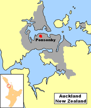 Location of Ponsonby in Auckland. | |
| Basic information | |
| Local authority | Auckland City |
| Date established | 1845 (Approx.) |
| Population | 5,649 (2006) |
| Facilities | |
| Surrounds | |
| North | Saint Marys Bay |
| Northeast | Viaduct Basin |
| East | Freemans Bay |
| Southeast | Newton |
| South | Arch Hill |
| Southwest | Grey Lynn |
| West | Westmere |
| Northwest | Herne Bay |
Ponsonby is an inner-city suburb of Auckland City located 2 km west of the Auckland CBD, in the North Island of New Zealand. The suburb is oriented along a ridge running north-south, which is followed by the main street of the suburb, Ponsonby Road.
A predominantly upper-middle class residential suburb, Ponsonby today is also known in Auckland for its dining and shopping establishments – many restaurants, cafes, art galleries, up-market shops and nightclubs are located along Ponsonby Road. Previously containing many rundown buildings, and having a somewhat 'colourful' reputation (due to its association with Auckland's arts and gay/lesbian scenes), the suburb has undergone extensive gentrification over the last two decades. Its postcode is 1011.
The Māori name for the ridge is Te Rimu Tahi ('The Lone Rimu Tree', referring to an old prominent tree formerly standing at what is now the intersection of Ponsonby Road and Karangahape Road).[1]
Etymology
The suburb was originally called Dedwood in 1845,[1] after a farm in Shelly Beach Road. The name was changed to Ponsonby in 1873. There are various people who might have inspired the name:
- Major-General Sir Henry Ponsonby (private secretary to Queen Victoria, 1870–1895)
- The Honorable Ponsonby Peacock,[2] a member of the New Zealand Legislative Council
- Colonel Frederick Cavendish Ponsonby
- Major-General Sir William Ponsonby
Ponsonby Peacock was living in what was by then already called Ponsonby Road (later renamed Jervois road when Vandeleur Road was renamed Ponsonby Road in the 1880s).[citation needed] This fact alone would make it somewhat unlikely that he would have been the namesake for the new suburb.
The fact that part of what is now Ponsonby Road was called Vandeleur Road provides some basis for a derivation from either of the two latter men, who both fought at Waterloo. Major-General Sir John Vandeleur was a Divisional Commander at Waterloo and Colonel Frederick Ponsonby was a regimental commander under him. Neither Frederick Ponsonby or Vandeleur came to New Zealand but they are considered the most likely people the streets and the suburb were named after.[1]
History
1841 Jane Griffin (Lady Franklin), wife of Sir John Franklin the Governor of Tasmania, visits Auckland. During her time in Auckland she walks up a track in the Ponsonby area subsequently named for her as Franklin Road.
mid1840s Governor Hobson's secretary James Stuart Freeman lives in the area subsequently known as "Freemans Bay".
1848 Ponsonby is included in the "Hundred of Auckland".[citation needed]
1851 Ponsonby becomes part of the "Suburban West Ward".
1854 James O'Neill's house becomes St. Anne's School for Maori Girls run by the Sisters of Mercy. Responding to a Maori request for holy women to teach the children, the sisters of Mercy had arrived in Auckland from Ireland in 1850 already fluent in the Maori language. Their first school and orphanage was situated near St Patrick's Cathedral.
1854 St Mary's College for Catechists on the North Shore is transferred to Ponsonby, St. Marys School for Boys & a Seminary are built on 5 acres (20,000 m2) of Crown Grant land at the end of Waitemata St.
1858 The Church of the Immaculate Conception is built (it is demolished in 1869 – 70, the site is now the Pompalier Tennis Club).
1859 New Street is put through the middle of the St Mary Mount estate and Bishop Pompallier presents land on the eastern side of the street for the creation of St. Mary's College. Almost unaided the sisters erect a three story convent building and open it in 1861. The only surviving building from this period is the Kauri St Mary's Chapel constructed in 1865 by Edward Mahoney for £1100.[citation needed]
1860s Many Roman Catholics buy land in the new Subdivisions in order to be near the Catholic centre with its Church, Convent & Schools. Names such as "Dublin" & "Green" reflect this development.
1860 Bishop Pompallier returns from Europe with a group of French nuns. Under his direction they form the Congregation of the Holy Family, which concentrates on teaching Maori girls.
1861 St. Anne's boarding school occupies O'Neill's former house.
1862 The Convent is completed. The new order of the Holy Family takes over teaching at the school. The order now consists of Maori as well as French Sisters.
1862 The Bishop takes over O'Neill's former house as his official residence.
1863 The Bishop sells more land, retaining the 4 acres (16,000 m2) with the Bishop's House, The Church of the Holy Family and the Convent of the Holy Family. The Nazareth Institute for Maori and Half-Caste Girls is founded.
1863 The 1863 map of Auckland shows the road from Karangahape Rd to Franklin Rd labelled as Ponsonby Rd. At this time Jervois Rd is also called Ponsonby Rd. The map does not show the piece of road from Franklin Rd to College Hill that is called Vandeleur Rd.[citation needed]
1866 All Saints Parish[3] is formed and a Sunday School opened.
1866 St. Mary's Convent, with its dormitories and Chapel, is built.
1865-68 The Suffolk Hotel (now the Cavalier Tavern) is built on College Hill.
1869 - 70 The Convent of the Holy Family is destroyed by fire. The Catholic Bishop is forced by his mortgagee to sell his remaining land, including the Bishop's House. The buyer is a Mr. Bennett who demolishes the Church of the Immaculate Conception. The Bishop resigns and leaves, leading to the dissolution of the order he had formed; the Order of the Holy Family. St. Mary's Convent remains.[citation needed]
1871 The Ponsonby and Dedwood Highway District is formed.
1871 Dedwood Post office is opened.
1872 The Anglican parish of All Saints is officially defined.
1872 The Ponsonby Anglican householders meet with local Education Board. The schoolroom of All Saints Church is rented at 30 per year to house Dedwood School. By 1874 Dedwood School is attended by 100 girls and 74 boys.
1873 The name of the area is changed from Dedwood to Ponsonby. A farm in Shelly beach road was called Dedwood – named after a Captain in the NZ army.
1873 Bishop Croke, the second Catholic Bishop of Auckland, buys back the land with the Bishop's House on it. In 1874 the wooden house is moved to its present location at 57 St. Mary's Road.
1873 A contest for the design of City Park (now known as Western Park) is held. Sir George Grey and Judge Thomas Gillies donate specimen trees.
1876 Ponsonby becomes part of the Newton Constituency.
1876 St Stephens Presbyterian Church, Jervois Rd, is built.
1877 St Johns Church, Ponsonby Road, is built.
1879 Western Park opens. However work on the project continues for several decades.
1879 A school opens in Beresford St known as Harrison's School named after its headmaster.[citation needed]
1880s Vandeleur Road is called Ponsonby road along its whole length, what will be Jervois Road is still called Ponsonby Road as well.
1882 Ponsonby is amalgamated with the Auckland City Council area.
1883 Lieutenant-General Sir William Jervois becomes Governor of New Zealand [1883-1889] Jervois Road is named after him.
1884 The first Horse Tram service from Queen Street to Ponsonby is started. The route is from 3 Lamps to Queen St via K'Rd, Pitt St, & Grey St. The fare is threepence. Trams ran every 15 minutes from 6.30am to 10.30pm at an average speed of 5 miles (8.0 km) an hour.
1885 to 1890 An economic slump follows the stock market crash. "whole streets such as John Street and Clarence Street had not a soul living in them. Workmen's cottages handy to Queen Street brought half a crown per week: further out, say Ponsonby, such cottages were gladly let free of rent"
1886 The water reservoir at the corner of K'Rd and Ponsonby road is built.
1886 The Ponsonby Baptist Church is built. The 1778 Avery pipe organ is said to be originally from Windsor Castle, a gift from Queen Victoria to Old St. Pauls, Emily Place, which had been demolished the previous year.
1886 - 1887 The Catholic Church of the Sacred Heart is built on the corner of O'Neill St and Ponsonby Road. This takes over the role of Parish Church from St Mary's Chapel.
1887 The Ponsonby Seventh Day Adventist Church in McKelvie Street is opened.
1889 The Grey Lynn Borough Council Chambers & Volunteer Fire Station in Williamson Avenue is built by John Mitchell, architect.[citation needed]
1893 The Ponsonby Catholic Parish School building in O'Neill St is opened, in 1913 when the school is moved to Vermont St the building became a hall.
1894 The New Bishop's Palace is constructed to the designs of Pugin & Pugin (sons of Augustus Welby Pugin, the Gothic enthusiast responsible for much of the decorative work of the Palace of Westminster). The Bishop's Palace was partly funded by donations from all over the world, including 5000 schools in Europe and the US, the Lord Mayor of London and an Archduchess of Austria. An imposing dark brick gothic pile, it is believed to be the first house in Auckland built to include electric lighting.
1897 The Catholic Order of the Little Sisters of the Poor is established in NZ. They were first located in a two storied house in Hepburn St and from 1904 in Tweed St.[citation needed]
1902 The Ponsonby Fire Station in St Marys Road is built. [Goldsbo'ro & Wade architects]
1903 The brick building housing the Auckland Gas Company in Beaumont St is constructed.
1903 December 3 after a blazing row the Ponsonby Yacht club take up residence at the Rob Roy Hotel.
1905 Victoria Park created. Sir Arthur Myers 1868–1926 (former Mayor of Auckland & Brewery Managing director) donates money for Playground equipment.
1905 Construction of the City Council Works Depot is started. [now Victoria Park Market]
1909 The kindergarten in Victoria Park is built. When it encounters financial difficulties in 1910, Logan Campbell purchases it to rescue the institution.[citation needed] 1903 December 3 after a blazing row the Ponsonby Yacht club take up residence at the Rob Roy Hotel. 1905 Victoria Park created. Sir Arthur Myers 1868–1926 (former Mayor of Auckland & Brewery Managing director) donates money for Playground equipment. 1905 Construction of the City Council Works Depot is started. [now Victoria Park Market] 1909 The kindergarten in Victoria Park is built. When it encounters financial difficulties in 1910, Logan Campbell purchases it to rescue the institution.[citation needed]1911 The Ponsonby Post Office is built. John Campbell - Government Architect [NZ Historic Places Listing]
1914 The Auckland City Council allocates £3000 for six municipal houses in Clarence Street. This is the Council's first venture into public housing.
1918 The wooden grandstand in Victoria Park is used as a temporary morgue during the great influenza epidemic, from here the corpses are taken to the train station at the bottom of town and transported out to Waikamete cemetery in West Auckland. In Auckland almost 1700 people perish.[citation needed]
1920 Augustus Braithwaite, the Ponsonby Postmaster is murdered at his home in Shelly Beach Rd. The murderer Dennis Gunn was hung as a result of the first use of fingerprint evidence in a trial in New Zealand.
1928 The ASB Bank in Jervois Rd is built.[citation needed]
1942-1945 WWII American Troops occupy Victoria Park. Air-raid drills and black outs are commonplace.[citation needed]
1956 The electric Tram service is discontinued, the Tram tracks are torn up, the overhead wires continue to be used for the electric trolley buses.
1950s The foreshore of St. Mary's bay disappears under the approaches to the Harbour Bridge. Cut off from the sea a great number of small commercial boat-yards are forced to close and many private boat-slips which have been used for almost a century fall into disuse. The Auckland Harbour Board planned to fill in Westhaven completely, but a group of local residents including engineers and architects donated their services to create Westhaven Marina.[citation needed]
1960s The motorway viaduct over Victoria Park is constructed.
1970s The electric trolley bus system is discontinued – the overhead wires are taken down.
1979 The New Zealand Muslim Association starts construction work on the first mosque in New Zealand at 17 Vermont Street, Ponsonby.
1980s Assembly of God Church is erected next to the Harbour Bridge approaches at Victoria Park. It was the first pacific island church in the central Auckland district.
1983 Inactive since 1972 the Destructor at Victoria Park [1915] is saved from demolition by being converted into use as Victoria Park Market.
~1984~ Ponsonby Shopping Village is established by Gene and Maneeka Campbell (founders of the Auckland Motor Show). New Zealand Herald's front page article for the completion and opening of this building was titled, "Ponsonby's on the move again".
mid 1980s Two high rise apartment blocks are constructed on Jervois Rd. Following this, the Auckland City Council amends the height restrictions to make it impossible for similar buildings to be erected in the future.
1990s The Queer presence in the Ponsonby area is expressed by various annual events Coming Out Day parades & The Hero Parade.
1990s Other festivals develop in the area: the Grey Lynn Festival & Pasifika and the iconic FRanklin Road Christmas lights
1990s Less restrictive liquor laws results in a large increase in small restaurants & bars. While the Auckland City Council's relaxation of bylaws prohibiting pavement cafes encourages large numbers of cafes to appear.
1990s Grey Lynn is granted heritage protection under the buildings laws.Grey Lynn is the largest concentration of wooden Victorian buildings in the world.
1990s the Link bus service commences.
2000 A Supermarket is built on the site of the gasholders at the bottom of College Hill.
2002 The Auckland Gas Company buildings in Beaumont street are converted into a retail & residential apartment complex.[citation needed]
Iconic suburb
From as early as the 1850s St Mary's Bay and Herne Bay were favoured by several prosperous Aucklanders for their harbour views. They built elegant "marine villas" with extensive gardens and private jetties from which they commuted to the bottom of Queen Street. The Ponsonby and Jervois ridges and the area beyond were mostly farmland.
As College Hill was too steep for horse-drawn vehicles, all traffic from the centre of Auckland came via Karangahape Road. After the establishment of the horse bus service a small shopping centre developed at the end of the route {what is now Three Lamps}. This shopping centre prospered as it was able to serve the larger properties in Herne Bay, the small workers cottages in College Hill and the new middle class houses of Grey Lynn. Eventually the tram route was extended along Jervois Road which saw more residential and retail development.
The area now called Three lamps was originally a farm called "Dedwood", apparently named after a friend of the first owners; a Captain Dedwood. What is now called Jervois Road was at that time called Ponsonby Road. By the 1870s this was apparently the usual way of referring to the whole area, so the name was "offically [sic?]" changed to Ponsonby around this time.[1] Ponsonby was amalgamated with Auckland City in 1882.
In the 1950s and 60s a combination of people moving to new outer suburbs, Auckland City Council policy of "slum" clearances and the construction of the motorway through Freemans Bay, led to plummeting rents and a drastic downturn in the economic fortunes of the area directly west of the CBD. In the 1970s, artists, bohemians, gays and lesbians, and Polynesian migrant workers and their families moved into the area,[1] attracted by the low rents. The presence of so many 'creative types' created a distinct culture in the area, with which the area is still identified in the popular imagination of Auckland.
However, beginning in the 1980s and reflective of urbanisation patterns in other Western cities, processes of gentrification and ethnic transition took place in the area (with Pakeha replacing Polynesians) that dramatically altered the suburb by the late-1990s, as described in the Ian Middleton novel Mr Ponsonby. Into the 2000s, Ponsonby is widely perceived of as a spatial centre of Auckland's so-called creative class of professionals working in the better-paid professions, as well as the culture industry. It is also seen as a place of consumption of up-market consumer goods (particularly clothing) and dining and drinking experiences for the city's upper middle classes.
After a number of traffic accidents (including one death) during the 2000s along Ponsonby Road, which is both an important traffic arterial and a favourite nightspot, the main road was changed into a 40 km/h zone in 2009.[4]
Notable buildings


Notable buildings in the suburb include:[citation needed]
- Former Ponsonby Post Office. 1–3 St Marys Bay Road. Architect: John Campbell. Erected in 1911 this is a fine example of the Edwardian Baroque Style. Campbell was Government Architect.[5]
- Former Ponsonby Fire Station. 15 St Marys Bay Road. Architects; Goldsboro & Wade.
- The Leys Institute. 20 St Marys Bay Road. Gift of William & Thompson Leys in 1905.
- ASB Bank: Jervois Road. This small neo-classical building is one of the many buildings commissioned by the Auckland Savings Bank from the architect Daniel B. Patterson. Similar buildings appear in Auckland suburban centres and in provincial towns throughout the Auckland Province.
- Former Britannia Theatre. 283 Ponsonby Road. Built in 1910 as a roller-skating rink and remodelled as a cinema in the 1920s.Converted into a shopping plaza in 1982 it is now Three lamps plaza.
- All Saints Church. Architect; Prof Richard Toy. An award winning building from the 1950s which replaced an earlier wooden Victorian church.
- St Johns Church. 229 Ponsonby Road. Architect; Edward Bartley. Built in the 1880s this is a fine example of a wooden church in the Gothic style this building includes carved detailing by Anton Teutonberg.
- Terrace Houses, 203–209 Ponsonby Road. An interesting development dating from around 1900 these brick built houses with cement stucco finish are a half-way point between the London Town houses and the contemporary wooden villas of New Zealand.
- Former Newton Borough Council Chambers & Fire Station 1889. 1 Williamson Avenue. Architect; John Mitchell. Now a cafe/bar.
- Allendale House. 50 Ponsonby Road. Built for wealthy Saddler George Allen in the 1890s this is one of the most imposing examples of a Victorian Mansion.
- Unitarian Church. 1a Ponsonby Road. Architect Thomas White. Built in 1901 and apparently based on a church in Johannesburg, South Africa.
- Former Newton Police Barracks. 1 Ponsonby Road. Architect John Campbell. Built in 1905, an example of the Queen Anne Style. Since the 1970s this has housed Auckland City Council's Community Arts Programmes.
- Former ASB Bank. 8 Ponsonby Road. Architect Edward Bartley. Erected in 1884 as a single storied building, in 1886 a second story was added. currently an Art Gallery. Of special note is the original Gas Street Lamp.
- Ponsonby Mosque. 17 Vermont Street. Built in 1980, it is the first mosque in the whole of New Zealand.
Demographics

According to the 2001 census, Ponsonby has a population of 5,697. Statistical information gathered by Auckland City[6] shows that generally speaking the Ponsonby area is one of:
- low population growth (9% from 1991–2001)
- average median age
- more than average number of households
- with access to the internet
- with unrelated people living together
- a more than average number of people who:
- have a bachelor or higher degree
- have no religious affiliation
- are employed full-time
- speak English / are New Zealand Europeans
- have a high median income
While official statistics are not collected, Ponsonby is also popularly imagined as having a large gay population relative to other Auckland suburbs. A survey by the NZ AIDS Foundation has however found that the stereotype seems to be true, and that the area and the directly adjacent suburbs have a (in comparison) very high percentage of gay people, possibly attracted by the fact that they feel more at ease in an environment where gay people are relatively commonplace.[7]
Education
The secondary schools which serve the area include Western Springs College (a co-ed school which was an important early school in Auckland originally located in the central city and called Seddon Memorial Technical College), Auckland Girls' Grammar School, Saint Mary's College (a Catholic school for girls and one of the oldest schools in New Zealand) and St Paul's College (a Catholic school for boys with origins which go back more than 100 years).
Ponsonby Intermediate School (P.I.S) on Clarence St is the only intermediate school in the area.
Sport
Ponsonby is home to the Ponsonby Ponies rugby league club.
References
- ↑ 1.0 1.1 1.2 1.3 1.4 Ponsonby Heritage Walks – Mace, Tania; Ponsonby Road Promotions & Auckland City Council, ca. 2005
- ↑ "Wellington (newspaper column item)". Otago Witness. 19 May 1866. p. 6. Retrieved 3 July 2009.
- ↑ All Saint Parish website
- ↑ Rein, Jocelyn (16 September 2009). "A week’s grace to ease in slower speed limit". Auckland City Harbour News. p. 1. Retrieved 3 November 2011.
- ↑ "Ponsonby Post Office". Register of Historic Places. New Zealand Historic Places Trust.
- ↑ Demographics (from the Auckland City Council website)
- ↑ Collins, Simon (7 September 2006). "It's true - Ponsonby really is NZ's gay capital". The New Zealand Herald. Retrieved 3 November 2011.
- The Lively Capital, Auckland 1840–1865 Una Platts, Avon Fine Prints Limited New Zealand 1971.
- The Heart of Colonial Auckland, 1865–1910. Terence Hodgson. Random Century NZ Ltd 1992.
- Colonial Architecture In New Zealand. John Stacpoole. A.H & A.W Reed 1976
- Decently And In Order, The Centennial History of the Auckland City Council. G.W.A Bush. Collins 1971.
- Auckland Through A Victorian Lens. William Main. Millwood Press 1977.
Coordinates: 36°51′08″S 174°44′19″E / 36.852356°S 174.738689°E
External links
| Wikimedia Commons has media related to Ponsonby, New Zealand. |
- Ponsonby Business Association (website of the local business association)