Place Royale (Brussels)

The Place Royale (French, "Royal Square") or Koningsplein (Dutch, "King's Square") is a historic square near the center of Brussels, Belgium.
History
%2C_Brussels%2C_Belgium_(ca._1890-1900).jpg)
The square itself is built on the former site of the Baliënplein, which was the main market square adjacent to the former palace of Coudenberg. The palace burned down, however, during a fire that took much of the original royal complex on the night of February 3, 1731. Construction of the new buildings around the square took from 1773 to 1780, using the design of French architect Barnabé Guimard, who received that commission in 1769. The square is almost an exact replica of the Place Royale in Reims.[1]
During the Belgian Revolution in 1830, a barricade was erected across the eastern exit of the square next to the current BELvue Museum, facing the Brussels Park.[2] Two cannon were also positioned on it.
Layout
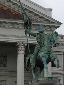
The principal building on the square is the Church of Saint Jacques-sur-Coudenberg, consecrated in 1787, and designed by Barré and Guimard. On the western side of the square is the main building of the Royal Museums of Fine Arts of Belgium, next to the Magritte Museum while on the south-east side is the BELvue Museum. At the center of Place Royale is a statue of Godfrey of Bouillon, the leader of the first crusade in 1096, riding on horseback. It was sculpted by Eugène Simonis in 1848 to replace the statue of Prince Charles Alexander of Lorraine that had been melted down for the metal during the French Revolution. Rue de Namur/Naamsestraat enters the square from the south, rue de la Régence/Regentschapstraat from the southwest, and Mont des Arts from the northwest.


External links
See also
References
- ↑ Fletcher, B: Sir Banister Fletcher's a History of Architecture, p. 821. Architectural Press (1996)
- ↑ "L'attaque du Parc de Bruxelles par les Volontaires en 1830". B1830.be. Retrieved 12 April 2013.
Coordinates: 50°50′32″N 4°21′34″E / 50.84222°N 4.35944°E