Pitsiulartok
 | |
| Geography | |
|---|---|
| Location | Hudson Bay |
| Coordinates | 63°15′N 090°33′W / 63.250°N 90.550°WCoordinates: 63°15′N 090°33′W / 63.250°N 90.550°W |
| Country | |
| Nunavut |
|
| Region | Kivalliq |
| Demographics | |
| Population | Uninhabited |
Pitsiulartok or Pituilaktok (formerly: Fairway Island),[1] is a small, uninhabited island located at 63°15'N, 90°33'W[2] in Hudson Bay, about 13 km[3] from the community of Chesterfield Inlet, Nunavut, Canada. The narrow island is about 3.5 km in length and barely 1 km wide at its widest point. Traditionally it was a walrus-hunting ground for the local Inuit,[2] and a landmark for southern whalers.[4] It is part of a loose chain of small islands running along the coast, including Sakpik Island and Promise Island.
The name "Pituilaktok" comes from the Inuktitut name for a local bird known in English as the black guillemot (cepphus grylle), "pitiula".[5]
-
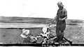
Fairway Island, early 1920s. Subject unidentified. Photo by Hudson's Bay Company employee Capt. George Cleveland of the motor schooner Fort Chesterfield.
References
- ↑ "Renaming the North". explorenorth.com. Retrieved 2008-04-15.
- ↑ 2.0 2.1 COSEWIC Assessment and Update Status Report on the Atlantic Walrus Odobenus rosmarus rosmarus in Canada (2006). Ottawa, ON.
|coauthors=requires|author=(help) - ↑ "Geographic features & Photographs around Chesterfield Inlet, in Nunavut, Canada". travelingluck.com. Retrieved 2008-04-15.
- ↑ Barr, William (2004). Red Serge and Polar Bear Pants: The Biography of Harry Stallworthy,. University of Alberta. ISBN 0-88864-433-7.
- ↑ Arctic Institute of North America. "Eskimo Bird Names at Chesterfield Inlet and Baker Lake, Keewatin, Northwest Territories". ucalgary.com. Retrieved 2008-04-15.
| ||||||||||||||