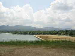
Pilar, Bohol
From Wikipedia, the free encyclopedia
| Pilar | |
|---|---|
| Municipality | |
 | |
 | |
.svg.png) Pilar | |
| Coordinates: 09°50′N 124°20′E / 9.833°N 124.333°ECoordinates: 09°50′N 124°20′E / 9.833°N 124.333°E | |
| Country | Philippines |
| Region | Central Visayas (Region VII) |
| Province | Bohol |
| District | 3rd district of Bohol |
| Incorporated | December 26, 1960 |
| Barangays | 21 |
| Government[1] | |
| • Mayor | Wilson L. Pajo |
| Area[1] | |
| • Total | 64.55 km2 (24.92 sq mi) |
| Population (2010)[2] | |
| • Total | 26,887 |
| • Density | 420/km2 (1,100/sq mi) |
| Time zone | PST (UTC+8) |
| ZIP code | 6321 |
| Dialing code | 38 |
| Income class | 4th class |
Pilar is a fourth class municipality in the province of Bohol, Philippines. According to the 2010 census, it has a population of 26,887 people.[2]
Barangays
Pilar is politically subdivided into 21 barangays.
- Aurora
- Bagacay
- Bagumbayan
- Bayong
- Buenasuerte
- Cagawasan
- Cansungay
- Catagda-an
- Del Pilar
- Estaca
- Ilaud
- Inaghuban
- La Suerte
- Lumbay
- Lundag
- Pamacsalan
- Poblacion
- Rizal
- San Carlos
- San Isidro
- San Vicente
History
Pilar was formerly a barrio of Sierra Bullones, known as Lungsodaan. It became a separate municipality on December 26, 1960, by Executive Order No. 460 issued by then President Carlos P. Garcia.[1]
Demographics
| Population census of Pilar | ||
|---|---|---|
| Year | Pop. | ±% p.a. |
| 1990 | 19,930 | — |
| 1995 | 21,141 | +1.19% |
| 2000 | 25,095 | +3.49% |
| 2007 | 27,276 | +1.20% |
| 2010 | 26,887 | −0.48% |
| Source: National Statistics Office[2][3] | ||
References
- ↑ 1.0 1.1 1.2 "Municipality of Pilar". Province of Bohol. Retrieved 2012-09-20.
- ↑ 2.0 2.1 2.2 "Population and Annual Growth Rates by Province, City, and Municipality - Region VII - Central Visayas: 1990, 2000, and 2010". National Statistics Office.
- ↑ National Statistics Office - Population and Annual Growth Rates by Province, City and Municipality: Central Visayas: 1995, 2000 and 2007
External links
 |
Dagohoy | |
Alicia |  |
| |
Candijay | |||
| ||||
| | ||||
| Sierra Bullones | |
Guindulman |
This article is issued from Wikipedia. The text is available under the Creative Commons Attribution/Share Alike; additional terms may apply for the media files.