Perledo
From Wikipedia, the free encyclopedia
| Perledo perledesi | |
|---|---|
| Comune | |
| Comune di Perledo | |
 | |
 Perledo | |
| Coordinates: 46°1′N 9°18′E / 46.017°N 9.300°ECoordinates: 46°1′N 9°18′E / 46.017°N 9.300°E | |
| Country | Italy |
| Region | Lombardy |
| Province | Province of Lecco (LC) |
| Area | |
| • Total | 12.53 km2 (4.84 sq mi) |
| Elevation | 199-1,350 m (−4,230 ft) |
| Population (Dec. 2010) | |
| • Total | 945 |
| • Density | 75/km2 (200/sq mi) |
| Time zone | CET (UTC+1) |
| • Summer (DST) | CEST (UTC+2) |
| Postal code | 23828 |
| Dialing code | 0341 |
| Patron saint | Saint Martin |
| Saint day | September 11 |
| Website | Official website |
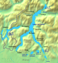
Perledo is a comune (municipality) in the Province of Lecco in the Italian region Lombardy, located about 60 km north of Milan and about 20 km northwest of Lecco. As of 31 December 2004, it had a population of 900 and an area of 12.5 km².[1]
Perledo borders the following municipalities: Bellano, Esino Lario, Menaggio, Parlasco, San Siro, Varenna.
Perledo includes the following "frazione" or hamlets: Tondello, Olivedo, Vezio, Regolo, Bologna, Gisazio, Regoledo, Cestaglia, Gittana, Gittana, Portone, Panighetto.
Demographic evolution

References
External links
| ||||||||||||||||||||||||||||||||
This article is issued from Wikipedia. The text is available under the Creative Commons Attribution/Share Alike; additional terms may apply for the media files.