Pangboche
From Wikipedia, the free encyclopedia
For the crater on Mars, see Pangboche (crater).
| Pangboche | |
|---|---|
| Village | |
 | |
 Pangboche | |
| Coordinates: 27°51′N 86°48′E / 27.850°N 86.800°ECoordinates: 27°51′N 86°48′E / 27.850°N 86.800°E | |
| Country |
|
| Zone | Sagarmatha Zone |
| District | Solukhumbu District |
| VDC | Khumjung |
| Time zone | Nepal Time (UTC+5:45) |
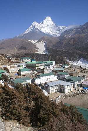
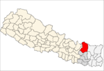
Pangboche or Panboche is a village in Khumjung VDC of Solukhumbu District, Nepal at an altitude of 13,074 feet (3,985 m).[1] It is located high in the Himalayas in the Imja Khole valley, about 3 kilometres northeast of Tengboche and is a base camp for climbing nearby Mount Everest and trekking. It contains a monastery, famed for its purported yeti scalp and hand, the latter of which was stolen.[2] The village is inhabited mainly by Sherpas, and Sungdare Sherpa, a native of the village, had the record for conquering Everest five times in the Sherpa climbing history and in the world history of mountaineering in 1989.[3] Sir Edmund Hillary once built a swing for Pangboche School. [4] North of the village is the Dughla lake and pass.
See also
References
- ↑ Deutschle, Phil (1 May 2012). The Two-Year Mountain: A Nepal Journey. Bradt Travel Guides. p. 107. ISBN 978-1-84162-385-6. Retrieved 13 May 2012.
- ↑ Paris match. April 1973. Retrieved 13 May 2012.
- ↑ Kunwar, Ramesh Raj (1989). Fire of Himal: an anthropological study of the Sherpas of Nepal Himalayan region. Nirala Publications. p. 100. Retrieved 13 May 2012.
- ↑ Johnston, Alexa (16 October 2005). Reaching the Summit: Sir Edmund Hillary's Life of Adventure. Dk Pub. pp. 147–8. ISBN 978-0-7566-1527-7. Retrieved 13 May 2012.
External links
This article is issued from Wikipedia. The text is available under the Creative Commons Attribution/Share Alike; additional terms may apply for the media files.
