Pápoc
From Wikipedia, the free encyclopedia
| Pápoc | ||
|---|---|---|
 | ||
| ||
 Pápoc | ||
| Coordinates: 47°24′48″N 17°07′42″E / 47.41328°N 17.12826°E | ||
| Country | Hungary | |
| Region | Western Transdanubia | |
| County | Vas | |
| Subregion | Celldömölki | |
| Rank | Village | |
| KSH code | 14067[1] | |
| Area[1] | ||
| • Total | 31.32 km2 (12.09 sq mi) | |
| Population (1 January 2008)[1] | ||
| • Total | 340 | |
| • Density | 11/km2 (28/sq mi) | |
| Time zone | CET (UTC+1) | |
| • Summer (DST) | CEST (UTC+2) | |
| Postal code | 9515 | |
| Area code | +36 95 | |
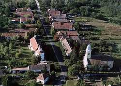
Pápoc is a village in Vas county, Hungary.
Sightseeing for visitors: the old rotunda of Árpád age
In the village there is an old architectural heritage from the romanesque art: the old rotunda. It was built in the 13th century. The inner space consists of four apses surrounding a central circular space. The rotunda has two floors: the stairs go up in a corridor inside the wall. The rotunda is built together with a monastery of St. Agustino Order. It has beautiful southern doorway.
Outer references
- Gervers-Molnár, V. (1972): A középkori Magyarország rotundái. (Rotunda in the Medieval Hungary). Akadémiai, Budapest
- Gerevich Tibor: Magyarország románkori emlékei. (Die romanische Denkmäler Ungarns.) Egyetemi nyomda. Budapest, 1938.
- Henszlmann, I. (1876): Magyarország ó-keresztyén, román és átmeneti stylü mű-emlékeinek rövid ismertetése, (Old-Christian, Romanesque and Transitional Style Architecture in Hungary). Királyi Magyar Egyetemi Nyomda, Budapest
- Bedy Vince: A pápóci prépostság és perjelség története. [Geschichte der Probstei und des Priorates Pápocz.] (Gyõregyházmegye Múltjából, 6.) Gyõr, 1939.
- Csányi Károly: A pápóci négykarélyos, emeletes kápolna mûszaki leírása. [Die technische Beschreibung der vierpassförmigen Geschosskapelle zu Pápóc.] In: Bedy Vince: A pápóci prépostság és perjelség története. [Geschichte der Probstei und des Priorates Pápocz.] (Gyõregyházmegye Múltjából, 6.) Gyõr, 1939. 119-124. p.
References
- ↑ 1.0 1.1 1.2 Pápoc at the Hungarian Central Statistical Office (Hungarian). 1 January 2008
Coordinates: 47°25′N 17°08′E / 47.417°N 17.133°E
This article is issued from Wikipedia. The text is available under the Creative Commons Attribution/Share Alike; additional terms may apply for the media files.
