Oudtshoorn
| Oudtshoorn | |
|---|---|
 | |
 Oudtshoorn | |
| Coordinates: 33°35′S 22°12′E / 33.583°S 22.200°ECoordinates: 33°35′S 22°12′E / 33.583°S 22.200°E | |
| Country | South Africa |
| Province | Western Cape |
| District | Eden |
| Municipality | Oudtshoorn |
| Established | 1857[1] |
| Area[2] | |
| • Total | 37.6 km2 (14.5 sq mi) |
| Population (2011)[2] | |
| • Total | 61,507 |
| • Density | 1,600/km2 (4,200/sq mi) |
| Racial makeup (2011)[2] | |
| • Black African | 12.5% |
| • Coloured | 70.9% |
| • Indian/Asian | 0.4% |
| • White | 15.3% |
| • Other | 1.0% |
| First languages (2011)[2] | |
| • Afrikaans | 87.8% |
| • Xhosa | 7.4% |
| • English | 2.6% |
| • Other | 2.2% |
| Postal code (street) | 6625 |
| PO box | 6620 |
| Area code | 044 |
Oudtshoorn is a town in the Western Cape province of South Africa. With 80,336 inhabitants, it is the largest town in the Little Karoo region. The town is home to the world's largest ostrich population, with a number of specialized ostrich breeding farms, such as the Safari Show Farm and the Highgate Ostrich Show Farm.
Bongelethu is a township 10 km east of Oudtshoorn. Derived from Xhosa, its name means 'our pride'.[3]
History

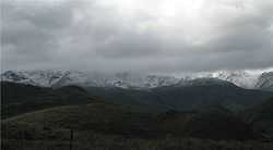
The area in which Oudtshoorn is situated was originally inhabited by Bushmen, as evidenced by the many rock paintings that are found in caves throughout the surrounding Swartberg mountains.
The first European explorers to the area was a trading party led by a certain Ensign Shrijver, who were guided there by a Griqua via an ancient elephant trail in January 1689. The expedition reached as far as present-day Aberdeen before turning back and exiting the Klein Karoo valley through Attaquas Kloof on 16 March of the same year. However, it was only a hundred years later that the first farmers started settling in the region.
The first large permanent structure of the Klein Karoo, a church of the Dutch Reformed denomination, was first erected in 1839, near the banks of the Grobbelaars River. The village (and later town) of Oudtshoorn gradually grew around this church; it was named after Baron Pieter van Rheede van Oudtshoorn, who was appointed Governor of the Cape Colony in 1772, but died on the voyage out.
A small one-room school was opened in 1858, followed by the formation of a municipality and the founding of an Agricultural Society in 1859. During the same year, work was also started on a larger church to replace the original small one.
Unfortunately, 1859 also signalled the start of a long and serious drought which severely depressed the national economy - by 1865, there was serious poverty. When the drought was finally broken by floods in 1869, the depression lifted and Oudtshoorn was transformed from a struggling village to a town of great prosperity.
At one time, there was a large Jewish immigrant population mostly from Lithuania and the town was known in the Jewish world as "Jerusalem of Africa".
First Ostrich Boom
The main reason for the large rise in prosperity was the ostrich, whose feathers had become extremely popular as fashion accessories in Europe; they were especially popular for use on hats. Between 1875 and 1880, ostrich prices reached up to GBP 1,000 a pair. The farmers of the region, realising that ostriches were far more profitable than any other activity, ripped out their other crops and planted lucerne, which was used as feed for the ostriches. The rising wealth also finally allowed for the completion of the Dutch Reformed Church - it was opened on 7 June 1879.
Owing to overproduction, the ostrich industry experienced a sudden slump in fortunes in 1885; the town's misery was compounded when it was hit by severe flooding during the same year, which washed away the nearby Victoria Bridge, which had been built over the Olifants River only the year before.
Second Ostrich Boom
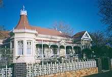
The ostrich industry recovered slowly and it was not until after the Second Anglo-Boer War of 1899 to 1902, that a second and bigger boom started. It was during this period that most of Oudtshoorn's famously opulent "Feather Palaces" were built. This boom peaked in 1913, before collapsing in 1914. This was blamed on Henry Ford and the arrival of the motor car. Ladies wearing large hats with ostrich plumes found that such hats were not suitable and were blown off at car speeds (related by a local ostrich farmer). As a result, the region's economy was ruined, and most farmers returned to more traditional crops.
Society and culture
Afrikaans
C. J. Langenhoven, the town's most famous inhabitant, rose to prominence during the post-collapse period. Considered by many to be one of the fathers of Afrikaans, Langenhoven was a prodigious writer who provided much of the literature that formed the backbone of the Afrikaans language during its early development.
Festivals
The Klein Karoo Nasionale Kunstefees, better known as the ABSA KKNK, ("Little Karoo National Arts Festival"), South Africa's largest Afrikaans language arts festival[citation needed], takes place in the town on a yearly basis.
Museums, monuments and memorials
- CP Nel Museum[4]
- Gottland House, 72 Baron van Rheede Street[5]
Churches
The oldest church is the Dutch Reformed Church, erected in 1837, and situated on the corner of Church Street and High Street. Other churches include, Apostolic Faith Mission, Anglican, Presbyterian, Baptist, Roman Catholic (Roman Catholic Diocese of Oudtshoorn) and other traditional churches. In recent years, the number of Independent churches (also referred to as non denominational churches) have grown dramatically. Independent Churches include the River of Life Church, New Life Ministries, The Vineyard and the Oudtshoorn Community Church.[6]
Educational Institutions
Apart from the many high schools in Oudtshoorn, there are also many independent tertiary educational institutions, including the South Cape College,[7] Principia College, Elsenburg Agricultural Training Institute[8] and Timothy Training Institute.[9]
Wine
Oudtshoorn is the start of the Route 62 wine route. Some of the best South African Port style wines are produced in the area surrounding Oudsthoorn.
Tourism
Tourist information
Oudtshoorn and De Rust are managed by Greater Oudtshoorn Tourism.[10] The tourism office (GOT) is centrally situated in Voortrekker Road (next to the CP Nel Museum).
Tourist attractions
Tourist attractions in Oudtshoorn and the surrounding areas include:
- Buffelsdrift Game Lodge
- Cango Caves
- Cango Ostrich Farm[11]
- Safari Show Farm
- Highgate Ostrich Show Farm
- Cango Wildlife Ranch[12]
- Oudtshoorn Ballooning[13]
- Swartberg Adventures
The area is also famed for its biodiversity, with the area home to an unusually large number of species of succulent plant. There are also several wine producers in the region.
Famous people
- C. J. Langenhoven - Writer, Poet & Politician
- Skipper Badenhorst - Rugby union player
- Lucas "Kabamba" Floors - Rugby union player
- Arthur Nortje - Poet
- Sid O'Linn - Cricket player
- Pauline Janet Smith - Writer
- Percival Henry Frederick Sonn - Lawyer and cricket administrator
- Allan Ladd -Country Singer
References
- ↑ "Chronological order of town establishment in South Africa based on Floyd (1960:20-26)". pp. xlv–lii.
- ↑ 2.0 2.1 2.2 2.3 Sum of the Main Places Oudtshoorn, Bongolethu and Bridgeton from Census 2011.
- ↑ Raper, Peter E. (1987). Dictionary of Southern African Place Names. Internet Archive. p. 87. Retrieved 28 August 2013.
- ↑ "C P Nel Museum, Baron van Rheede Street - 9/2/068/0007". South African Heritage Resource Agency.
- ↑ "Gottland House 72 Baron van Rheede Street - 9/2/068/0015". South African Heritage Resource Agency.
- ↑ http://www.oudtshoorninfo.com/gen_info.php?action=show_article&id=163&category=97
- ↑ http://www.sccollege.co.za
- ↑ http://www.elsenburg.com/ciat.html
- ↑ http://www.timothy.org.za
- ↑ http://www.oudtshoorn.com
- ↑ http://www.cangoostrich.co.za
- ↑ http://www.cango.co.za
- ↑ http://www.oudtshoornballooning.co.za
External links
| Wikimedia Commons has media related to Oudtshoorn. |
| Wikivoyage has a travel guide for Oudtshoorn. |
| |||||||||||||||||||||||||||||

.svg.png)