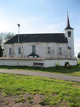
Orlické Záhoří
From Wikipedia, the free encyclopedia
| Orlické Záhoří | |
| Village | |
 | |
| Country | Czech Republic |
|---|---|
| Region | Hradec Králové |
| District | Rychnov nad Kněžnou |
| Little District | Rychnov nad Kněžnou |
| Elevation | 649 m (2,129 ft) |
| Coordinates | 50°17′4″N 16°27′8″E / 50.28444°N 16.45222°E |
| Area | 29.14 km2 (11.25 sq mi) |
| Population | 212 (2006-08-28) |
| Density | 7 / km2 (18 / sq mi) |
| First mentioned | 1571 |
| Mayor | Vojtěch Špinler |
| Timezone | CET (UTC+1) |
| - summer (DST) | CEST (UTC+2) |
| Postal code | 517 64 |
  Location in the Czech Republic
| |
| Wikimedia Commons: Orlické Záhoří | |
| Website: www.orlickezahori.eu/ | |
Orlické Záhoří is a municipality (obec) in the Rychnov nad Kněžnou District, Czech Republic It consists of several settlements in the Divoká Orlice valley between the Bystrzyckie Mountains and Orlické Mountains, along the border with Poland (which matches the flow of the Divoká Orlice river in this area). It was established in 1951, while the constituting settlements trace back to 15-16th centuries.[1][2] The name may be approximately translated as "Orlice Transmountain Area"
The municipality encompasses the following villages:
- Trčkov (Trschkadorf)
- Bedřichovka (Friedrichswald)
- Zelenka (Grünborn)
- Jadrná (Kerndorf)
- Kunštát (Kronstadt)
- Černá Voda (Schwarzwasser)
The municipality has a pass to Poland for pedestrians, cyclists and personal cars.[2]
Gallery
-

Former custom-house
-

Joseph II, Holy Roman Emperor
References
- ↑ Orlické Záhoří profile, referring to the source: J. Šůla: Počátky osídlení horního toku Divoké Orlice, part 1. (sympozium Panorama 8, editorship SEN Dobré, 2000)
- ↑ 2.0 2.1 Orlické Záhoří website (Czech)
| Wikimedia Commons has media related to Orlické Záhoří. |
This article is issued from Wikipedia. The text is available under the Creative Commons Attribution/Share Alike; additional terms may apply for the media files.