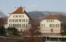
Oberhofen am Thunersee
| Oberhofen am Thunersee | ||||||||||
|---|---|---|---|---|---|---|---|---|---|---|
 | ||||||||||
| Population | 2,366 (Dec 2012)[1] | |||||||||
| - Density | 845 /km2 (2,189 /sq mi) | |||||||||
| Area | 2.72 km2 (1.05 sq mi)[2] | |||||||||
| Elevation | 585 m (1,919 ft) | |||||||||
| Postal code | 3653 | |||||||||
| SFOS number | 0934 | |||||||||
| Surrounded by | Heiligenschwendi, Hilterfingen, Sigriswil, Spiez | |||||||||
| Website | www.oberhofen.ch SFSO statistics | |||||||||
 Oberhofen am Thunersee | ||||||||||
| Location of Oberhofen am Thunersee
 | ||||||||||
Oberhofen am Thunersee is a municipality in the administrative district of Thun in the canton of Bern in Switzerland.
_334.JPG)
History
Oberhofen is first mentioned in 1133 as Obrenhoven.[3]
Geography
Oberhofen has an area, as of 2009, of 2.72 square kilometers (1.05 sq mi). Of this area, 0.55 km2 (0.21 sq mi) or 20.2% is used for agricultural purposes, while 1.43 km2 (0.55 sq mi) or 52.6% is forested. Of the rest of the land, 0.76 km2 (0.29 sq mi) or 27.9% is settled (buildings or roads), 0.01 km2 (2.5 acres) or 0.4% is either rivers or lakes and 0.02 km2 (4.9 acres) or 0.7% is unproductive land.[4]
Of the built up area, housing and buildings made up 18.8% and transportation infrastructure made up 5.1%. Power and water infrastructure as well as other special developed areas made up 1.1% of the area while parks, green belts and sports fields made up 2.6%. Out of the forested land, 51.1% of the total land area is heavily forested and 1.5% is covered with orchards or small clusters of trees. Of the agricultural land, 17.3% is pastures, while 2.9% is used for orchards or vine crops. All the water in the municipality is in rivers and streams.[4]
It is located on the northern shore of Lake Thun (German: Thunersee) about 5 km (3.1 mi) from the city of Thun (which is located where the Aare river leaves the lake). Ecclestically the village has always been a section of the parish of Hilterfingen, the next village north along the lake (The village church of Hilterfingen is actually on ground that is a part of Oberhofen township). The neighboring village to the south-east is Gunten (part of the township of Sigriswil), while up the steep mountain to the north-east is the village of Heiligenschwendi (no road connection, only a footpath).
Demographics
Oberhofen has a population (as of 31 December 2012) of 2,366.[1] As of 2007, 7.7% of the population was made up of foreign nationals. Over the last 10 years the population has grown at a rate of 10.2%. Most of the population (as of 2000) speaks German (94.3%), with Albanian being second most common ( 1.1%) and French being third ( 0.9%).
In the 2007 election the most popular party was the SVP which received 33.6% of the vote. The next three most popular parties were the FDP (21.2%), the SPS (17.5%) and the Green Party (14.8%).
The age distribution of the population (as of 2000) is children and teenagers (0–19 years old) make up 15.9% of the population, while adults (20–64 years old) make up 60.5% and seniors (over 64 years old) make up 23.6%. In Oberhofen about 86.7% of the population (between age 25-64) have completed either non-mandatory upper secondary education or additional higher education (either university or a Fachhochschule).
Oberhofen has an unemployment rate of 1.65%. As of 2005, there were 36 people employed in the primary economic sector and about 13 businesses involved in this sector. 92 people are employed in the secondary sector and there are 17 businesses in this sector. 440 people are employed in the tertiary sector, with 84 businesses in this sector.[5] The historical population is given in the following table:[3]
| year | population |
|---|---|
| 1764 | 349 |
| 1850 | 731 |
| 1900 | 909 |
| 1950 | 1,486 |
| 2000 | 2,179 |
Sights

Historically Oberhofen was primarily an agricultural community (mainly vinticulture) until the late 19th century. Today it is a rather affluent residential community, privileged by geography. The hill slopes to the lake toward south-west, giving both much sunlight, and a spectacular view to the glacier covered high alpine peaks of the Bernse Alps across the lake.
The dominant feature of the village is the lakeside castle of Oberhofen, dating back to the Middle Ages, but constantly changed and updated throughout the ages. The castle today houses a division of the Historic Museum of Bern, and has a spectacular formal lakeside garden in the English style with many rare specimen trees.

The Wichterheer estate, lakeside to the south of the castle, houses the Museum fũr Uhren und Mechanische Musik (Museum of Timekeeping and Mechanical Music) as well as an exhibit of 20th century local art.
References
- ↑ 1.0 1.1 Swiss Federal Statistical Office - STAT-TAB, online database – Datenwürfel für Thema 01.2 - Bevölkerungsstand und -bewegung (German) accessed 29 August 2013
- ↑ Arealstatistik Standard - Gemeindedaten nach 4 Hauptbereichen
- ↑ 3.0 3.1 Oberhofen in German, French and Italian in the online Historical Dictionary of Switzerland.
- ↑ 4.0 4.1 Swiss Federal Statistical Office-Land Use Statistics 2009 data (German) accessed 25 March 2010
- ↑ Swiss Federal Statistical Office accessed 17-Jul-2009
External links
| Wikimedia Commons has media related to Oberhofen. |
