Nyíradony
From Wikipedia, the free encyclopedia
| Nyíradony | |
|---|---|
| Country |
|
| County | Hajdú-Bihar |
| Area | |
| • Total | 96.59 km2 (37.29 sq mi) |
| Population (2001) | |
| • Total | 8,070 |
| • Density | 83.2/km2 (215/sq mi) |
| Time zone | CET (UTC+1) |
| • Summer (DST) | CEST (UTC+2) |
| Postal code | 4254 |
| Area code(s) | 52 |

Hunting lodge nearby
Nyíradony

Ruin of little chapel
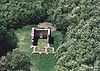
Aerialphotography: Nyíradony - ruins
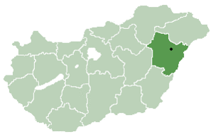
Location of Hajdú-Bihar county in Hungary
Nyíradony is a town in Hajdú-Bihar county, in the Northern Great Plain region of eastern Hungary.
Geography
It covers an area of 96.59 km2 (37 sq mi) and has a population of 8,070 people (2001).
Places of interest
- New sports hall with indoor pool and sauna
- Greek catholic church in the city centre with nice wall paintings
- Ruin of a little chapel that was destroyed by the Tatars in the 12. century.
Transportation
- By car: Highway 471 connects Nyíradony with Debrecen.
- By train: There are sporadic direct connections to Budapest. In general it is necessary to change trains in Debrecen for long distance connections.
Accommodation
- In the forest (about 3 Kilometer east of Nyíradony) there is a hunting lodge with a guesthouse.
External links
- Official homepage of Nyíradony (Hungarian)
- Information about Nyíradony on 1hungary.com (English)
| |||||||||||||||||

Coordinates: 47°41′N 21°55′E / 47.683°N 21.917°E
This article is issued from Wikipedia. The text is available under the Creative Commons Attribution/Share Alike; additional terms may apply for the media files.