Northern Range


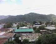
The Northern Range is the range of tall hills across north Trinidad, the major island in the Republic of Trinidad and Tobago. The hills range from the Chaguaramas peninsula on the west coast to Toco in the east.[1]:3
The hills rise abruptly from the lowlands of northern Trinidad (the so-called East-West Corridor), but only the two tallest peaks, El Cerro del Aripo and El Tucuche top 900 m. The south-facing valleys run deep into the hills and support major rivers, while the north-facing valleys are generally short and are drained by smaller streams.
The Northern Range consists mainly of sedimentary rocks - schists and limestones; portions at the eastern end of the range are of volcanic origin. The hills are mostly forested, although deforestation and the formation of fire-savannahs is one of the major environmental concerns in Trinidad.
The Northern Range runs from the Chaguaramas Peninsula in the west to Toco in the east. The eastern Northern Range (areas east of Arima) remain most heavily forested. Portions west of Arima, especially the southern slopes and valleys, have been extensively deforested, since they lie immediately north of the most heavily populated parts of the island.
At the western end of the Northern Range, the capital city, Port of Spain, climbs into the hills and the valleys are settled and largely deforested.
The Arima Valley remains as the westernmost valley that is still primarily forested, in a large part due to the presence of the Asa Wright Nature Centre in this valley.
Gallery
|
|
See also
References
- ↑ Northern Range Assessment (2005). Report of an Assessment of the Northern Range, Trinidad and Tobago: People and the Northern Range. State of the Environment Report 2004. Environmental Management Authority of Trinidad and Tobago.
Coordinates: 10°44′N 61°15′W / 10.733°N 61.250°W


