Nobska Light
 | |
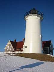
| Nobska Light (March 2005) | |
| Location | Woods Hole, Massachusetts |
|---|---|
| Coordinates | 41°30′56.7″N 70°39′18.5″W / 41.515750°N 70.655139°W |
| Year first constructed | 1829 |
| Year first lit | 1876 (current tower) |
| Automated | 1985 |
| Foundation | Natural Emplaced |
| Construction | Iron with brick lining |
| Tower shape | Cylindrical |
| Markings / pattern | White with black lantern |
| Height | 40 feet (12 m) |
| Focal height | 87 feet (27 m) |
| Original lens | Fifth order Fresnel lens, 1876 |
| Current lens | Fourth order Fresnel lens, 1888 |
| Range | White 13 nautical miles (24 km; 15 mi), Red 11 nautical miles (20 km; 13 mi) |
| Characteristic | Fl W, 6 sec. Red sector |
| Fog signal | 2 blasts every 30s |
| Admiralty number | J0456 |
| ARLHS number | USA-550 |
| USCG number | 1-15560[1][2][3] |
|
Nobska Point Light Station | |
 | |
| Location | Nobska Rd., Falmouth, Massachusetts |
| Coordinates | 41°30′59″N 70°39′27″W / 41.51639°N 70.65750°WCoordinates: 41°30′59″N 70°39′27″W / 41.51639°N 70.65750°W |
| Area | 2.1 acres (0.85 ha) |
| Built | 1876 |
| Architectural style | Italianate, Other, Federal Revival |
| Governing body | Federal |
| MPS | Lighthouses of Massachusetts TR |
| NRHP Reference # | 87001483[4] |
| Added to NRHP | June 15, 1987 |
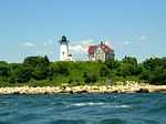
Nobska Light, or Nobsque Light, also known as Nobska Point Light is a lighthouse located at the division between Buzzards Bay and Vineyard Sound in Woods Hole on the southwestern tip of Cape Cod, Massachusetts. It overlooks Martha's Vineyard and Nonamessett Island.
First built in 1828, Nobska Light was rebuilt in 1876. The structure was added to the National Register of Historic Places as Nobska Point Light Station in 1987.
The home adjacent to the light serves as the residence for the Commanding Officer of United States Coast Guard Sector Southeastern New England.
Gallery
-

-

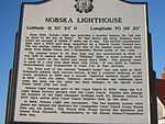
History of Nobska Point
-

Brick lined interior & spiral stairway
-

Fourth Order Fresnel Lens at Nobska
-

Vineyard Sound viewed through glass enclosure at Nobska Light
-

Signage at Nobska
-

Looking at Vineyard Sound through the lighthouse porthole!
-

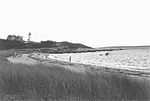
Local beach near Nobska Point, Woods Hole
References
- ↑ "Historic Light Station Information and Photography: Massachusetts". United States Coast Guard Historian's Office.
- ↑ Light List, Volume I, Atlantic Coast, St. Croix River, Maine to Shrewsbury River, New Jersey (PDF). Light List. United States Coast Guard. 2012. p. 145.
- ↑ Rowlett, Russ (2012-02-24). "Lighthouses of the United States: Southeast Massachusetts". The Lighthouse Directory. University of North Carolina at Chapel Hill.
- ↑ "National Register Information System". National Register of Historic Places. National Park Service. 2010-07-09.
See also
- Cape Neddick Light, a similar lighthouse in Maine, constructed in 1879.
External links
| ||||||||||||||||||||
