Nilambur
From Wikipedia, the free encyclopedia
| Nilambur | |
|---|---|
| town | |
 | |
 Nilambur | |
| Coordinates: 11°16′37″N 76°13′33″E / 11.27694°N 76.22583°ECoordinates: 11°16′37″N 76°13′33″E / 11.27694°N 76.22583°E | |
| Country |
|
| State | Kerala |
| District | Malappuram |
| Government | |
| • MP | M.I.Shanavas - Wayanad (Lok Sabha constituency) |
| • MLA | Aryadan Muhammed - Nilambur (Assembly constituency) |
| • Chairman | Aryadan Shoukath - Nilambur Municipality |
| Languages | |
| • Official | Malayalam, English |
| Time zone | IST (UTC+5:30) |
| PIN | 679329 |
| Telephone code | 04931 |
| Vehicle registration | KL 71 |
| Sex ratio | 1000:1070 ♂/♀ |
| Literacy | 100% |
| Website | www.nilambur.info |
Nilambur is a municipality and a taluk in the Malappuram district of Kerala, South India. It is situated close to the Nilgiris range of the Western Ghats on the banks of the Chaliyar River. It is about 40 kilometres from Malappuram city and 24 kilometres from Manjeri on the Kozhikode–Gudalur road.
Nilambur Municipality
Area: 36.26 km2 Population based on social audit report 2008-09 Male: 20659 Female: 21106 Total: 41765 Population Density: 1149 km2 Female Male ratio: 1.02:1 Schedule caste: 1315 Schedule tribe: 563

The Nilgiri mountains

Landscape in inner parts of nilambur

Nilambur Rubber Estate

Punnapuzha
Politics
The Nilambur assembly constituency is part of the Malappuram District and Wayanad (Lok Sabha constituency).
Places of interest

Biggest Teak in Conolly Plot

Hanging Bridge across Chaliyar river
- Conolly Plot - 2 km from Nilambur Town. The plot was named in memory of H.V.Conolly, then Malabar District Collector.
- The longest Hanging Bridge in Kerala, across river Chaliyar will take one to the Conolly plot, which is just 300 metres off the Calicut-Nilambur-Ooty State Highway.
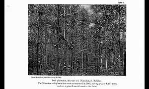
- Giant Teak, an old planted teak
- The Teak Museum, maintained by the Kerala Forest Research Institute
- Banglavu Kunnu (Bungalow Hill) at Nilambur is famous for its winding road where ayurvedic herbs are planted on both the sides of the officers'cottages (which are now used as forest range offices).
- Aruvacode Pottery Village.'Kumbham' and Artist Jinan has made this pottery village famous.
- Adyan Para Waterfalls, situated a few kilometers away on the other side of the Chaliyar River. It is situated 14 km from Nilambur.
- Koyippara Waterfalls (near kakkadampoyil) is also popular with visitors. It can be reached by travelling through a side road through Akampadam.
- Nedumkayam in the Nilambur reserve forest, where one can have a close look at the elephant camp run by the forest department. It is 18 km from Nilambur.
- Elephant Training Centre, where elephants poached from the forests were trained. Huge wooden cages can still be seen, though poaching has been banned.
Transport and Other Facilities

Nilambur Teak plantations (1917)
- Nearest Airport - Calicut International Airport - 45 km.
- Nearest Railway station - Nilambur Road Railway Station - 4 km
- A KSRTC Bus Stand is situated here (Aruvacode). KSRTC Online reservation facility is available here.
References
| Wikimedia Commons has media related to Nilambur. |
External links
- Nilambur Images
- Ecological history of Nilambur valley, see chapter 6
- Kerala Tourism page for Nilambur
- Nilambur Directory and Current Affairs
| ||||||||
This article is issued from Wikipedia. The text is available under the Creative Commons Attribution/Share Alike; additional terms may apply for the media files.