New York metropolitan area
| Metropolitan New York City New York–New Jersey–Connecticut-Pennsylvania (CSA) | |
|---|---|
 | |
| Coordinates: 40°48′31″N 74°1′13.39″W / 40.80861°N 74.0203861°WCoordinates: 40°48′31″N 74°1′13.39″W / 40.80861°N 74.0203861°W | |
| National | United States |
| State |
|
| Largest city |
New York City (Brooklyn) (Queens) (Manhattan) (The Bronx) (Staten Island) |
| Other Municipalities |
Newark Jersey City Yonkers Paterson Bridgeport Elizabeth Stamford New Haven Allentown Waterbury Edison Norwalk Trenton Danbury New Rochelle Passaic |
| Area | |
| • Total | 13,318 sq mi (34,490 km2) |
| Population ((2012)) | |
| • Total | 23,508,600 (1st) |
| • Density | 1,876/sq mi (724/km2) |
| Time zone | Eastern Time Zone (UTC-5) |
| Area code(s) | 201, 203, 212, 215, 267, 272, 347, 475, 484, 516, 518, 551, 570, 609, 610, 631, 646, 718, 732, 845, 860, 862, 908, 914, 917, 929, 973 |
|
Highest elevation 4,180 ft/1,274 m (Slide Mountain (Ulster County, New York), in the Catskill Mountains). Lowest elevation 0 ft/0 m (sea level) at the Atlantic Ocean, Long Island Sound, and at Hudson River estuary waterways. | |
The New York Metropolitan area includes the most populous city in the United States (New York City); counties comprising Long Island and the Mid- and Lower Hudson Valley in the state of New York; the six largest cities in New Jersey (Newark, Jersey City, Paterson, Elizabeth, Trenton, and Edison) and their vicinities; six of the seven largest cities in Connecticut (Bridgeport, New Haven, Stamford, Waterbury, Norwalk, and Danbury) and their vicinities; and five counties in Northeastern Pennsylvania, including the state's third-largest city of Allentown.
As per the 2012 United States Census Bureau estimates, the New York metropolitan area remains by a significant margin the most populous in the United States, by both the Metropolitan Statistical Area definition (19.8 million[12]) as well as by the Combined Statistical Area definition (23.4 million[13]); it is also one of the most populous urban agglomerations in the world.[14][15][16] The MSA covers 6,720 sq mi (17,405 km2), while the CSA area is 13,318 sq mi (34,493 km2), encompassing an ethnically and geographically diverse region. As a center of many industries, including finance, international trade, media and entertainment, tourism, biotechnology, and manufacturing, it is one of the most important economic regions in the world.
Definitions
Metropolitan Statistical Area

New York–Jersey City–White Plains, NY–NJ Metropolitan Division
Dutchess County–Putnam County, NY Metropolitan Division
Nassau County–Suffolk County, NY Metropolitan Division
Newark, NJ–PA Metropolitan Division
Remainder of the New York-Newark, NY–NJ–CT–PA Combined Statistical Area

The U.S. Office of Management and Budget utilizes two definitions of the area: the Metropolitan Statistical Area (MSA) and the Combined Statistical Area (CSA). The MSA definition is titled the New York-Newark-Bridgeport, NY-NJ-PA Metropolitan Statistical Area, and includes a population of 19,831,858 people by 2012 estimates[12](roughly 1 in 16 Americans). The MSA is further subdivided into four metropolitan divisions. The 25-county metropolitan area includes twelve counties in New York State (coinciding with the five boroughs of New York City, the two counties of Long Island, and five counties in the lower Hudson Valley); 12 counties in Northern and Central New Jersey; and one county in northeastern Pennsylvania. The largest urbanized area in the United States is at the heart of the metropolitan area, the New York–Newark, NY–NJ–CT Urbanized Area (estimated to have a population of 18,319,939 as of 2008 and an area of 6,720 square miles).
The counties and county groupings constituting the New York metropolitan area are listed below:
New York-Newark-Bridgeport, NY-NJ-PA Metropolitan Statistical Area (19,831,858)
- New York–Jersey City-White Plains, NY–NJ Metropolitan Division (11,732,233)
- Kings County (Brooklyn), NY
- Queens County, NY
- New York County (Manhattan), NY
- Bronx County, NY
- Richmond County (Staten Island), NY
- Westchester County, NY
- Bergen County, NJ
- Hudson County, NJ
- Middlesex County, NJ
- Monmouth County, NJ
- Ocean County, NJ
- Passaic County, NJ
- Rockland County, NY
- Orange County, NY
- Nassau County–Suffolk County, NY Metropolitan Division (2,875,904)
- Dutchess County-Putnam County, NY Metropolitan Division
- Newark, NJ–PA Metropolitan Division (2,126,269)
Combined Statistical Area


Combined Statistical Areas (CSA) group together adjacent core-based statistical areas with a high degree of economic interconnection.[17] The New York-Newark, NY-NJ-CT-PA Combined Statistical Area has an estimated population of 23,362,099 as of 2012.[13] About one out of every fifteen Americans resides in this region, which includes seven additional counties in New York, New Jersey, and Connecticut. This area, less the Pennsylvania portion, is often referred to as the Tri-State Area and less commonly the Tri-state Region. The New York City television designated market area (DMA) includes Pike County, Pennsylvania,[18] which is also included in the CSA.
In addition to the New York–Newark-Jersey City, NY–NJ–PA Metropolitan Statistical Area, the following core-based statistical areas are also included in the New York-Newark, NY-NJ-CT-PA Combined Statistical Area (total pop. 23,362,099):
- Bridgeport–Stamford–Norwalk, CT Metropolitan Statistical Area (916,829)
- New Haven–Milford, CT Metropolitan Statistical Area (862,477)
- Allentown-Bethlehem-Easton, PA-NJ Metropolitan Statistical Area (821,173)
- Trenton, NJ Metropolitan Statistical Area (366,222)
- Torrington, CT Micropolitan Statistical Area (189,927)
- Kingston, NY Metropolitan Statistical Area (182,693)
- East Stroudsburg, PA Metropolitan Statistical Area (169,842)
Geography

The area is frequently divided into the following regions:[19][20]
- New York City (Center of the region)
- Long Island (Nassau & Suffolk Counties, NY – separated by water from the rest of the region except New York City; not including Queens County or Kings County (Brooklyn), which coincide with two of New York City's Five Boroughs)
- North Jersey (Northern portion of New Jersey)
- Central Jersey (Middle portion of New Jersey)
- Hudson Valley (Lower Hudson Valley suburbs of Westchester, Putnam and Rockland Counties; and Mid-Hudson exurbs of Dutchess, Orange and Ulster Counties)
- Western Connecticut (Only Fairfield, New Haven and Litchfield Counties are part of the region and separated by the state line)
- Lehigh Valley (Carbon, Lehigh, and Northampton counties in Pennsylvania and Warren County in New Jersey)
- Southern and Eastern Poconos (Monroe and Pike Counties in Pennsylvania)
All eight areas can be (and often are) further divided. For instance, Long Island can be divided into its South and North Shores (usually when speaking about Nassau County), Western Suffolk, and the East End. The Hudson Valley and Connecticut are sometimes grouped together and referred to as the Northern Suburbs, largely because of the shared usage of Metro-North Railroad.[21]
Subregions
New York City
Long Island

Long Island, identified mostly by its more suburban Nassau and Suffolk counties, is also home to two of New York City's boroughs: Brooklyn and Queens.
Known especially for recreation, boating and miles of world-class public beaches, including numerous town, county and state parks and Fire Island National Seashore. Along the north shore, nicknamed the "Gold Coast", is an upscale section of Nassau and western Suffolk counties that once featured many lavish mansions built and inhabited by wealthy business tycoons in the earlier years of the 20th century, of which only a few remain, some preserved as historic sites. The east end of Long Island (known as the "Twin Forks" because of its physical shape) boasts open spaces for farmland and wineries. The south fork, in particular, comprises numerous towns and villages known collectively as "The Hamptons" and has an international reputation as a "playground for the rich and famous". During the summer season, many celebrities and the wealthy visit or reside in multi-million dollar mansions and waterfront homes, while others spend weekends enjoying the beaches, attractions, bars, restaurants and nightclubs.
It has a population of 7,568,304 as of the United States Census 2010 and is the most populated island in the United States and the 17th most populous island in the world. It should also be noted that Queens boasts the most ethnically diverse population of any county in the United States, or any urban area in the world, with residents representing over 100 different nations and speaking 138 languages.
For transportation, it is served by a network of parkways and expressways, with the Long Island Expressway being the major east-west route to New York City. Passenger rail access is provided by the Metropolitan Transit Authority (MTA) Long Island Railroad, one of the largest commuter railroads in the United States. Air travel needs are served by several airports - most notably Farmingdale-Republic Airport (private and commuter) and Islip-MacArthur Airport (commercial airlines), both in Suffolk County. Within Queens, it is home to John F. Kennedy International Airport and LaGuardia Airport, two of the three major airline hubs serving the New York City area (with Newark Liberty International Airport being the third; all three major airports are operated by The Port Authority of New York & New Jersey).
Northern New Jersey

Northern New Jersey is typically defined as the following counties:
- Bergen County
- Essex County
- Hudson County
- Hunterdon County (anything north of Readington Township)
- Morris County
- Passaic County
- Somerset County (anything north of Watchung)
- Sussex County
- Union County (anything north of Westfield)
- Warren County
The New Jersey State Department of Tourism splits North Jersey into the urban Gateway Region and the more rural Skylands Region.
Northern New Jersey is home to four of the largest cities of New Jersey: Newark, Jersey City, Paterson, and Elizabeth.
The region is geographically diverse with wetlands, mountains, and valleys throughout the area. It has a large network of expressways and public transportation rail services, mostly operated by New Jersey Transit. It is also home to the second largest airport in the area, Newark Liberty International Airport.

Central New Jersey
Central Jersey is the middle portion of the state of New Jersey. It is home to both New York City and Philadelphia commuters. Due to this fact, it is loosely associated with the Delaware Valley and is considered part of both regions. Important towns such as Trenton (State capital of New Jersey) and Princeton (home to Princeton University) are located in this subregion, as is a significant portion of the Jersey Shore.
- Middlesex County
- Mercer County
- Monmouth County
- Ocean County (some consider this county a part of South Jersey)
- Union County (anything south of Westfield)
- Somerset County (anything south of Watchung)
- Hunterdon County (anything south of Readington Township)


Lower Hudson Valley
Known for its hilly terrain, picturesque settings, and quaint small towns and villages, the Lower Hudson Valley is centered around the Hudson River north of New York City and lies within New York State. It is mostly suburban and contains fewer job centers than the rest of the region. Its two most populous counties, Westchester and Rockland, are located on opposite sides of the river, connected by the heavily trafficked Tappan Zee Bridge (a major commuter route from Rockland towards New York City) as well as the Bear Mountain Bridge near their northern ends. Several branches of the MTA Metro-North Railroad serve the region's rail commuters. Southern Westchester County contains more densely populated areas and includes the cities of Yonkers, Mount Vernon, New Rochelle and White Plains. Although many of the suburban communities of Westchester are known for their affluence and expense (some examples: Scarsdale, Chappaqua, Armonk, Katonah and Briarcliff Manor), the Lower Hudson Valley as a whole is one the fastest growing areas in the metropolitan area because of high housing costs in New York City and the inner suburbs.
Historically, the valley was home to many factories, including paper mills, but a significant number have closed. After years of lingering pollution, cleanup efforts to improve the Hudson River water quality are currently planned and will be supervised by the United States Environmental Protection Agency (EPA).[22]
Western Connecticut
Fairfield, New Haven, and Litchfield Counties are located in the western portion of Connecticut with large business and industrial parks scattered throughout the area although mostly contained within Fairfield County. The three counties (and Connecticut in general) have had a long-standing reputation for affluence. Geographically, the areas are flat along the coast with low hills eventually giving way to large mountain ranges such as The Berkshires further inland. Most of the largest cities in the state are located within New Haven County (home to Yale University) and Fairfield County.
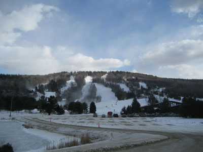
Monroe and Pike Counties, Pennsylvania

Pike County is located in northeastern Pennsylvania. As of the 2010 Census, the population was 57,369.[23] Its county seat is Milford.[24] Part of the Pocono Mountains region lies within Pike County, which has ranked among the fastest growing counties of Pennsylvania.[25]
Monroe County was added to the CMSA in March 2013, as was the Lehigh Valley. Monroe's county seat is Stroudsburg and its largest borough is East Stroudsburg. Monroe and Pike are the fastest-growing counties in Pennsylvania and have many residents who commute to jobs in New Jersey and New York. They are located largely in the Pocono Mountains and have multiple state parks as well as most of the Pennsylvania portion of the Delaware Water Gap National Recreation Area. Efforts continue to resume passenger rail service on the Lackawanna Cutoff route between Scranton and Greater NYC via Monroe County.
Lehigh Valley
The Allentown-Bethlehem-Easton MSA (better known as the Lehigh Valley) consists of Carbon, Lehigh, and Northampton Counties, PA and Warren County, NJ. The Pennsylvania portion alone constitutes the third-largest metropolitan area of Pennsylvania and Allentown is Pennsylvania's third-largest city. The region is important for east-west transportation between Greater NYC, the Harrisburg metropolitan area, and points west, both by rail and Interstate 78. The Lehigh Valley is in the process of major urban economic redevelopment including the Two Rivers Landing in downtown Easton, the Steel Stacks/Sands complex on the south side of Bethlehem, and (under construction) a multi-purpose arena in downtown Allentown. In 2010 the population was 712,481 for the PA portion and 821,173 in the MSA as a whole.
Urban areas of the region


The combined statistical area is a multicore metropolitan region containing several urban areas.


| Population rank |
Urbanized area | State(s) | 2010 population |
|---|---|---|---|
| 1 | New York–Newark | NY–NJ–CT | 18,351,295 |
| 48 | Bridgeport–Stamford | CT–NY | 923,311 |
| 61 | Allentown-Bethlehem-Easton | PA-NJ | 664,651 |
| 72 | New Haven | CT | 562,839 |
| 89 | Poughkeepsie–Newburgh | NY | 423,566 |
| 128 | Trenton | NJ | 296,668 |
| 185 | Waterbury | CT | 194,535 |
| 201 | Danbury | CT–NY | 168,136 |
| 429 | Twin Rivers-Hightstown | NJ | 64,037 |
| 453 | Middletown | NY | 58,381 |
| 457 | Kingston | NY | 57,442 |
Principal cities
The following is a list of "principal cities" and their respective population estimates from the 2010 U.S. Census Bureau publication. Principal cities are generally those where there is a greater number of jobs than employed residents.[26][27][28][29]
- New York–Northern New Jersey–Long Island MSA
- New York City: 8,175,133
- Newark, New Jersey: 277,140
- Jersey City, New Jersey: 247,597
- Yonkers, New York: 195,976
- Paterson, New Jersey: 146,199
- Edison, New Jersey: 105,652
- Woodbridge Township, New Jersey: 99,265
- New Rochelle, New York: 77,062
- Mount Vernon, New York: 67,292
- White Plains, New York: 56,853
- Union, New Jersey: 56,642
- Wayne, New Jersey: 54,717
- Trenton–Ewing MSA
- Trenton, New Jersey: 84,913
- Ewing, New Jersey: 35,790
- Bridgeport–Stamford–Norwalk MSA
- Bridgeport, Connecticut: 144,229
- Stamford, Connecticut: 122,643
- Norwalk, Connecticut: 85,603
- Danbury, Connecticut: 80,893
- Stratford, Connecticut: 51,384
- New Haven–Milford MSA
- New Haven, Connecticut: 129,779
- Milford, Connecticut: 51,271
- Allentown-Bethlehem-Easton MSA
- Poughkeepsie–Newburgh–Middletown MSA
- Poughkeepsie, New York: 32,736
- Newburgh, New York: 28,866
- Middletown, New York: 28,086
- Kingston MSA
- Kingston, New York: 23,893
- Torrington Micropolitan Area
- Torrington, Connecticut: 36,383
Climate
Under the Köppen climate classification, using the 0 °C (32 °F) January isotherm, New York City, western (and parts of eastern) Long Island, and a sliver of the Jersey Shore experience a humid subtropical climate (Cfa),[30][31] and New York is thus the northernmost major city on the North American continent with this climate type.
Much of the remainder of the metropolitan area lies in the transition zone from a humid subtropical (Cfa) to a humid continental climate (Dfa),[30][31] and it is only the inland, more exurban areas far to the north and west such as Sussex County, New Jersey, that have a January daily average of −3 °C (26.6 °F) or below and are fully humid continental; the Dfb (warm summer subtype) regime is only found inland at a higher elevation,[30] and receives greater snowfall[32] than the Dfa region. Carbon, Monroe, and Pike Counties in Pennsylvania also have a fully humid continental climate, as do colder areas of Lehigh and Northampton Counties.
Winters are cold and damp, and prevailing wind patterns that blow offshore minimize the moderating effects of the Atlantic Ocean; yet the Atlantic and the partial shielding of the Appalachians keep the New York area warmer in the winter than inland North American metropolitan areas located at similar or lesser latitudes including Pittsburgh, Cincinnati, and Indianapolis. Warm periods with 50 °F (10 °C)+ temperatures may occasionally occur during winter.[33] Spring and autumn are unpredictable and can range from chilly to warm, although they are usually mild with low humidity. Summers in the area are typically hot and humid. Nighttime conditions in and around the Five Boroughs are often exacerbated by the urban heat island phenomenon, and temperatures exceed 90 °F (32 °C) on average of 7–8 days (on the immediate Long Island Sound and Atlantic coasts), up to in excess of 27 days (inland suburbs in New Jersey) each summer and may exceed 100 °F (38 °C).[34]
Almost all of the metro area receives at least 42 inches (1,070 mm) of precipitation annually, which is fairly spread throughout the year, and many areas receive upwards of 50 in (1,270 mm). Average winter snowfall for 1981 to 2010 ranges from just under 25 inches (64 cm) along the coast of Long Island to more than 50 in (127 cm) in some inland areas, but this usually varies considerably from year to year.[35] Hurricanes and tropical storms are rare in the New York area, but are not unheard of and always have the potential to strike the area, with storm surge a major threat in coastal areas and heavy rain (with the danger of flooding) further inland.[36]
The New York metro area averages 234 days with at least some sunshine and 58% of possible sunlight annually,[37] accumulating 2,400 to 2,800 hours of sunshine per annum.[38]
| Climate data for New York (Belvedere Castle, Central Park) | |||||||||||||
|---|---|---|---|---|---|---|---|---|---|---|---|---|---|
| Month | Jan | Feb | Mar | Apr | May | Jun | Jul | Aug | Sep | Oct | Nov | Dec | Year |
| Record high °F (°C) | 72 (22) |
75 (24) |
86 (30) |
96 (36) |
99 (37) |
101 (38) |
106 (41) |
104 (40) |
102 (39) |
94 (34) |
84 (29) |
75 (24) |
106 (41) |
| Average high °F (°C) | 38.3 (3.5) |
41.6 (5.3) |
49.7 (9.8) |
61.2 (16.2) |
70.8 (21.6) |
79.3 (26.3) |
84.1 (28.9) |
82.6 (28.1) |
75.2 (24) |
63.8 (17.7) |
53.8 (12.1) |
43.0 (6.1) |
62.0 (16.7) |
| Average low °F (°C) | 26.9 (−2.8) |
28.9 (−1.7) |
35.2 (1.8) |
44.8 (7.1) |
54.0 (12.2) |
63.6 (17.6) |
68.9 (20.5) |
67.9 (19.9) |
60.8 (16) |
50.0 (10) |
41.6 (5.3) |
32.0 (0) |
47.9 (8.8) |
| Record low °F (°C) | −6 (−21) |
−15 (−26) |
3 (−16) |
12 (−11) |
32 (0) |
44 (7) |
52 (11) |
50 (10) |
39 (4) |
28 (−2) |
7 (−14) |
−13 (−25) |
−15 (−26) |
| Precipitation inches (mm) | 3.65 (92.7) |
3.09 (78.5) |
4.36 (110.7) |
4.49 (114) |
4.19 (106.4) |
4.41 (112) |
4.60 (116.8) |
4.44 (112.8) |
4.28 (108.7) |
4.40 (111.8) |
4.02 (102.1) |
4.00 (101.6) |
49.92 (1,268) |
| Snowfall inches (cm) | 8.0 (20.3) |
9.4 (23.9) |
3.7 (9.4) |
0.6 (1.5) |
0 (0) |
0 (0) |
0 (0) |
0 (0) |
0 (0) |
0 (0) |
0.3 (0.8) |
4.8 (12.2) |
26.7 (67.8) |
| Avg. precipitation days (≥ 0.01 in) | 10.4 | 9.2 | 10.9 | 11.5 | 11.1 | 11.2 | 10.4 | 9.5 | 8.7 | 8.9 | 9.6 | 10.6 | 121.9 |
| Avg. snowy days (≥ 0.1 in) | 4.1 | 2.9 | 1.8 | 0.3 | 0 | 0 | 0 | 0 | 0 | 0 | 0.2 | 2.3 | 11.5 |
| Mean monthly sunshine hours | 162.7 | 163.1 | 212.5 | 225.6 | 256.6 | 257.3 | 268.2 | 268.2 | 219.3 | 211.2 | 151.0 | 139.0 | 2,534.7 |
| Source: NOAA (1981–2010 temperature & precipitation normals, 1981–2011 snowfall normals, sun 1961–1990, extremes 1871–present)[34][39][37]
See Geography of New York City for additional climate information from the outer boroughs. | |||||||||||||
| Climate data for Newark, New Jersey (Newark Liberty Int'l) | |||||||||||||
|---|---|---|---|---|---|---|---|---|---|---|---|---|---|
| Month | Jan | Feb | Mar | Apr | May | Jun | Jul | Aug | Sep | Oct | Nov | Dec | Year |
| Record high °F (°C) | 74 (23) |
76 (24) |
89 (32) |
97 (36) |
99 (37) |
102 (39) |
108 (42) |
105 (41) |
105 (41) |
93 (34) |
85 (29) |
76 (24) |
108 (42) |
| Average high °F (°C) | 38.8 (3.8) |
42.3 (5.7) |
50.7 (10.4) |
62.0 (16.7) |
72.1 (22.3) |
81.5 (27.5) |
86.0 (30) |
84.0 (28.9) |
76.7 (24.8) |
65.3 (18.5) |
54.6 (12.6) |
43.5 (6.4) |
63.1 (17.3) |
| Average low °F (°C) | 24.5 (−4.2) |
26.9 (−2.8) |
33.6 (0.9) |
43.7 (6.5) |
53.3 (11.8) |
63.3 (17.4) |
68.7 (20.4) |
67.5 (19.7) |
59.7 (15.4) |
48.0 (8.9) |
39.0 (3.9) |
29.6 (−1.3) |
46.5 (8.1) |
| Record low °F (°C) | −8 (−22) |
−14 (−26) |
6 (−14) |
16 (−9) |
33 (1) |
41 (5) |
51 (11) |
45 (7) |
35 (2) |
25 (−4) |
12 (−11) |
−8 (−22) |
−14 (−26) |
| Precipitation inches (mm) | 3.53 (89.7) |
2.88 (73.2) |
4.18 (106.2) |
4.20 (106.7) |
4.09 (103.9) |
4.02 (102.1) |
4.76 (120.9) |
3.70 (94) |
3.82 (97) |
3.60 (91.4) |
3.65 (92.7) |
3.80 (96.5) |
46.24 (1,174.5) |
| Snowfall inches (cm) | 8.9 (22.6) |
9.5 (24.1) |
4.4 (11.2) |
.9 (2.3) |
0 (0) |
0 (0) |
0 (0) |
0 (0) |
0 (0) |
0 (0) |
.4 (1) |
5.4 (13.7) |
29.5 (74.9) |
| Avg. precipitation days (≥ 0.01 inch) | 10.4 | 9.8 | 11.0 | 11.5 | 11.3 | 11.0 | 10.1 | 9.7 | 8.6 | 8.7 | 9.5 | 10.6 | 122.1 |
| Avg. snowy days (≥ 0.1 inch) | 5.0 | 3.7 | 2.4 | .4 | 0 | 0 | 0 | 0 | 0 | 0 | .4 | 2.9 | 14.7 |
| Source: NOAA (1981–2010 normals, extremes 1931–present)[34] | |||||||||||||
| Climate data for White Plains, New York (Westchester Co. Airport) | |||||||||||||
|---|---|---|---|---|---|---|---|---|---|---|---|---|---|
| Month | Jan | Feb | Mar | Apr | May | Jun | Jul | Aug | Sep | Oct | Nov | Dec | Year |
| Average high °F (°C) | 35.4 (1.9) |
38.8 (3.8) |
46.8 (8.2) |
58.0 (14.4) |
68.0 (20) |
77.0 (25) |
81.6 (27.6) |
79.9 (26.6) |
72.5 (22.5) |
61.5 (16.4) |
51.4 (10.8) |
40.4 (4.7) |
59.4 (15.2) |
| Average low °F (°C) | 21.1 (−6.1) |
22.9 (−5.1) |
29.3 (−1.5) |
39.3 (4.1) |
48.6 (9.2) |
58.9 (14.9) |
63.9 (17.7) |
62.9 (17.2) |
55.1 (12.8) |
43.7 (6.5) |
36.0 (2.2) |
26.8 (−2.9) |
42.5 (5.8) |
| Precipitation inches (mm) | 3.78 (96) |
2.99 (75.9) |
4.52 (114.8) |
4.40 (111.8) |
4.12 (104.6) |
4.25 (108) |
3.71 (94.2) |
4.16 (105.7) |
4.72 (119.9) |
4.41 (112) |
3.97 (100.8) |
4.32 (109.7) |
49.35 (1,253.4) |
| Snowfall inches (cm) | 8.9 (22.6) |
8.8 (22.4) |
5.4 (13.7) |
1.0 (2.5) |
0 (0) |
0 (0) |
0 (0) |
0 (0) |
0 (0) |
0 (0) |
.3 (0.8) |
5.5 (14) |
29.9 (76) |
| Avg. precipitation days (≥ 0.01 inch) | 9.3 | 8.5 | 10.3 | 10.3 | 10.9 | 9.9 | 9.0 | 9.5 | 8.7 | 9.0 | 9.9 | 10.4 | 115.7 |
| Avg. snowy days (≥ 0.1 inch) | 3.6 | 2.7 | 2.0 | .3 | 0 | 0 | 0 | 0 | 0 | 0 | .3 | 2.3 | 11.2 |
| Source: NOAA (1981–2010 normals)[34] | |||||||||||||
| Climate data for West Point, New York | |||||||||||||
|---|---|---|---|---|---|---|---|---|---|---|---|---|---|
| Month | Jan | Feb | Mar | Apr | May | Jun | Jul | Aug | Sep | Oct | Nov | Dec | Year |
| Record high °F (°C) | 71 (22) |
72 (22) |
86 (30) |
96 (36) |
97 (36) |
102 (39) |
106 (41) |
105 (41) |
105 (41) |
92 (33) |
82 (28) |
72 (22) |
106 (41) |
| Average high °F (°C) | 34.8 (1.6) |
38.6 (3.7) |
47.7 (8.7) |
60.6 (15.9) |
71.3 (21.8) |
79.8 (26.6) |
84.5 (29.2) |
82.5 (28.1) |
74.8 (23.8) |
62.5 (16.9) |
51.3 (10.7) |
39.6 (4.2) |
60.7 (15.9) |
| Average low °F (°C) | 20.1 (−6.6) |
22.4 (−5.3) |
29.4 (−1.4) |
40.1 (4.5) |
49.8 (9.9) |
59.1 (15.1) |
63.7 (17.6) |
63.0 (17.2) |
55.2 (12.9) |
44.5 (6.9) |
35.8 (2.1) |
26.2 (−3.2) |
42.4 (5.8) |
| Record low °F (°C) | −15 (−26) |
−17 (−27) |
−2 (−19) |
12 (−11) |
25 (−4) |
39 (4) |
40 (4) |
35 (2) |
28 (−2) |
20 (−7) |
5 (−15) |
−16 (−27) |
−17 (−27) |
| Precipitation inches (mm) | 3.73 (94.7) |
2.97 (75.4) |
3.93 (99.8) |
4.00 (101.6) |
4.15 (105.4) |
4.59 (116.6) |
4.59 (116.6) |
4.54 (115.3) |
4.47 (113.5) |
4.99 (126.7) |
4.33 (110) |
4.27 (108.5) |
50.55 (1,284) |
| Snowfall inches (cm) | 12.2 (31) |
11.2 (28.4) |
5.6 (14.2) |
.2 (0.5) |
0 (0) |
0 (0) |
0 (0) |
0 (0) |
0 (0) |
0 (0) |
.6 (1.5) |
5.5 (14) |
35.3 (89.6) |
| Avg. precipitation days (≥ 0.01 inch) | 9.8 | 7.8 | 9.2 | 10.6 | 11.4 | 11.3 | 10.2 | 9.3 | 8.2 | 8.8 | 9.4 | 10.0 | 115.9 |
| Avg. snowy days (≥ 0.1 inch) | 5.1 | 3.1 | 1.6 | .1 | 0 | 0 | 0 | 0 | 0 | 0 | .3 | 1.7 | 11.9 |
| Source: NOAA (1981–2010 normals, extremes 1890–present)[34] | |||||||||||||
| Climate data for Bridgehampton, New York | |||||||||||||
|---|---|---|---|---|---|---|---|---|---|---|---|---|---|
| Month | Jan | Feb | Mar | Apr | May | Jun | Jul | Aug | Sep | Oct | Nov | Dec | Year |
| Record high °F (°C) | 67 (19) |
63 (17) |
79 (26) |
92 (33) |
93 (34) |
95 (35) |
102 (39) |
100 (38) |
94 (34) |
88 (31) |
75 (24) |
70 (21) |
102 (39) |
| Average high °F (°C) | 38.9 (3.8) |
40.5 (4.7) |
47.0 (8.3) |
56.3 (13.5) |
66.1 (18.9) |
75.2 (24) |
81.0 (27.2) |
80.2 (26.8) |
73.5 (23.1) |
63.2 (17.3) |
53.7 (12.1) |
43.8 (6.6) |
60.0 (15.6) |
| Average low °F (°C) | 23.8 (−4.6) |
25.5 (−3.6) |
31.0 (−0.6) |
39.6 (4.2) |
48.2 (9) |
58.3 (14.6) |
64.0 (17.8) |
63.2 (17.3) |
56.0 (13.3) |
45.1 (7.3) |
37.5 (3.1) |
28.6 (−1.9) |
43.4 (6.3) |
| Record low °F (°C) | −11 (−24) |
−12 (−24) |
6 (−14) |
14 (−10) |
29 (−2) |
36 (2) |
46 (8) |
41 (5) |
35 (2) |
22 (−6) |
10 (−12) |
−6 (−21) |
−12 (−24) |
| Precipitation inches (mm) | 4.00 (101.6) |
3.72 (94.5) |
5.07 (128.8) |
4.52 (114.8) |
3.78 (96) |
4.12 (104.6) |
3.45 (87.6) |
3.92 (99.6) |
4.60 (116.8) |
4.20 (106.7) |
4.37 (111) |
4.38 (111.3) |
50.13 (1,273.3) |
| Snowfall inches (cm) | 7.8 (19.8) |
8.4 (21.3) |
5.0 (12.7) |
.9 (2.3) |
0 (0) |
0 (0) |
0 (0) |
0 (0) |
0 (0) |
0 (0) |
.7 (1.8) |
3.9 (9.9) |
26.7 (67.8) |
| Avg. precipitation days (≥ 0.01 inch) | 9.9 | 8.9 | 10.2 | 10.5 | 10.7 | 8.8 | 7.9 | 7.7 | 8.1 | 8.4 | 9.5 | 10.0 | 110.6 |
| Avg. snowy days (≥ 0.1 inch) | 3.2 | 3.0 | 1.9 | .3 | 0 | 0 | 0 | 0 | 0 | 0 | .2 | 1.7 | 10.3 |
| Source: NOAA (1981–2010 normals, extremes 1930–present)[34] | |||||||||||||
| Climate data for Bridgeport, Connecticut (Sikorsky Airport) | |||||||||||||
|---|---|---|---|---|---|---|---|---|---|---|---|---|---|
| Month | Jan | Feb | Mar | Apr | May | Jun | Jul | Aug | Sep | Oct | Nov | Dec | Year |
| Record high °F (°C) | 68 (20) |
67 (19) |
84 (29) |
91 (33) |
97 (36) |
97 (36) |
103 (39) |
100 (38) |
99 (37) |
89 (32) |
78 (26) |
76 (24) |
103 (39) |
| Average high °F (°C) | 37.1 (2.8) |
39.7 (4.3) |
47.2 (8.4) |
57.6 (14.2) |
67.6 (19.8) |
77.0 (25) |
82.1 (27.8) |
80.8 (27.1) |
74.0 (23.3) |
63.2 (17.3) |
53.1 (11.7) |
42.3 (5.7) |
60.1 (15.6) |
| Average low °F (°C) | 23.1 (−4.9) |
25.2 (−3.8) |
31.4 (−0.3) |
41.0 (5) |
50.5 (10.3) |
60.2 (15.7) |
66.3 (19.1) |
65.6 (18.7) |
58.0 (14.4) |
46.4 (8) |
37.9 (3.3) |
28.4 (−2) |
44.5 (6.9) |
| Record low °F (°C) | −7 (−22) |
−5 (−21) |
4 (−16) |
18 (−8) |
31 (−1) |
41 (5) |
49 (9) |
44 (7) |
36 (2) |
26 (−3) |
16 (−9) |
−4 (−20) |
−7 (−22) |
| Precipitation inches (mm) | 3.10 (78.7) |
2.79 (70.9) |
4.04 (102.6) |
4.13 (104.9) |
3.80 (96.5) |
3.64 (92.5) |
3.46 (87.9) |
3.96 (100.6) |
3.48 (88.4) |
3.64 (92.5) |
3.39 (86.1) |
3.33 (84.6) |
42.75 (1,085.9) |
| Snowfall inches (cm) | 9.2 (23.4) |
8.2 (20.8) |
5.4 (13.7) |
.9 (2.3) |
0 (0) |
0 (0) |
0 (0) |
0 (0) |
0 (0) |
0 (0) |
.7 (1.8) |
5.5 (14) |
30.0 (76.2) |
| Avg. precipitation days (≥ 0.01 inch) | 10.9 | 9.7 | 11.3 | 11.0 | 11.8 | 11.1 | 8.9 | 8.9 | 8.2 | 8.8 | 10.0 | 11.1 | 121.7 |
| Avg. snowy days (≥ 0.1 inch) | 5.0 | 3.6 | 2.4 | .3 | 0 | 0 | 0 | 0 | 0 | 0 | .5 | 3.1 | 15.0 |
| Source: NOAA (1981–2010 normals)[34] | |||||||||||||
| Climate data for Danbury, Connecticut | |||||||||||||
|---|---|---|---|---|---|---|---|---|---|---|---|---|---|
| Month | Jan | Feb | Mar | Apr | May | Jun | Jul | Aug | Sep | Oct | Nov | Dec | Year |
| Record high °F (°C) | 71 (22) |
77 (25) |
92 (33) |
95 (35) |
97 (36) |
105 (41) |
106 (41) |
104 (40) |
100 (38) |
91 (33) |
82 (28) |
80 (27) |
106 (41) |
| Average high °F (°C) | 35.6 (2) |
39.6 (4.2) |
48.7 (9.3) |
61.0 (16.1) |
71.9 (22.2) |
80.8 (27.1) |
84.9 (29.4) |
82.5 (28.1) |
74.5 (23.6) |
62.7 (17.1) |
51.3 (10.7) |
39.9 (4.4) |
61.1 (16.2) |
| Average low °F (°C) | 19.2 (−7.1) |
21.8 (−5.7) |
28.6 (−1.9) |
38.9 (3.8) |
48.4 (9.1) |
58.5 (14.7) |
63.4 (17.4) |
61.8 (16.6) |
53.4 (11.9) |
41.8 (5.4) |
33.6 (0.9) |
24.6 (−4.1) |
41.2 (5.1) |
| Record low °F (°C) | −18 (−28) |
−16 (−27) |
−9 (−23) |
14 (−10) |
25 (−4) |
35 (2) |
38 (3) |
37 (3) |
23 (−5) |
16 (−9) |
0 (−18) |
−11 (−24) |
−18 (−28) |
| Precipitation inches (mm) | 3.76 (95.5) |
3.18 (80.8) |
4.43 (112.5) |
4.36 (110.7) |
4.57 (116.1) |
4.74 (120.4) |
4.99 (126.7) |
4.55 (115.6) |
4.66 (118.4) |
4.89 (124.2) |
4.54 (115.3) |
4.16 (105.7) |
52.83 (1,341.9) |
| Snowfall inches (cm) | 14.9 (37.8) |
13.1 (33.3) |
9.7 (24.6) |
1.6 (4.1) |
0 (0) |
0 (0) |
0 (0) |
0 (0) |
0 (0) |
0 (0) |
1.2 (3) |
9.7 (24.6) |
50.2 (127.4) |
| Avg. precipitation days (≥ 0.01 inch) | 11.5 | 10.0 | 11.8 | 11.5 | 12.2 | 12.0 | 10.4 | 9.4 | 9.3 | 9.2 | 10.0 | 11.6 | 128.9 |
| Avg. snowy days (≥ 0.1 inch) | 7.9 | 5.4 | 4.2 | .9 | 0 | 0 | 0 | 0 | 0 | .1 | 1.0 | 5.0 | 24.5 |
| Source: NOAA (1981–2010 normals, extremes 1937–present)[34][40] | |||||||||||||
| Climate data for Allentown, Pennsylvania (Lehigh Valley Int'l), 1981–2010 normals | |||||||||||||
|---|---|---|---|---|---|---|---|---|---|---|---|---|---|
| Month | Jan | Feb | Mar | Apr | May | Jun | Jul | Aug | Sep | Oct | Nov | Dec | Year |
| Record high °F (°C) | 72 (22) |
76 (24) |
87 (31) |
93 (34) |
97 (36) |
100 (38) |
105 (41) |
100 (38) |
99 (37) |
92 (33) |
81 (27) |
72 (22) |
105 (41) |
| Average high °F (°C) | 36.0 (2.2) |
39.8 (4.3) |
49.4 (9.7) |
61.3 (16.3) |
71.5 (21.9) |
80.1 (26.7) |
84.2 (29) |
82.4 (28) |
74.9 (23.8) |
63.6 (17.6) |
52.5 (11.4) |
40.5 (4.7) |
61.4 (16.3) |
| Average low °F (°C) | 19.5 (−6.9) |
21.7 (−5.7) |
28.8 (−1.8) |
38.5 (3.6) |
48.3 (9.1) |
58.1 (14.5) |
62.7 (17.1) |
60.9 (16.1) |
52.9 (11.6) |
41.3 (5.2) |
32.9 (0.5) |
24.0 (−4.4) |
40.8 (4.9) |
| Record low °F (°C) | −15 (−26) |
−12 (−24) |
−5 (−21) |
12 (−11) |
28 (−2) |
39 (4) |
46 (8) |
41 (5) |
30 (−1) |
19 (−7) |
3 (−16) |
−8 (−22) |
−16 (−27) |
| Precipitation inches (mm) | 3.06 (77.7) |
2.70 (68.6) |
3.38 (85.9) |
3.57 (90.7) |
4.13 (104.9) |
4.31 (109.5) |
4.95 (125.7) |
3.69 (93.7) |
4.61 (117.1) |
3.88 (98.6) |
3.49 (88.6) |
3.58 (90.9) |
45.35 (1,151.9) |
| Snowfall inches (cm) | 10.5 (26.7) |
11.3 (28.7) |
4.9 (12.4) |
1.0 (2.5) |
0 (0) |
0 (0) |
0 (0) |
0 (0) |
0 (0) |
0 (0) |
0.7 (1.8) |
5.6 (14.2) |
34.0 (86.4) |
| Avg. precipitation days (≥ 0.01 in) | 11.1 | 9.8 | 11.0 | 12.1 | 12.1 | 11.4 | 10.9 | 9.5 | 9.1 | 9.1 | 9.8 | 10.9 | 126.8 |
| Avg. snowy days (≥ 0.1 in) | 5.6 | 4.8 | 2.5 | .4 | 0 | 0 | 0 | 0 | 0 | 0 | .6 | 3.5 | 17.4 |
| Source: NOAA (extremes 1922–present)[34] | |||||||||||||
| Climate data for Stroudsburg, Pennsylvania | |||||||||||||
|---|---|---|---|---|---|---|---|---|---|---|---|---|---|
| Month | Jan | Feb | Mar | Apr | May | Jun | Jul | Aug | Sep | Oct | Nov | Dec | Year |
| Record high °F (°C) | 72 (22) |
74 (23) |
87 (31) |
96 (36) |
97 (36) |
110 (43) |
104 (40) |
103 (39) |
106 (41) |
95 (35) |
98 (37) |
72 (22) |
110 (43) |
| Average high °F (°C) | 35 (2) |
39 (4) |
49 (9) |
61 (16) |
72 (22) |
80 (27) |
85 (29) |
83 (28) |
75 (24) |
64 (18) |
51 (11) |
40 (4) |
61.2 (16.2) |
| Average low °F (°C) | 16 (−9) |
17 (−8) |
26 (−3) |
36 (2) |
46 (8) |
55 (13) |
59 (15) |
58 (14) |
50 (10) |
38 (3) |
30 (−1) |
22 (−6) |
37.8 (3.2) |
| Record low °F (°C) | −25 (−32) |
−21 (−29) |
−14 (−26) |
10 (−12) |
24 (−4) |
32 (0) |
36 (2) |
32 (0) |
20 (−7) |
14 (−10) |
2 (−17) |
−14 (−26) |
−25 (−32) |
| Precipitation inches (mm) | 3.98 (101.1) |
3.01 (76.5) |
3.84 (97.5) |
4.00 (101.6) |
5.01 (127.3) |
4.56 (115.8) |
4.42 (112.3) |
4.28 (108.7) |
4.89 (124.2) |
3.81 (96.8) |
4.26 (108.2) |
3.92 (99.6) |
49.98 (1,269.6) |
| Source: Weatherbase [41] | |||||||||||||
| Climate data for Morristown, New Jersey | |||||||||||||
|---|---|---|---|---|---|---|---|---|---|---|---|---|---|
| Month | Jan | Feb | Mar | Apr | May | Jun | Jul | Aug | Sep | Oct | Nov | Dec | Year |
| Average high °F (°C) | 38 (3) |
41 (5) |
50 (10) |
61 (16) |
71 (22) |
80 (27) |
85 (29) |
83 (28) |
75 (24) |
65 (18) |
54 (12) |
43 (6) |
62.2 (16.7) |
| Average low °F (°C) | 18 (−8) |
19 (−7) |
27 (−3) |
36 (2) |
46 (8) |
54 (12) |
59 (15) |
58 (14) |
51 (11) |
39 (4) |
32 (0) |
23 (−5) |
38.5 (3.6) |
| Precipitation inches (mm) | 4.50 (114.3) |
3.00 (76.2) |
4.41 (112) |
4.64 (117.9) |
5.09 (129.3) |
4.40 (111.8) |
5.29 (134.4) |
4.37 (111) |
5.33 (135.4) |
4.17 (105.9) |
4.37 (111) |
4.10 (104.1) |
53.67 (1,363.2) |
| Source: [42] | |||||||||||||
| Climate data for Toms River, New Jersey | |||||||||||||
|---|---|---|---|---|---|---|---|---|---|---|---|---|---|
| Month | Jan | Feb | Mar | Apr | May | Jun | Jul | Aug | Sep | Oct | Nov | Dec | Year |
| Record high °F (°C) | 72 (22) |
75 (24) |
87 (31) |
97 (36) |
99 (37) |
102 (39) |
105 (41) |
102 (39) |
99 (37) |
91 (33) |
85 (29) |
76 (24) |
105 (41) |
| Average high °F (°C) | 41 (5) |
44 (7) |
51 (11) |
61 (16) |
71 (22) |
80 (27) |
85 (29) |
83 (28) |
77 (25) |
67 (19) |
57 (14) |
46 (8) |
63.6 (17.6) |
| Average low °F (°C) | 22 (−6) |
24 (−4) |
30 (−1) |
39 (4) |
49 (9) |
59 (15) |
64 (18) |
62 (17) |
55 (13) |
43 (6) |
35 (2) |
27 (−3) |
42.4 (5.8) |
| Record low °F (°C) | −19 (−28) |
−14 (−26) |
3 (−16) |
12 (−11) |
26 (−3) |
39 (4) |
43 (6) |
38 (3) |
31 (−1) |
19 (−7) |
9 (−13) |
−3 (−19) |
−19 (−28) |
| Precipitation inches (mm) | 3.92 (99.6) |
3.30 (83.8) |
4.79 (121.7) |
4.07 (103.4) |
3.73 (94.7) |
3.80 (96.5) |
4.60 (116.8) |
4.69 (119.1) |
3.79 (96.3) |
3.90 (99.1) |
4.11 (104.4) |
4.51 (114.6) |
49.8 (1,265) |
| Snowfall inches (cm) | 7.01 (17.81) |
5.99 (15.21) |
5.00 (12.7) |
0.98 (2.49) |
0 (0) |
0 (0) |
0 (0) |
0 (0) |
0 (0) |
0 (0) |
0.98 (2.49) |
4.02 (10.21) |
23.98 (60.91) |
| Avg. precipitation days | 11 | 10 | 11 | 11 | 11 | 10 | 9 | 9 | 8 | 8 | 10 | 10 | 118 |
| Avg. snowy days | 4 | 3 | 2 | .5 | 0 | 0 | 0 | 0 | 0 | 0 | .2 | 2 | 11.7 |
| Mean monthly sunshine hours | 155.0 | 155.4 | 201.5 | 216.0 | 244.9 | 270.0 | 275.9 | 260.4 | 219.0 | 204.6 | 156.0 | 136.4 | 2,495.1 |
| Source: [43] | |||||||||||||
History


During the Wisconsinan glaciation, the region was situated at the edge of a large ice sheet over 1000 feet in depth. The ice sheet scraped away large amounts of soil, leaving bedrock. Later on, the ice sheet would help split apart what are now Long Island and Staten Island.

At the time of European contact the region was inhabited by Native Americans, predominantly the Lenape[44] and others. The Native Americans used the abundant waterways in the area for many purposes such as fishing and trade routes. Sailing for France in 1524, Giovanni da Verrazzano was the first European to enter the local waters and encounter the residents, but he did not make landfall. Henry Hudson, sailing for the Dutch in 1609, visited the area and built a settlement on Lower Manhattan Island that was eventually renamed New Amsterdam by Dutch colonists in 1626.[45] The area came under English control in 1664[45][46] and were renamed New York after King Charles II of England granted the lands to his brother, the Duke of York.[47][48]
As the fur trade expanded north, New York became a trading hub, which brought in a diverse set of ethnic groups including Africans, Jews, and Portuguese. The island of Manhattan had an extraordinary natural harbor formed by New York Bay (actually the drowned lower river valley of the Hudson River, enclosed by glacial moraines), the East River (actually a tidal strait), and the Hudson River, all of which are confluent at the southern tip, from which all later development spread. During the American Revolution, the strategic waterways made New York vitally important as a wartime base for the British navy. Many battles such as the Battle of Long Island and the Battle of New York were fought in the region to secure it. New York City was captured by the British early in the war, becoming a haven for Loyalist refugees from other parts of the country, and remained in the hands of the British until the war ended in 1783. New York served as the capital of the United States from 1785 until 1790,[49] after which the capital moved to Philadelphia. New York City has been the country's largest city since 1790.[50] In 1792, the Buttonwood Agreement, made by a group of merchants, created what is now the New York Stock Exchange in Lower Manhattan. Today, many people in the metropolitan area work in this important stock exchange.
The Statue of Liberty in New York Harbor greeted millions of immigrants as they came to America by ship in the late 19th and early 20th centuries[51] and is a globally recognized symbol of the United States and its democracy.[52] Large-scale immigration into New York was a result of a large demand for manpower. A cosmopolitan attitude in the city created tolerance for various cultures and ethnic groups. German, Irish, and Italian immigrants were among the largest ethnic groups. Today, many of their descendents continue to live in the region. Cultural buildings such as the Metropolitan Museum of Art, the Metropolitan Opera, the American Museum of Natural History were built. New York newspapers were read around the country as media moguls James Gordon Bennett, Sr., Joseph Pulitzer and William Randolph Hearst battled for readership. In 1884, over 70% of exports passed through ports in New York or in one of the surrounding towns. The five boroughs of New York City — The Bronx, Brooklyn, Manhattan, Queens, and Staten Island — were consolidated into a single city in 1898.[53][54]
The now-unified New York City encouraged both more physical connections between the boroughs and the growth of bedroom communities. The New York City Subway began operating in 1905 as different private systems that were later taken over by the city. Railroad stations such as Grand Central Terminal and Pennsylvania Station helped fuel suburban growth. During the era of the Prohibition, when alcohol was banned nationwide, organized crime grew to supply the high demand for bootleg alcohol. The iconic Broadway Theater District developed with the showing of the musical, Show Boat.
The Great Depression suspended the region's fortunes as a period of widespread unemployment and poverty began. City planner Robert Moses began his automobile-centered career of building bridges, parkways, and later expressways. During World War II, the city economy was hurt by blockades of German U-Boats, which limited of shipping with Europe.
After its population peaked in 1950, much of the city's population began leaving for the suburbs. The effects were a result of white flight. Industry and commerce also declined in this era, with businesses leaving for the suburbs and other cities. Crime affected the city severely. Urban renewal projects alleviated the decay in Midtown Manhattan to a certain extent, but later failed. Blackouts such as the Northeast Blackout of 1965 and the New York City Blackout of 1977 caused massive rioting. A rare highlight was the completion of the former World Trade Center, which once stood as the tallest buildings in the world.
In the 1980s, the city economy was booming. Wall Street was fueling an economic surge in the real estate market. Despite this, crime was still an issue. Beginning in the 1990s, however, crime dropped substantially.

A major event in the region's history was the September 11th attacks in 2001, that killed nearly 3,000 people as two planes crashed into the former World Trade Center and caused the towers to collapse. Businesses led an exodus from Lower Manhattan because of this. In 2003, another blackout occurred, the 2003 North America blackout, but the city suffered no looting and a building boom in New York City continues to this day.
On October 29 and 30, 2012, Hurricane Sandy caused extensive destruction in the metropolitan area, ravaging portions of the Atlantic coastline with record-high storm surge, severe flooding, and high winds, causing power outages for millions of residents via downed trees and power lines and malfunctions at electrical substations, leading to gasoline shortages and snarling mass transit systems. Damage to New York and New Jersey in terms of physical infrastructure and private property as well as including interrupted commerce was estimated at several tens of billions of dollars.[55] The storm and its profound impacts have prompted the discussion of constructing seawalls and other coastal barriers around the shorelines of the metropolitan area to minimize the risk of destructive consequences from another such event in the future.[56]
Statistical history
| Historical population | |||
|---|---|---|---|
| Census | Pop. | %± | |
| 1990 | 19,710,239 | ||
| 2000 | 21,361,797 | 8.4% | |
| 2010 | 22,085,649 | 3.4% | |
| Est. 2012 | 23,362,099 | 5.8% | |
| [notes 1] | |||


The U.S. Census Bureau first designated metropolitan areas in 1950 as standard metropolitan areas (SMAs). The "New York–Northeastern NJ SMA" was defined to include 17 counties: 9 in New York (the five boroughs of New York City, Nassau, Suffolk, Westchester, and Rockland) and 8 in New Jersey (Bergen, Hudson, Passaic, Essex, Union, Morris, Somerset, and Middlesex). In 1960, the metropolitan area standards were modified and renamed standard metropolitan statistical areas (SMSAs). The new standards resulted in the splitting of the former SMA into several pieces: the nine New York counties became the "New York SMSA"; three of the New Jersey counties (Essex, Union, and Morris) became the "Newark SMSA"; two other New Jersey counties (Bergen and Passaic) became the "Paterson–Passaic–Clifton SMSA"; Hudson County was designated the "Jersey City SMSA"; and Middlesex and Somerset counties lost their metropolitan status. In 1973, a new set of metropolitan area standards resulted in further changes: Nassau and Suffolk counties were split off as their own SMSA ("Nassau–Suffolk SMSA"); Bergen County (originally part of the Paterson–Clifton–Passaic SMSA) was transferred to the New York SMSA; the New York SMSA also received Putnam County (previously non-metropolitan); Somerset County was added to the Newark SMSA; and two new SMSAs, the "New Brunswick–Perth Amboy–Sayreville SMSA" (Middlesex County) and "Long Branch–Asbury Park SMSA" (Monmouth County), were established. In 1983, the concept of a consolidated metropolitan statistical area (CMSA) was first implemented. A CMSA consisted of several primary metropolitan statistical areas (PMSAs), which were individual employment centers within a wider labor market area. The "New York–Northern New Jersey–Long Island CMSA" consisted of 12 PMSAs. Seven PMSAs were based on the original 1950 New York SMA that were split up: New York, Bergen–Passaic, Jersey City, Middlesex–Somerset–Hunterdon (Hunterdon added for the first time), Monmouth–Ocean (Ocean added for the first time), Nassau–Suffolk, and Newark (Sussex added for the first time). One additional PMSA was the Orange County PMSA (previously the Newburgh–Middletown SMSA). The other four PMSAs were former SMSAs in Connecticut: Bridgeport, Stamford, Norwalk, and Danbury. In 1993, four PMSAs were added to the New York–Northern New Jersey–Long Island CMSA: Trenton PMSA (Mercer County), Dutchess County PMSA, Waterbury PMSA, and New Haven PMSA. Several new counties were also added to the CMSA: Sussex, Warren, and Pike. The CMSA model was originally utilized for tabulating data from the 2000 census. In 2003, a new set of standards was established using the Core Based Statistical Area (CBSA) model was adopted and remains in use as of 2010. The CBSA model resulted in the splitting up of the old CMSA into several metropolitan statistical areas: New York–Northern New Jersey–Long Island, Poughkeepsie–Newburgh–Middletown, Trenton–Ewing, Bridgeport–Stamford–Norwalk (includes Danbury), and New Haven–Milford (includes Waterbury). In 2013, the Census Bureau added Carbon, Lehigh, Northampton, and Monroe counties in Pennsylvania, and Warren County, New Jersey (encompassing collectively the Allentown-Bethlehem-Easton, PA-NJ MSA and the East Stroudsburg, PA MSA), to the Combined Statistical Area.[57]
Demographics
2010 Census
As of the 2010 Census, the metropolitan area had a population of 22,085,649. The population density was 1,865 per square mile. The racial markup was that 61.6% or 13,595,960 were White, 16.9% or 3,727,105 were African Americans, 0.5% or 102,349 were American Indian and Alaskan Native, Asians were 9.1% or 2,008,906 overall, Pacific Islanders were less than 1% with a population of 9,971, 8.8% or 1,944,165 listed themselves as "some other race", while 3.2% (697,193) were of two or more races. Hispanics were 21.7% of any race or 4,790,542.[citation needed]
The median age was 37.9. 25.5% were under 18, 9.5% were 18 to 24 years, 28% were 25 to 44 years of age, 26.6% were 45 to 64 years old, and 13.2% were over the age of 65. Males composed 48.3% of the population while females were 51.7% of the population.[citation needed]
97.7% of the population were in households, 2.3% were in group quarters, and 1% were institutionalized. There were 8,103,731 of which 30.2% or 2,449,343 had children. 46.1% or 3,736,165 were composted of opposite sex and married couples. Male households with no wife composed 4.9% or 400,534. 15.0% or 1,212,436 were female households, with no husbands. 34% or 2,754,596 were non-family households. The household density were 684 per square mile. 91.9% of housing units were occupied with a 3.8% vacancy rate. The average household size was 2.65 per household. The average income for non-family households was $90,335, and the average income for families was $104,715. 13.3% or 2,888,493 of the population were below the poverty line.[citation needed]
26.7% or 5,911,993 of the population were born outside the United States. Out of this, 17.4% or 1,028,506 were born in Europe, 27.0% or 1,595,523 were born in Asia, 3.8% or 224,109 were born in Africa, 0.2% or 11,957 were born in Oceania, 50.6% or 2,992,639 were born in Latin America.[citation needed]
Population estimates
As of July 1, 2011, the United States Census Bureau estimated the population of the metropolitan area at 22,214,083, an increase of 128,434 (0.6%) from the previous year.[58]
The New York City metropolitan area is ethnically diverse. It is home to the largest Jewish community outside Israel.[59] The metropolitan area is also home to 20% of the nation's Indian Americans and at least 20 Little India enclaves, as well as 15% of all Korean Americans and four Koreatowns;[60][61] the largest Asian Indian population in the Western Hemisphere; the largest Italian American and African American populations and the second-largest Hispanic community in the United States; and includes 6 Chinatowns in New York City alone[62] (8 including the emerging Chinese enclave in Bensonhurst, Brooklyn and Corona, Queens), as well as one each in Edison, New Jersey and Nassau County, Long Island,[63] with the urban agglomeration comprising as of the 2010 Census a population of 682,265 overseas Chinese,[64] the largest outside of Asia. The New York region continues to be by far the leading metropolitan gateway for legal immigrants admitted into the United States, substantially exceeding the combined totals of Los Angeles and Miami, the next most popular gateway regions.[65][66][67][68]
The metropolitan area is home to a self-identifying gay and bisexual community estimated at 568,903 individuals, the largest in the United States.[69] Same-sex marriages in New York were legalized on June 24, 2011 and were authorized to take place beginning 30 days thereafter.[70]
Economy


The regional economy is a center for international banking and commerce. It is the largest in the United States and one of the most important in the world. New York is considered a global city. In 2012, New York City topped the first Global Economic Power Index, published by The Atlantic (to be differentiated from a namesake list published by the Martin Prosperity Institute), with cities ranked according to criteria reflecting their presence on similar lists as published by other entities.[71] Finance, international trade, media, real estate, manufacturing, tourism, biotechnology, and education are the leading industries in the area. Other industries include entertainment and news media. In 2010, the gross metropolitan product was $1.28 trillion,[72] second only to Tokyo, and is larger than all but 14 countries.[73]
Along with its wealth, the area has a cost of living that is among the highest in the United States.[74] Changes in house prices for the area are publicly tracked on a regular basis using the Case–Shiller index; the statistic is published by Standard & Poor's and is also a component of S&P's 10-city composite index of the value of the residential real estate market.
Education
The New York metropolitan area is home to many prestigious institutions of higher education. Three Ivy League universities (Columbia University in Manhattan, Princeton University in Princeton, New Jersey, and Yale University in New Haven, Connecticut - all ranked amongst the top 4 U.S. national universities as per U.S. News & World Report[75]) reside in the region,[76] as well as New York University and The Rockefeller University, both located in Manhattan; all of the above have been ranked amongst the top 35 universities in the world.[77] Fordham University, also a nationally ranked university,[78] is located on three campuses, in the Bronx, Manhattan, and Westchester County.[79] The New York City Department of Education is the largest school district in the United States serving over 1.2 million students.[80]
The region also hosts many public high schools, some of which have been described as among the most prestigious in the country.[81]
Attainment
According to the 2010 American Community Survey, of the 14,973,063 persons in this area over 25 years of age, 14.8% (2,216,578) had a graduate or professional degree, 21.1% (3,166,037) had a bachelor's degree, 6.4% (962,007) had an associate degree, 16.0% (2,393,990) had some college education but no degree, 26.8% (4,009,901) had a high school diploma or equivalent, 14.8% (2,224,557) had less than a high school education.[82] In 2010, CNN Money ranked the area as one of the top 10 smartest regions in the United States.[83]
Transportation
 The New York City Subway is the world's largest rapid transit system by length of routes and by number of stations.  The Port Authority Trans-Hudson (PATH) rapid transit rail system connects Manhattan and metropolitan northern New Jersey beneath the Hudson River.  An Acela Express train going to New York City. The Acela Express, operated by Amtrak through the Northeast Corridor, is the sole high-speed rail service in the country. |
The depth and intricacy of the transportation network in the New York City region parallel the size and complexity of the metropolis itself.
Rail
About one in every three users of mass transit in the United States and two-thirds of the nation's rail riders live in the New York City metropolitan area.[84][85]
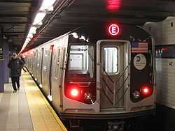
New York City Subway
The New York City Subway is the largest rapid transit system in the world when measured by stations in operation, with 468, and by length of routes. It is the third largest when measured by annual ridership (1.5 billion passenger trips in 2006).[86] New York's subway is also notable because nearly the entire system remains open 24 hours a day, in contrast to the overnight shutdown common to systems in most cities, including Hong Kong,[87][88] London, Seoul,[89][90] Tokyo, and Toronto.
Commuter rail
The metropolitan area is also fundamentally defined by the areas from which people commute into New York City. The city is served by three primary commuter rail systems plus Amtrak.
Metro-North Railroad (MNRR), the busiest commuter railroad in the United States (as of 2012),[91] is operated by the Metropolitan Transportation Authority (MTA) (an agency of New York state that focuses on New York City-area transit), in conjunction with the Connecticut Department of Transportation and New Jersey Transit. Its major terminal is Grand Central Terminal. Trains on the Port Jervis Line and Pascack Valley Line terminate at Hoboken Terminal in Hoboken, New Jersey; commuters may transfer at either Secaucus Junction for New Jersey Transit trains to New York Pennsylvania Station or at Hoboken Terminal for PATH trains into Manhattan.
The Long Island Rail Road (LIRR), the second busiest commuter railroad in the United States,[91] is also operated by the MTA. It has two major terminals at Pennsylvania Station in Midtown Manhattan and Atlantic Terminal in Downtown Brooklyn, with a minor terminal at the Long Island City station and a major transfer point at the Jamaica station in Queens.
New Jersey Transit (NJT), the third busiest commuter railroad in the United States by passenger miles and also third in trips (when direct operated and purchased transportation services are both included – fourth if only direct operated are included),[91] is operated by the New Jersey Transit Corporation, an agency of the state of New Jersey, in conjunction with Metro-North Railroad and Amtrak. A map of the system can be found here . It has major terminals at Pennsylvania Station in Manhattan, Hoboken Terminal, and Newark Pennsylvania Station, with a major transfer point at Secaucus Junction in Hudson County, New Jersey. New Jersey Transit also operates the Hudson–Bergen Light Rail through Hudson County, the Newark City Subway, and the River Line that runs along tracks shared with Conrail Shared Assets Operations from Trenton to Camden in southern New Jersey. NJ Transit also has commuter buses operating in and out of Manhattan.
Amtrak's Northeast Corridor offers service to Philadelphia, New Haven, and other points between and including Boston and Washington, D.C. Additionally, the Port Authority of New York and New Jersey, an agency controlled by the states of New York and New Jersey, operates the PATH system; this heavy rail transportation service links Manhattan in New York and the counties of Hudson and Essex in New Jersey. A map can be found here .
Major stations in the metropolitan area include:
| Station | Railroad(s) | State | County | Type |
|---|---|---|---|---|
| Pennsylvania Station (New York City) | Amtrak, LIRR, NJT | NY | New York | Terminal and Transfer |
| Grand Central Terminal | MNRR | NY | New York | Terminal |
| Pennsylvania Station (Newark) | Amtrak, NJT, PATH | NJ | Essex | Terminal and Transfer |
| Hoboken Terminal | NJT, MNRR, PATH | NJ | Hudson | Terminal |
| Atlantic Terminal | LIRR | NY | Kings | Terminal |
| Hunterspoint Avenue | LIRR | NY | Queens | Terminal |
| Woodside Station | LIRR | NY | Queens | Terminal and Transfer |
| Jamaica Station | LIRR | NY | Queens | Terminal and Transfer |
| Secaucus Junction | NJT, MNRR | NJ | Hudson | Transfer |
| New Haven Union Station | Amtrak, MNRR, Shore Line East | CT | New Haven | Terminal and Transfer |
| Trenton Station | Amtrak, NJT, SEPTA | NJ | Mercer | Terminal and Transfer |
The following table shows all train lines operated by these commuter railroads in the New York metropolitan area. New Jersey Transit operates an additional train line in the Philadelphia metropolitan area. (Shown counterclockwise from the Atlantic Ocean):
Major highways
The following highways serve the region:


Interstates
_4.JPG)
-
 I-78
I-78 -
 I-80
I-80 -
 I-84
I-84 -
 I-87
I-87 -
 I-91
I-91 -
 I-95
I-95 -
 I-195
I-195 -
 I-278 – serves as southern beltway around New York City
 -
 I-280
I-280 -
 I-287 – serves as northern beltway around New York City
 -
.svg.png) I-295
I-295 -
 I-380
I-380 -

 I-476 / Penna. Tpk. NE Ext.
 -
.svg.png) I-478
I-478 -
.svg.png) I-495 − also known as Long Island Expressway or LIE
I-495 − also known as Long Island Expressway or LIE -
.svg.png) I-678
I-678 -
 I-684
I-684 -
.svg.png) I-895
I-895
U.S. Routes
State Routes
-
 Route 3
 -
 Route 4
 -
 Route 8
 -
 NY 9A
NY 9A -
 Route 15
 -
 Route 17
 -
 Route 18
 -
 Route 21
 -
 Route 23
 -
 Route 24
 -
 Route 25
 -
 NY 25
NY 25 -
 NY 27
NY 27 -
 Route 31
 -
 PA 33
PA 33 -
 Route 139
 -
 Route 208
 -
 PA 309
 -

 NY 440 / Route 440
 -
 Route 495
 -
 PA 611
Other limited-access roads

Some of these roads have a numerical designation assigned to it:
-
 Belt Parkway
 -
 Bronx River Parkway
 -
 Conn. Tpk. (part of I-95)
 -
 FDR Drive
 -
 GS Pkwy.
 -
 Grand Central Parkway
 -
 Harlem River Drive
 -
 Henry Hudson Parkway
 -
 Hutchinson River Parkway
 -
 Jackie Robinson Parkway (formerly: Interboro Parkway)
 -
 Merritt Pkwy. (part of Route 15)
 -
 NJ Tpk. (part of I-95)
 -
 NY Thruway (part of I-87)
 -
 Northern State Parkway (part of Long Island's State Parkway network)
 -
 Palisades Parkway
 - Penna. Tpk. NE Ext. (part of I-476)
-
 Saw Mill River Parkway
 -
 Sprain Brook Parkway
 -
 Taconic State Parkway
Named bridges and tunnels
 The Brooklyn Bridge.  The Verrazano-Narrows Bridge, one of the world's longest suspension bridges,[2][3] connects Brooklyn and Staten Island across The Narrows. 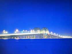 The Great South Bay Bridge, in Suffolk County, connects the mainland of Long Island to barrier islands across the Great South Bay. |
- Alexander Hamilton Bridge connecting the Trans-Manhattan Expressway in the Washington Heights section of Manhattan and the Cross-Bronx Expressway, as part of Interstate 95
- Basilone Bridge (part of I-95 and the New Jersey Turnpike)
- Bayonne Bridge (part of NY 440 and NJ 440), scheduled to undergo a $1 billion project to raise the roadway by 64 feet to 215 feet to allow taller container ships to pass underneath to access seaports in New York City and northern New Jersey.[92]
- Bear Mountain Bridge (part of US 6 and US 202)
- Bronx–Whitestone Bridge (part of I-678) - connects the boroughs of Bronx and Queens.
- Brooklyn Bridge, iconic of New York City and designated a National Historic Landmark by the U.S. National Park Service on January 29, 1964.[93] Connects Brooklyn and lower Manhattan (at Park Row and City Hall).
- Brooklyn–Battery Tunnel (part of I-478), officially renamed the Hugh L. Carey Tunnel, in honor of the former New York State governor - connects Brooklyn and lower Manhattan (financial district).
- Delaware Water Gap Toll Bridge (part of I-80 crossing the Delaware River)
- Driscoll Bridge (part of the Garden State Parkway), with a total of 15 travel lanes and 6 shoulder lanes, the widest motor vehicle bridge in the world by number of lanes[94] and one of the world's busiest.
- Easton–Phillipsburg Toll Bridge (part of US 22 crossing the Delaware River)
- Ed Koch Queensboro Bridge (part of NY 25) - renamed in honor of former New York City Mayor Edward I. Koch, also known informally as the "59th Street Bridge". Connects Queens and east side of Manhattan.
- George Washington Bridge (part of I-95 and US 1-9/46), the world's busiest motor vehicle bridge[95][96] and one of the world's widest, with 14 lanes.[94]
- Goethals Bridge (part of I-278)
- Great South Bay Bridge, Long Island
- Hill to Hill Bridge, part of PA-378 over the Lehigh River in Bethlehem, Pennsylvania
- Heroes Tunnel (formerly the West Rock Tunnel) (part of CT 15)
- Holland Tunnel (part of I-78)
- Interstate 78 Toll Bridge (over the Delaware River)
- Lehigh Tunnel (part of Interstate 476) in Carbon and Lehigh Counties, PA
- Lincoln Tunnel (part of Route 495)
- Manhattan Bridge, connecting Brooklyn to Manhattan's Chinatown, carries 4 tracks of the B D N Q R trains of the New York City Subway, in addition to other traffic.
- Mid-Hudson Bridge (part of US 44 and NY 55)
- Newark Bay Bridge (part of I-78)
- New Hope – Lambertville Toll Bridge (part of US 202 crossing the Delaware River)
- Newburgh–Beacon Bridge (part of I-84 and NY 52)
- Otisville Tunnel (takes the Metro-North Railroad Port Jervis Line through the Shawangunk Ridge in Orange County, New York)
- Outerbridge Crossing (part of NY 440 and NJ 440)
- Pearl Harbor Memorial Bridge (part of I-95 and the Connecticut Turnpike)
- Poughkeepsie Bridge, also known as Walkway over the Hudson, the world's longest pedestrian bridge,[97] connecting Ulster and Dutchess counties in New York
- Pulaski Skyway (part of US 1–9)
- Queens–Midtown Tunnel (part of I-495) - connects Queens and Midtown Manhattan.
- Scudder Falls Bridge (part of I-95 crossing the Delaware River)
- Sikorsky Memorial Bridge (part of CT 15 Merritt & Wilbur Cross Parkways)
- Tappan Zee Bridge (part of I-87, I-287, and the New York State Thruway), the longest bridge in New York State; planned to undergo a $4 billion replacement.[98]
- Thomas Alva Edison Memorial Bridge (part of US 9)
- Throgs Neck Bridge (part of I-295) - connects the boroughs of Bronx and Queens (at western end of Long Island Sound).
- Trenton–Morrisville Toll Bridge (part of US 1)
- Triborough Bridge (part of I-278), officially renamed the Robert F. Kennedy (RFK) Bridge, also known as the RFK–Triboro Bridge - connects the three boroughs of Manhattan, Bronx and Queens (hence its name).
- Verrazano-Narrows Bridge (part of I-278), the longest suspension bridge in the Americas and one of the longest in the world - connects the boroughs of Staten Island and Brooklyn.[2][3]
- William A. Stickel Memorial Bridge (part of I-280)
- Williamsburg Bridge, carries 2 tracks of the J M Z trains of the New York City Subway, in addition to other traffic - connects the boroughs of Brooklyn and Manhattan (lower east side).
Commuter bus
New Jersey Transit, Academy Bus, Coach USA, Spanish Transportation, and several other companies operate commuter coaches into the Port Authority Bus Terminal in Manhattan, and many other bus services in New Jersey. Bus services also operate in other nearby counties in the states of New York and Connecticut, but most terminate at a subway terminal or other rail station.
Major airports

The New York metropolitan area handles the busiest urban airspace in the United States – carrying over 100 million passengers annually,[99] and is served by three major airports.
| Airport | IATA code | ICAO code | County | State |
|---|---|---|---|---|
| John F. Kennedy International Airport | JFK | KJFK | Queens | New York |
| Newark Liberty International Airport | EWR | KEWR | Essex/Union | New Jersey |
| LaGuardia Airport | LGA | KLGA | Queens | New York |
The following smaller airports are also in the metro area and provide daily commercial service:
| Airport | IATA code | ICAO code | County | State |
|---|---|---|---|---|
| Lehigh Valley International Airport | ABE | KABE | Lehigh | Pennsylvania |
| Long Island MacArthur Airport | ISP | KISP | Suffolk | New York |
| Stewart International Airport | SWF | KSWF | Orange | New York |
| Trenton-Mercer Airport | TTN | KTTN | Mercer | New Jersey |
| Tweed New Haven Regional Airport | HVN | KHVN | New Haven | Connecticut |
| Westchester County Airport | HPN | KHPN | Westchester | New York |
Commuter usage
According to the 2010 American Community Survey, 54.3% (5,476,169) of commuters used a car or other private vehicle alone, 7.0% (708,788) used a carpool, 27.0% (2,721,372) used public transportation, 5.5% (558,434) walked to work, 2.0% (200,448) used some other means of transportation such as a bicycle to get to work.[100]
Culture and contemporary life
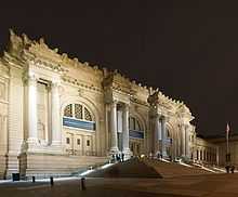 The Metropolitan Museum of Art, part of Museum Mile in the Carnegie Hill neighborhood of Manhattan's Upper East Side, is one of the largest museums in the world.[1]    MetLife Stadium, in East Rutherford, New Jersey, home to the New York Giants and New York Jets, is the most expensive stadium ever built,[4] at approximately $1.6 billion.[5]  The New York Knicks, Rangers, and Liberty sports teams play at Madison Square Garden in Midtown Manhattan.  According to Travel + Leisure magazine's October 2011 survey, Times Square in Midtown Manhattan, iconified as the "Crossroads of the World",[6][7][8][9][10] is the world's most visited tourist attraction, bringing in over 39 million visitors annually.[11] |
New York City has been described as the cultural capital of the world by the diplomatic consulates of Iceland[101] and Latvia[102] and by New York's own Baruch College.[103] A book containing a series of essays titled New York, culture capital of the world, 1940–1965 has also been published as showcased by the National Library of Australia.[104] Tom Wolfe has quoted regarding New York's culture that "Culture just seems to be in the air, like part of the weather".[105]
Although Manhattan remains the epicenter of cultural life in the metropolitan area, the entire region is replete with prominent cultural institutions, with artistic performances and ethnically oriented events receiving international attention throughout the year.
Sports teams
New York City is home to the headquarters of the National Football League,[106] Major League Baseball,[107] the National Basketball Association,[108] the National Hockey League,[109] and Major League Soccer.[110] Four of the ten most expensive stadiums ever built worldwide (MetLife Stadium, the new Yankee Stadium, Madison Square Garden, and Citi Field) are located in the New York metropolitan area.[4] The New York metropolitan area has the most professional sports teams in these five leagues.
Listing of the professional sports teams in the New York metropolitan area:
- National Basketball Association (NBA)
- Women's National Basketball Association (WNBA)
- Major League Baseball (MLB)
- Minor League Baseball (MiLB)
- International League (AAA)
- Eastern League (AA)
- South Atlantic League (A)
- Lakewood Blue Claws (Phillies)
- New York-Penn League (SS)
- Atlantic League of Professional Baseball (ALPB)
- Canadian American Association of Professional Baseball (CanAm League)
- National Football League (NFL)
- National Hockey League (NHL)
- American Hockey League (AHL)
- East Coast Hockey League (ECHL)
- Major League Soccer (MLS)
- New York Red Bulls
- The New York area's second Major League Soccer club, to be called New York City FC, is planned to start play in the 2015 season, to be majority-owned by Manchester City F.C. owner Sheikh Mansour bin Zayed bin Sultan Al Nahyan of Abu Dhabi, partnering with the New York Yankees baseball organization.[111]
- Professional Indoor Football League (PIFL)
- Major League Lacrosse (outdoor) (MLL)
- Long Island Lizards
- New Jersey Pride
- World Team Tennis (WTT)
- College Sports (NCAA)
Media
The New York City metropolitan area is home to the headquarters of several well-known media companies, subsidiaries, and publications, including Thomson Reuters, The New York Times Company, the Associated Press, Time Warner, NBCUniversal, the Hearst Corporation, Viacom, News Corporation, The Wall Street Journal, Fox News, ABC, CBS, and NBC. Local television channels include WCBS-TV 2 (CBS), WNBC 4 (NBC), WNYW 5 (FOX), WABC-TV 7 (ABC), WWOR-TV 9 (MyNetworkTV), WPIX 11 (CW), WNET 13 (PBS), WNYE-TV 25 (NYC Media) and WPXN-TV 31 (Ion). NY1 is a 24/7 local news provider available only to cable television subscribers. Radio stations serving the area include: WNYC, WFMU, WABC-AM, and WFAN. Many television and radio stations use the top of the Empire State Building to broadcast their terrestrial television signals, while some media entities broadcast from studios in Times Square.
The New York metropolitan area is extensive enough so that its own channels must compete with channels from neighboring television markets (including Philadelphia, Scranton/Wilkes-Barre, and Hartford) within its outlying counties. Cable companies offer such competition in the Pennsylvania portion, Connecticut, and a few counties in central New Jersey.
Theme parks
In New Jersey

| Main Park | Other Parks | Location | Year Opened |
|---|---|---|---|
| Six Flags Great Adventure | Six Flags Wild Safari, Six Flags Hurricane Harbor | Jackson | 1974 |
| Land of Make Believe | None | Hope | 1954 |
| Mountain Creek Waterpark | None | Vernon | 1998 |
In New York State
Playland, Rye, Westchester County
Plans were unveiled by New York City Mayor Michael Bloomberg on September 27, 2012 for the New York Wheel, the world's tallest ferris wheel, to be built at the northern shore of Staten Island, overlooking the Statue of Liberty, New York Harbor, and the Lower Manhattan skyline.[112][113]
In Pennsylvania
Dorney Park & Wildwater Kingdom, Dorneyville, Lehigh County
Although the DP&WWK complex is not planned as a theme park, it is nonetheless one of the largest amusement parks in Pennsylvania and draws substantially from Greater NYC since it is just off Interstate 78 in a location just west of Allentown.
Area codes
The area is served by at least 29 area codes:
|
|
See also
- Cities and metropolitan areas of the United States
- Mass transit in New York City
- Regional Plan Association
- Transportation in New York City
Notes
- ↑ New York-Newark-Bridgeport, NY-NJ-CT-PA CSA populations.[1][2] Note that the Lehigh Valley and Monroe County, Pennsylvania were newly included following the 2010 Census.
References
- ↑ "The Metropolitan Museum of Art General Information". © 2000–2012 The Metropolitan Museum of Art. All rights reserved. Retrieved 2012-09-10.
- ↑ 2.0 2.1 "Longest Suspension Bridges in the World". © 2000–2012 Pearson Education, publishing as Infoplease. Retrieved 2012-09-07.
- ↑ 3.0 3.1 "Verrazano–Narrows Bridge". Eastern Roads. Retrieved 2012-09-07.
- ↑ 4.0 4.1 Esteban (October 27, 2011). "11 Most Expensive Stadiums In The World". Total Pro Sports. Retrieved May 18, 2013.
- ↑ Belson, Ken (April 8, 2010). "New Stadium, a Football Palace, Opens Saturday With Lacrosse". The New York Times. Retrieved May 18, 2013.
- ↑ "Big Apple History Arts and Entertainment The Crossroads of the World". Thirteen/WNET New York 2005 Educational Broadcasting Corporation. Retrieved 2012-09-03.
- ↑ "Crossroads of the world – Times Square the official website of Times Square". Times Square District Management Association, Inc. Retrieved 2012-09-03.
- ↑ "Times Square New York, NY Times Square". 2011 NYCTourist.com. Retrieved 2012-09-03.
- ↑ Aditya Rangroo (October 14, 2010). "Times Square Crossroads of the World New York City Info". (C) 1980 – 2010 TimesSquare.com A Dataware Corporation Company. Retrieved 2012-09-03.
- ↑ Allan Tannenbaum. "New York in the 70s: A Remembrance". © The Digital Journalist. Retrieved 2012-09-03.
- ↑ Joshua Pramis (October 2011). "World's Most-Visited Tourist Attractions No. 1: Times Square, New York City". American Express Publishing Corporation. Retrieved 2012-09-03.
- ↑ 12.0 12.1 "Geographic area,"April 1, 2010",,Population estimates (as of July 1),, ,,,Census,Estimates base,2010,2011,2012". U.S. Census Bureau. Retrieved October 27, 2013.
- ↑ 13.0 13.1 "ACS DEMOGRAPHIC AND HOUSING ESTIMATES Geographies - 2012 American Community Survey 1-Year Estimates New York-Newark-Bridgeport, NY-NJ-CT-PA CSA". U.S. Census Bureau. Retrieved October 27, 2013.
- ↑ "World's Largest Urban Areas [Ranked by Urban Area Population]". Rhett Butler. 2003–2006. Retrieved 2011-11-25.
- ↑ "Largest Cities of the World – (by metro population)". Woolwine-Moen Group d/b/a Graphic Maps. Retrieved 2011-11-25.
- ↑ "Largest urban areas in the world: 2008 All Urban Areas 2,000,000 & Over". Wendell Cox Consultancy. Retrieved 2011-11-25.
- ↑ "OMB's Decisions Regarding Recommendations From the Metropolitan and Micropolitan Statistical Area Standards Review Committee Concerning Changes to the Standards for Defining Metropolitan and Micropolitan Statistical Areas". Federal Register. Retrieved 8 October 2013.
- ↑ New York City Designated Market Area map PDF
- ↑ Geography Explained (see Change in Labor Market Areas) http://www.labor.ny.gov/stats/lsgeog.shtm
- ↑ http://www2.census.gov/geo/maps/puma/puma2k/ct_puma5.pdf
- ↑ "Metro-North Railroad". Metropolitan Transportation Authority of the State of New York. Retrieved September 27, 2011.
- ↑ "Frequently Asked Questions". Hudson River PCBs. New York, NY: U.S. Environmental Protection Agency. Retrieved September 29, 2011.
- ↑ "Pike County, Pennsylvania QuickFacts". U.S. Census Bureau. Retrieved 2012-09-11.
- ↑ "Pike County, PA Court Administration". Pike County Commissioners. Retrieved 2012-09-11.
- ↑ David Pierce (2010-06-25). "Population pops in Pike, Monroe counties". The Pocono Record. Retrieved 2012-09-11.
- ↑ Office of Management and Budget – Standards for Defining Metropolitan and Micropolitan Statistical Areas, Sec. 5
- ↑ United States Census Bureau (web) (3 April 2011). "USA: New York". City Population. Thomas Brinkhoff. Retrieved 9 June 2012.
- ↑ United States Census Bureau (web) (3 April 2011). "USA: New Jersey". City Population. Thomas Brinkhoff. Retrieved 9 June 2012.
- ↑ United States Census Bureau (web) (3 April 2011). "USA: Connecticut". City Population. Thomas Brinkhoff. Retrieved 9 June 2012.
- ↑ 30.0 30.1 30.2 Peel, M. C.; Finlayson, B. L.; McMahon, T. A. "World Map of Köppen-Geiger climate classification". The University of Melbourne. Retrieved 2012-09-03.
- ↑ 31.0 31.1 "New York Polonia Polish Portal in New York". NewYorkPolonia.com. Retrieved 2012-09-03.
- ↑ "united states annual snowfall map". ©1998–2012 HowStuffWorks, Inc. Retrieved 2012-09-03.
- ↑ "The Climate of New York". New York State Climate Office. Retrieved 2012-09-03.
- ↑ 34.0 34.1 34.2 34.3 34.4 34.5 34.6 34.7 34.8 "NowData - NOAA Online Weather Data". National Oceanic and Atmospheric Administration. Retrieved 2013-03-04.
- ↑ "Weatherbase New York, New York". Canty and Associates LLC. Retrieved 2012-09-03.
- ↑ Sam Dolnick (August 28, 2011). "Damage From Irene Largely Spares New York – Recovery Is Slower in New York Suburbs". © 2011 The New York Times Company. Retrieved 2012-09-03.
- ↑ 37.0 37.1 "Average Percent Sunshine through 2009". National Climatic Data Center. Retrieved 2012-11-14.
- ↑ "united states annual sunshine map". HowStuffWorks, Inc. Retrieved April 26, 2013.
- ↑ "New York Central Park, NY Climate Normals 1961−1990". NOAA.
- ↑ "Station Name: CT DANBURY". National Oceanic and Atmospheric Administration. Retrieved 2013-03-28.
- ↑ "Weatherbase: Weather for Stroudsburg, Pennsynlvania". Weatherbase. 2011. Retrieved on November 22, 2011.
- ↑ "Average Weather for Morristown, New Jersey - Temperature and Precipitation". Weather.com. Retrieved 28 March 2008.
- ↑ "Average weather for Toms River, New Jersey". Weather.com. Retrieved April 1, 2012.
- ↑ "About the Lenapes". [Lenape Lifeways]. Retrieved 2012-09-08.
- ↑ 45.0 45.1 "United States History – History of New York City, New York". Retrieved 2012-09-09.
- ↑ Shorto, Russell (2005). The Island at the Center of The World, 1st Edition. New York: Vintage Books. p. 30. ISBN 1-4000-7867-9.
- ↑ "New Jersey Colony Reading Comprehension". MrNussbaum.com. Retrieved 2012-09-09.
- ↑ "KINGSTON Discover 300 Years of New York History DUTCH COLONIES". National Park Service, U.S. Department of the Interior. Retrieved 2012-09-09.
- ↑ "The Nine Capitals of the United States". United States Senate. Retrieved 2012-09-09.
- ↑ "Rank by Population of the 100 Largest Urban Places, Listed Alphabetically by State: 1790–1990". U.S. Census Bureau. June 15, 1998. Retrieved 2012-09-09.
- ↑ "Statue of Liberty". 1996–2011, A&E Television Networks, LLC. All Rights Reserved. Retrieved 2012-09-09.
- ↑ "Statue of Liberty". World Heritage. © UNESCO World Heritage Centre 1992–2011. Retrieved 2011-10-23.
- ↑ "A 5-Borough Centennial Preface for Katharine Bement Davis Mini-History". The New York City Department of Correction. 1997. Retrieved 2012-09-02.
- ↑ "New York: A City of Neighborhoods". New York City Department of City Planning. Retrieved 2012-09-02.
- ↑ Martin Z. Braun & Freeman Klopott (2012-11-26). "Bloomberg Seeks $9.8 Billion Aid for NYC Sandy Storm Losses". ©2012 BLOOMBERG L.P. ALL RIGHTS RESERVED. Retrieved 2012-11-27.
- ↑ Robert S. Eshelman (2012-11-15). "ADAPTATION: Political support for a sea wall in New York Harbor begins to form". © 1996–2012 E&E Publishing, LLC. Retrieved 2012-12-01.
- ↑ http://www.policom.com/2013MAPS/Combined%202013.pdf. Retrieved October 28, 2013. Missing or empty
|title=(help) - ↑ "Population Estimates: Metropolitan and Micropolitan Statistical Areas". United States Census Bureau. Retrieved 8 August 2012.
- ↑ "World Jewish Population". SimpleToRemember.com – Judaism Online. Retrieved 2013-01-22.
- ↑ "Profile of General Population and Housing Characteristics: 2010 Demographic Profile Data Geography: New York–Newark–Bridgeport, NY–NJ–CT–PA CSA". Retrieved 2013-01-22.
- ↑ "Profile of General Population and Housing Characteristics: 2010 Demographic Profile Data Geography: United States". U.S. Census Bureau. Retrieved 2013-01-22.
- ↑ Kirk Semple (June 23, 2011). "Asian New Yorkers Seek Power to Match Numbers". The New York Times Company. Retrieved 2013-01-22.
- ↑ Lawrence A. McGlinn, Department of Geography SUNY–New Paltz. "BEYOND CHINATOWN: DUAL IMMIGRATION AND THE CHINESE POPULATION OF METROPOLITAN NEW YORK CITY, 2000, Page 6". Middle States Geographer, 2002, 35: 110–119, Journal of the Middle States Division of the Association of American Geographers. Retrieved 2013-01-22.
- ↑ "Profile of General Population and Housing Characteristics: 2010 Demographic Profile Data Geography: New York–Newark–Bridgeport, NY–NJ–CT–PA CSA". Retrieved 2013-01-22.
- ↑ "Yearbook of Immigration Statistics: 2012 Supplemental Table 2". U.S. Department of Homeland Security. Retrieved 2013-04-02.
- ↑ "Yearbook of Immigration Statistics: 2011 Supplemental Table 2". U.S. Department of Homeland Security. Retrieved 2013-04-02.
- ↑ "Yearbook of Immigration Statistics: 2010 Supplemental Table 2". U.S. Department of Homeland Security. Retrieved 2013-04-02.
- ↑ "Yearbook of Immigration Statistics: 2009 Supplemental Table 2". U.S. Department of Homeland Security. Retrieved 2013-04-02.
- ↑ Gary J. Gates, PhD. "Same-sex Couples and the Gay, Lesbian, Bisexual Population: New Estimates from the American Community Survey". The Williams Institute on Sexual Orientation. Retrieved 2012-09-02.
- ↑ Nicholas Confessore and Michael Barbaro (June 24, 2011). "New York Allows Same-Sex Marriage, Becoming Largest State to Pass Law". The New York Times Company. Retrieved 2012-09-02.
- ↑ Richard Florida (2012-05-08). "What Is the World's Most Economically Powerful City?". The Atlantic Monthly Group. Retrieved 2012-11-22.
- ↑ "GDP by State". Greyhill Advisors. Retrieved September 23, 2011.
- ↑ Zumbrun, Joshua. "In Pictures: World's Most Economically Powerful Cities". Forbes.
- ↑ Huddleston, Cameron. "Top 5 Cities with the highest cost of living". Kiplinger's. Retrieved 2012-09-02.
- ↑ "National University Rankings". U.S. News & World Report. Retrieved September 10, 2013.
- ↑ "List of Ivy League Schools". University Review. Retrieved September 10, 2013.
- ↑ "Academic Ranking of World Universities 2013". ShanghaiRanking Consultancy. Retrieved September 10, 2013.
- ↑ "Fordham University". U.S. News & World Report. Retrieved October 2, 2013.
- ↑ http://www.fordham.edu/campus_resources/enewsroom/archives/archive_706.asp
- ↑ "Selected statistics on enrollment, teachers, dropouts, and graduates in public school districts enrolling more than 15,000 students, by state: 1990, 2000, and 2006". Digest of Education Statistics 2008. U.S. Department of Education. Institute of Education Sciences, National Center for Education Statistics. 18 March 2009. pp. 129–139. Retrieved 2009-04-26.
- ↑ "U.S. News and World Report Best High Schools National Rankings". U.S.News & World Report. Retrieved 2012-09-10.
- ↑ "SELECTED SOCIAL CHARACTERISTICS IN THE UNITED STATES 2010 American Community Survey 1-Year Estimates". U.S Census Bureau. Retrieved November 16, 2011.
- ↑ Christie, Les (October 1, 2010). "America's brainiest places to live". CNN Money. Retrieved November 16, 2011.
- ↑ "The MTA Network: Public Transportation for the New York Region". Metropolitan Transportation Authority. Retrieved 2012-09-07.
- ↑ Pisarski, Alan (October 16, 2006). "Commuting in America III: Commuting Facts" (PDF). Transportation Research Board. Retrieved 2012-09-07.
- ↑ "The MTA Network: Public Transportation for the New York Region". Metropolitan Transportation Authority. Retrieved 2012-09-04.
- ↑ "Service Hours". MTR. Retrieved 2012-09-06.
- ↑ "Tsuen Wan Line". TravelChinaGuide.com. Retrieved 2012-09-06.
- ↑ "Train Time Table – Search station". Seoul Metropolitan Rapid Transit Corporation. Retrieved 2012-09-06.
- ↑ "Subway map". Seoul Metropolitan Rapid Transit Corporation. Retrieved 2012-09-06.
- ↑ 91.0 91.1 91.2 Metro-North ridership tops LIRR for 1st time – Poughkeepsie Journal
- ↑ "Port Authority: Bayonne Bridge Project 6 Months Ahead Of Schedule". ©2012 CBS Local Media, a division of CBS Radio Inc. All rights reserved. 2012-07-18. Retrieved 2012-09-07.
- ↑ "Brooklyn Bridge – National Historic Landmarks Program". U.S. National Park Service. Retrieved 2012-09-07.
- ↑ 94.0 94.1 "Garden State Parkway opens world's widest bridge – 15 lanes". TOLLROADSnews, Peter Samuel. 2006-04-11. Retrieved 2012-09-07.
- ↑
- ↑
- ↑
- ↑ Khurram Saeed and Theresa Juva-Brown (2012-12-17). "It's official: State picks builder for new Tappan Zee Bridge". lohud.com. Retrieved 2012-12-19.
- ↑ Susan Fleming. FAA Airspace Redesign: An Analysis of the New York/New Jersey/Philadelphia Project, United States Government Accountability Office Report to the Congressional Requesters. Diane Publishing Company. Retrieved 2012-09-07.
- ↑ http://factfinder2.census.gov/faces/tableservices/jsf/pages/productview.xhtml?pid=ACS_10_1YR_DP03&prodType=table|title=SELECTED ECONOMIC CHARACTERISTICS 2010 American Community Survey 1-Year Estimates|publisher=US Census Bureau
- ↑ "Consulate General of Iceland New York Culture". Consulate General of Iceland New York. Retrieved 2012-09-10.
- ↑ "Consulate of Latvia in New York". Consulate of Latvia. Retrieved 2012-09-10.
- ↑ "Introduction to Chapter 14: New York City (NYC) Culture". The Weissman Center for International Business, Baruch College/CUNY 2011. Retrieved 2012-09-10.
- ↑ "New York, Culture Capital of the World, 1940–1965 / edited by Leonard Wallock ; essays by Dore Ashton ... [et al.]". NATIONAL LIBRARY OF AUSTRALIA. Retrieved 2012-09-10.
- ↑ "Speeches: Tom Christopher Exhibit Opening" (Press release). Consulate General of the United States: Frankfurt, Germany. May 9, 2007. Archived from the original on 2007-07-23. Retrieved 2012-09-10.
- ↑ "National Football League Company Information". Hoover's, Inc. Retrieved May 18, 2013.
- ↑ "Major League Baseball Company Information". Hoover's, Inc. Retrieved May 18, 2013.
- ↑ "National Basketball Association, Inc. Company Information". Hoover's, Inc. Retrieved May 18, 2013.
- ↑ "National Hockey League Company Information". Hoover's, Inc. Retrieved May 18, 2013.
- ↑ "Major League Soccer, L.L.C. Company Information". Hoovers, Inc. Retrieved May 18, 2013.
- ↑ Associated Press, Fox Sports Interactive Media (May 21, 2013). "Man City, Yankees to own MLS club". Retrieved May 21, 2013.
- ↑ Jennifer Peltz, Associated Press (2012-09-28). "NYC to get 'world's largest' Ferris wheel". ©2012 NBCNews.com. Associated Press. Archived from the original on 2013-01-04. Retrieved 2012-09-29.
- ↑ James Barron (2012-09-27). "World’s Tallest Ferris Wheel Planned for Staten Island". The New York Times. Retrieved 2012-09-29.
External links
| Find more about New York metropolitan area at Wikipedia's sister projects | |
| |
Definitions and translations from Wiktionary |
| |
Media from Commons |
| |
Quotations from Wikiquote |
| |
Source texts from Wikisource |
| |
Textbooks from Wikibooks |
| |
Travel guide from Wikivoyage |
| |
Learning resources from Wikiversity |
- Government Census, Table 1.

| |||||||||||||||
| ||||||||||||||||||||
| ||||||||||||||||||||
| |||||||||||||||||||||||
| ||||||||||||||||||||||||||
| ||||||||||||||
| ||||||||||||||
| ||||||||||
| ||||||||