| [3] |
Name on the Register |
Image |
Date listed[4] |
Location |
Summary |
|---|
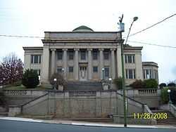
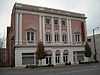
| 1 |
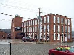
Academy of Music |
|
01969-06-11June 11, 1969
(#69000340) |
522-526 Main St.
37°25′01″N 79°08′44″W / 37.416944°N 79.145556°W / 37.416944; -79.145556 (Academy of Music) |
|
| 2 |
Allied Arts Building |
|
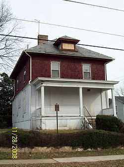
01985-12-19December 19, 1985
(#85003203) |
725 Church St.
37°24′52″N 79°08′39″W / 37.414444°N 79.144167°W / 37.414444; -79.144167 (Allied Arts Building) |
|
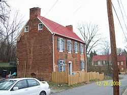
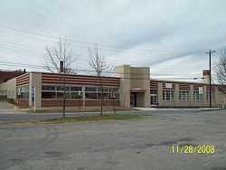
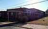
| 3 |
Armstrong Elementary School |
|
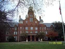
02012-08-22August 22, 2012
(#12000542) |
1721 Monsview Pl.
37°25′47″N 79°09′38″W / 37.429615°N 79.160691°W / 37.429615; -79.160691 (Armstrong Elementary School) |
|
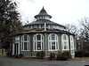
| 4 |
Aviary |
|
01980-07-30July 30, 1980
(#80004309) |
402 Grove St.
37°24′08″N 79°09′47″W / 37.402222°N 79.163056°W / 37.402222; -79.163056 (Aviary) |
|
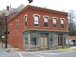
| 5 |
Bragassa Toy Store |
|
01991-01-11January 11, 1991
(#90002136) |
323-325 Twelfth St.
37°24′41″N 79°08′32″W / 37.411389°N 79.142222°W / 37.411389; -79.142222 (Bragassa Toy Store) |
|
| 6 |
Centerview |
|
02000-12-01December 1, 2000
(#00001435) |
1900 Memorial Ave.
37°24′30″N 79°09′43″W / 37.408333°N 79.161944°W / 37.408333; -79.161944 (Centerview) |
|
| 7 |
Court House Hill-Downtown Historic District |
|
02001-08-16August 16, 2001
(#01000853) |
Church, Clay, Court, Main Sts., roughly bounded by 5th through 13th Sts.
• Boundary increase (listed 02002-11-22November 22, 2002, refnum 02001361): Roughly along Madison St., Harrison St., 7th St., 6th St.
37°24′51″N 79°08′37″W / 37.414131°N 79.143581°W / 37.414131; -79.143581 (Court House Hill-Downtown Historic District) |
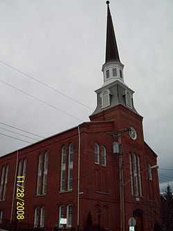
|
| 8 |
Court Street Baptist Church |
|
01982-07-08July 8, 1982
(#82004569) |
6th and Court Sts.
37°24′58″N 79°08′50″W / 37.416111°N 79.147222°W / 37.416111; -79.147222 (Court Street Baptist Church) |
|
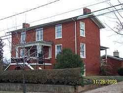
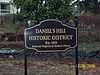
| 9 |
Daniel's Hill Historic District |
|
01983-02-24February 24, 1983
(#83003289) |
Cabell, Norwood, Hancock, Stonewall from 6th to H St.
37°25′21″N 79°08′45″W / 37.4225°N 79.145833°W / 37.4225; -79.145833 (Daniel's Hill Historic District) |
|
| 10 |
Diamond Hill Baptist Church |
|
02011-02-22February 22, 2011
(#11000026) |
1415 Grace St.
37°24′27″N 79°08′38″W / 37.4075°N 79.143889°W / 37.4075; -79.143889 (Diamond Hill Baptist Church) |
|
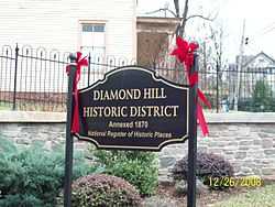
| 11 |
Diamond Hill Historic District |
|
01979-10-01October 1, 1979
(#79003283) |
Roughly bounded by Dunbar Dr., Main, Jackson and Arch Sts.
• Boundary increase (listed 01983-04-14April 14, 1983, refnum 83003290): Grace St.
37°24′31″N 79°08′23″W / 37.408611°N 79.139722°W / 37.408611; -79.139722 (Diamond Hill Historic District) |
|
| 12 |
Federal Hill Historic District |
|
01980-09-17September 17, 1980
(#80004310) |
Roughly bounded by 8th, 12th, Harrison and Polk Sts.
37°24′39″N 79°08′51″W / 37.410833°N 79.1475°W / 37.410833; -79.1475 (Federal Hill Historic District) |
|
| 13 |
Fifth Street Historic District |
|
02012-02-08February 8, 2012
(#12000019) |
5th, 6th, Court, Clay, Madison, Harrison, Federal, Jackson, Polk, & Monroe Sts.
37°24′54″N 79°08′59″W / 37.414922°N 79.149853°W / 37.414922; -79.149853 (Fifth Street Historic District) |
|
| 14 |
First Baptist Church |
|
01982-09-09September 9, 1982
(#82004570) |
1100 Court St.
37°24′43″N 79°08′33″W / 37.411944°N 79.1425°W / 37.411944; -79.1425 (First Baptist Church) |
|
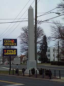
| 15 |
Fort Early and Jubal Early Monument |
|
02002-01-24January 24, 2002
(#01001517) |
3511 Memorial Ave.
37°23′23″N 79°10′24″W / 37.389722°N 79.173333°W / 37.389722; -79.173333 (Fort Early and Jubal Early Monument) |
|
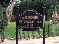
| 16 |
Garland Hill Historic District |
|
01972-09-07September 7, 1972
(#72001507) |
Bounded roughly by 5th St., Federal Ave., and Norfolk Western Ry. tracks
37°25′03″N 79°09′03″W / 37.4175°N 79.150833°W / 37.4175; -79.150833 (Garland Hill Historic District) |
|
| 17 |
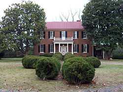
Carter Glass House |
|
01976-12-08December 8, 1976
(#76002183) |
605 Clay St.
37°24′55″N 79°08′51″W / 37.415278°N 79.1475°W / 37.415278; -79.1475 (Carter Glass House) |
|
| 18 |
Dr. Robert Walter Johnson House and Tennis Court |
|
02002-01-24January 24, 2002
(#01001519) |
1422 Pierce St.
37°24′43″N 79°09′02″W / 37.411944°N 79.150556°W / 37.411944; -79.150556 (Dr. Robert Walter Johnson House and Tennis Court) |
|
| 19 |
Jones Memorial Library |
|
01980-10-30October 30, 1980
(#80004311) |
434 Rivermont Ave.
37°25′20″N 79°09′40″W / 37.422222°N 79.161111°W / 37.422222; -79.161111 (Jones Memorial Library) |
|
| 20 |
Kentucky Hotel |
|
01986-12-11December 11, 1986
(#86003468) |
900 Fifth St.
37°24′52″N 79°09′03″W / 37.414444°N 79.150833°W / 37.414444; -79.150833 (Kentucky Hotel) |
|
| 21 |
Locust Grove |
|
01992-12-17December 17, 1992
(#92001704) |
Marvin Pl.
37°26′26″N 79°14′59″W / 37.440556°N 79.249722°W / 37.440556; -79.249722 (Locust Grove) |
|
| 22 |
Lower Basin Historic District |
|
01987-04-24April 24, 1987
(#87000601) |
700-1300 blocks of Jefferson St., 600-1300 blocks of Commerce St., and 1200-1300 blocks of Main St.
• Boundary increase (listed 02002-06-06June 6, 2002, refnum 02000620): 1307 Main St., 103-109 Sixth St.
37°24′52″N 79°08′21″W / 37.414444°N 79.139167°W / 37.414444; -79.139167 (Lower Basin Historic District) |
|
| 23 |
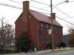
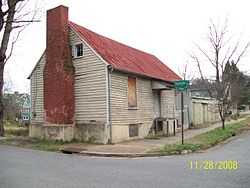
Lynch's Brickyard House |
|
02002-03-13March 13, 2002
(#02000180) |
700 Jackson St.
37°24′45″N 79°09′00″W / 37.4125°N 79.15°W / 37.4125; -79.15 (Lynch's Brickyard House) |
|
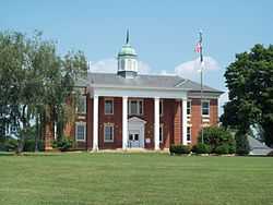
| 24 |
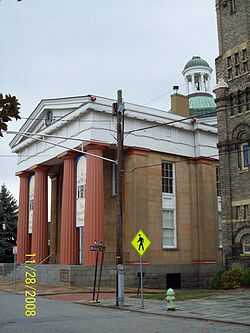
Lynchburg Courthouse |
|
01972-05-19May 19, 1972
(#72001508) |
9th St. between Court and Church Sts.
37°24′49″N 79°08′41″W / 37.413611°N 79.144722°W / 37.413611; -79.144722 (Lynchburg Courthouse) |
|
| 25 |
Lynchburg Hospital |
|
01999-12-09December 9, 1999
(#99001506) |
701-709 Hollins Mill Rd.
37°25′12″N 79°09′21″W / 37.42°N 79.155833°W / 37.42; -79.155833 (Lynchburg Hospital) |
|
| 26 |
Main Hall, Randolph-Macon Women's College |
|
01979-06-19June 19, 1979
(#79003285) |
2500 Rivermont Ave.
37°26′12″N 79°10′21″W / 37.436667°N 79.1725°W / 37.436667; -79.1725 (Main Hall, Randolph-Macon Women's College) |
|
| 27 |
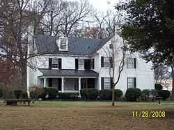
Samuel Miller House |
|
01992-11-12November 12, 1992
(#92001579) |
1433 Nelson Dr.
37°21′57″N 79°12′47″W / 37.365833°N 79.213056°W / 37.365833; -79.213056 (Samuel Miller House) |
|
| 28 |
Miller-Claytor House |
|
01976-05-06May 6, 1976
(#76002223) |
Treasure Island Rd. at Miller-Claytor Lane
37°26′12″N 79°09′49″W / 37.436667°N 79.163611°W / 37.436667; -79.163611 (Miller-Claytor House) |
|
| 29 |
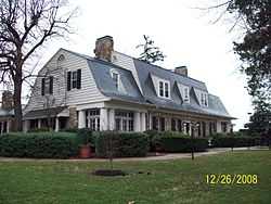
Montview |
|
01987-06-05June 5, 1987
(#87000854) |
Liberty University campus between VA 670 and US 29
37°21′10″N 79°10′43″W / 37.352778°N 79.178611°W / 37.352778; -79.178611 (Montview) |
|
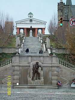
| 30 |
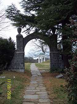
Old City Cemetery |
|
01973-04-02April 2, 1973
(#73002216) |
4th, Monroe, 1st Sts. and Southern RR. tracks
37°24′54″N 79°09′24″W / 37.415°N 79.156667°W / 37.415; -79.156667 (Old City Cemetery) |
|
| 31 |
William Phaup House |
|
02002-03-13March 13, 2002
(#02000182) |
911 Sixth St.
37°24′48″N 79°09′06″W / 37.413333°N 79.151667°W / 37.413333; -79.151667 (William Phaup House) |
|
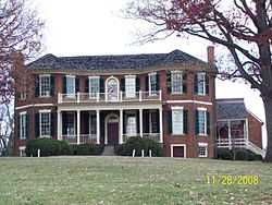
| 32 |
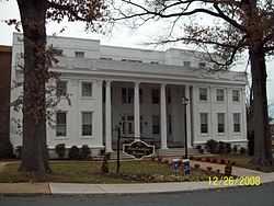
Point of Honor |
|
01970-02-26February 26, 1970
(#70000872) |
112 Cabell St.
37°25′13″N 79°08′39″W / 37.420278°N 79.144167°W / 37.420278; -79.144167 (Point of Honor) |
|
| 33 |
Presbyterian Orphans Home |
|
02010-06-24June 24, 2010
(#08000073) |
150 Linden Ave.
37°26′50″N 79°11′42″W / 37.447222°N 79.195°W / 37.447222; -79.195 (Presbyterian Orphans Home) |
|
| 34 |
Pyramid Motors |
|
02007-11-01November 1, 2007
(#07001140) |
405-407 Federal St.
37°24′56″N 79°09′06″W / 37.415556°N 79.151667°W / 37.415556; -79.151667 (Pyramid Motors) |
|
| 35 |
Rivermont |
|
02000-05-11May 11, 2000
(#00000496) |
205 F St.
37°25′29″N 79°08′50″W / 37.424722°N 79.147222°W / 37.424722; -79.147222 (Rivermont) |
|
| 36 |
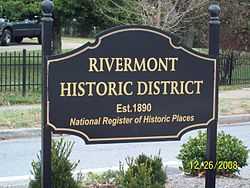
Rivermont Historic District |
|
02003-04-11April 11, 2003
(#03000224) |
Rivermont Avenue and 200 Boston Avenue
37°25′43″N 79°09′29″W / 37.428611°N 79.158056°W / 37.428611; -79.158056 (Rivermont Historic District) |
Boundary increase 05-28-2013 to add one building: The St. John's Episcopal Church at 200 Boston Avenue (ref 13000338).
|
| 37 |
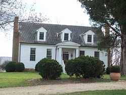
Rosedale |
|
01983-07-07July 7, 1983
(#83003291) |
Old Graves Mill Rd.
• Boundary increase (listed 01992-04-10April 10, 1992, refnum 92000240): Graves Mill Rd. west of the junction with VA 291
37°22′34″N 79°13′44″W / 37.376111°N 79.228889°W / 37.376111; -79.228889 (Rosedale) |
|
| 38 |
Saint Paul's Vestry House |
|
01997-02-21February 21, 1997
(#97000157) |
308 7th St.
37°24′53″N 79°08′40″W / 37.414722°N 79.144444°W / 37.414722; -79.144444 (Saint Paul's Vestry House) |
|
| 39 |
Sandusky House |
|
01982-07-26July 26, 1982
(#82004571) |
757 Sandusky Dr.
37°22′48″N 79°11′49″W / 37.38°N 79.196944°W / 37.38; -79.196944 (Sandusky House) |
|
| 40 |
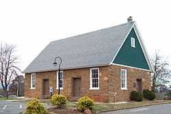
South River Friends Meetinghouse |
|
01975-08-28August 28, 1975
(#75002113) |
5810 Fort Ave.
37°22′23″N 79°11′32″W / 37.373056°N 79.192222°W / 37.373056; -79.192222 (South River Friends Meetinghouse) |
|
| 41 |
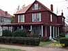
Anne Spencer House |
|
01976-12-06December 6, 1976
(#76002224) |
1313 Pierce St.
37°24′13″N 79°09′08″W / 37.403611°N 79.152222°W / 37.403611; -79.152222 (Anne Spencer House) |
|
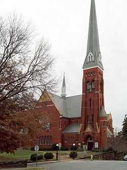
| 42 |
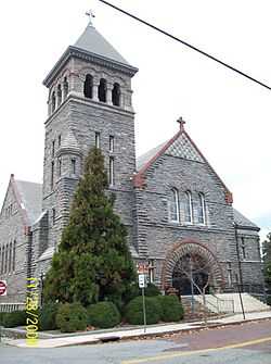
St. Paul's Church |
|
01982-09-09September 9, 1982
(#82004572) |
605 Clay St.
37°24′54″N 79°08′51″W / 37.415°N 79.1475°W / 37.415; -79.1475 (St. Paul's Church) |
|
| 43 |
Virginia Episcopal School |
|
01992-10-28October 28, 1992
(#92001392) |
400 Virginia Episcopal School Rd.
37°27′11″N 79°11′26″W / 37.453056°N 79.190556°W / 37.453056; -79.190556 (Virginia Episcopal School) |
|
| 44 |
Virginia University of Lynchburg |
|
02011-02-22February 22, 2011
(#11000035) |
2058 Garfield Ave.
37°23′43″N 79°09′07″W / 37.395278°N 79.151944°W / 37.395278; -79.151944 (Virginia University of Lynchburg) |
|
| 45 |
John Marshall Warwick House |
|
01996-12-06December 6, 1996
(#96001449) |
720 Court St.
37°24′47″N 79°08′37″W / 37.413056°N 79.143611°W / 37.413056; -79.143611 (John Marshall Warwick House) |
|
| 46 |
Western Hotel |
|
01974-07-22July 22, 1974
(#74002236) |
5th and Madison Sts.
37°24′57″N 79°08′57″W / 37.415833°N 79.149167°W / 37.415833; -79.149167 (Western Hotel) |
|
| 47 |
J. W. Wood Building |
|
01983-02-17February 17, 1983
(#83003292) |
23-27 Ninth St.
37°24′58″N 79°08′26″W / 37.416111°N 79.140556°W / 37.416111; -79.140556 (J. W. Wood Building) |
|


.jpg)