| [3] |
Name on the Register[4] |
Image |
Date listed[5] |
Location |
City or town |
Summary |
|---|
| 1 |
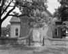
Abingdon Church |
|
01970-09-15September 15, 1970
(#70000796) |
U.S. 17, S of jct. with VA 614
37°20′00″N 76°30′49″W / 37.333333°N 76.513611°W / 37.333333; -76.513611 (Abingdon Church) |
White Marsh |
|
| 2 |
Abingdon Glebe House |
|
01970-09-15September 15, 1970
(#70000794) |
S of jct. of U.S. 17 and VA 615
37°22′36″N 76°32′22″W / 37.376667°N 76.539444°W / 37.376667; -76.539444 (Abingdon Glebe House) |
Gloucester |
|
| 3 |
Airville |
|
01990-12-06December 6, 1990
(#90001824) |
VA 629 S of jct. with VA 626
37°23′12″N 76°30′15″W / 37.386667°N 76.504167°W / 37.386667; -76.504167 (Airville) |
Gloucester |
|
| 4 |
Burgh Westra |
|
01976-10-08October 8, 1976
(#76002107) |
E of Gloucester off VA 3
37°25′11″N 76°27′14″W / 37.419722°N 76.453889°W / 37.419722; -76.453889 (Burgh Westra) |
Gloucester |
|
| 5 |
Cappahosic House |
|
02003-04-11April 11, 2003
(#03000211) |
3198 Cappahosic Rd.
37°22′49″N 76°38′00″W / 37.380278°N 76.633333°W / 37.380278; -76.633333 (Cappahosic House) |
Gloucester |
|
| 6 |
Gloucester Downtown Historic District |
|
02010-12-27December 27, 2010
(#10001063) |
Seven blocks of Main St. from the courthouse circle to Ware House Rd.
37°24′48″N 76°31′26″W / 37.413333°N 76.523889°W / 37.413333; -76.523889 (Gloucester Downtown Historic District) |
Gloucester |
|
| 7 |
Fairfield Site |
|
01973-07-16July 16, 1973
(#73002019) |
Address Restricted
|
White Marsh |
|
| 8 |
Gloucester County Courthouse Square Historic District |
|
01973-10-03October 3, 1973
(#73002016) |
Main St. and Gloucester County Courthouse Sq.
37°24′53″N 76°31′47″W / 37.414722°N 76.529722°W / 37.414722; -76.529722 (Gloucester County Courthouse Square Historic District) |
Gloucester |
|
| 9 |
Gloucester Point Archaeological District |
|
01985-06-10June 10, 1985
(#85001251) |
Address Restricted
|
Gloucester |
|
| 10 |
Gloucester Women's Club |
|
01974-01-24January 24, 1974
(#74002117) |
On U.S. 17
37°24′44″N 76°31′11″W / 37.412222°N 76.519722°W / 37.412222; -76.519722 (Gloucester Women's Club) |
Gloucester |
|
| 11 |
Hockley |
|
02010-07-09July 9, 2010
(#10000446) |
6640 Ware Neck Rd.
37°24′14″N 76°27′48″W / 37.403889°N 76.463333°W / 37.403889; -76.463333 (Hockley) |
Gloucester |
|
| 12 |
Holly Knoll |
|
01981-12-21December 21, 1981
(#81000640) |
Off RR 662
37°23′17″N 76°38′38″W / 37.388056°N 76.643889°W / 37.388056; -76.643889 (Holly Knoll) |
Capahosic |
Also known as Robert R. Moton House
|
| 13 |
Kempsville |
|
01978-12-21December 21, 1978
(#78003018) |
E of Shacklefords on VA 33
37°33′38″N 76°38′18″W / 37.560556°N 76.638333°W / 37.560556; -76.638333 (Kempsville) |
Shacklefords |
|
| 14 |
Lands End |
|
01974-11-06November 6, 1974
(#74002118) |
SE of Naxera on VA 614
37°19′35″N 76°25′34″W / 37.326389°N 76.426111°W / 37.326389; -76.426111 (Lands End) |
Naxera |
|
| 15 |
Little England |
|
01970-12-18December 18, 1970
(#70000795) |
E of Gloucester on VA 672
37°15′09″N 76°28′33″W / 37.2525°N 76.475833°W / 37.2525; -76.475833 (Little England) |
Gloucester |
|
| 16 |
Lowland Cottage |
|
01971-09-22September 22, 1971
(#71001104) |
SW of Ware Neck, 0.5 mi. S of VA 623
37°24′04″N 76°28′06″W / 37.401111°N 76.468333°W / 37.401111; -76.468333 (Lowland Cottage) |
Ware Neck |
|
| 17 |
Walter Reed Birthplace |
|
01973-09-20September 20, 1973
(#73002017) |
SW of Gloucester at jct. of VA 614 and 616
37°23′18″N 76°35′18″W / 37.388333°N 76.588333°W / 37.388333; -76.588333 (Walter Reed Birthplace) |
Belroi |
|
| 18 |
Roaring Spring |
|
01972-09-22September 22, 1972
(#72001395) |
0.3 mi. E of VA 616
37°25′53″N 76°31′49″W / 37.431389°N 76.530278°W / 37.431389; -76.530278 (Roaring Spring) |
Gloucester |
|
| 19 |
Rosewell |
|
01969-10-01October 1, 1969
(#69000244) |
Address Restricted
|
Gloucester |
|
| 20 |
Shelly Archeological District |
|
01990-07-12July 12, 1990
(#89001932) |
Address Restricted
|
Hayes |
|
| 21 |
Site 44GL103-Quest End |
|
01979-09-10September 10, 1979
(#08000387) |
5488 & 5476 Roanes Wharf Rd.
37°21′42″N 76°28′00″W / 37.361797°N 76.466797°W / 37.361797; -76.466797 (Site 44GL103-Quest End) |
Selden |
|
| 22 |
Timberneck |
|
01979-09-10September 10, 1979
(#79003041) |
E of Wicomico off VA 635
37°17′45″N 76°32′08″W / 37.295833°N 76.535556°W / 37.295833; -76.535556 (Timberneck) |
Wicomico |
|
| 23 |
Toddsbury |
|
01969-11-12November 12, 1969
(#69000245) |
E of jct. of Rtes. 662 and 14
37°26′00″N 76°27′09″W / 37.433333°N 76.4525°W / 37.433333; -76.4525 (Toddsbury) |
Gloucester |
|
| 24 |
T.C. Walker House |
|
02009-12-04December 4, 2009
(#09001050) |
1 Main St.
37°24′47″N 76°31′19″W / 37.413103°N 76.521817°W / 37.413103; -76.521817 (T.C. Walker House) |
Gloucester |
|
| 25 |
Ware Neck Store and Post Office |
|
02009-06-03June 3, 2009
(#09000393) |
6495 VA 629
37°24′12″N 76°27′32″W / 37.403333°N 76.458889°W / 37.403333; -76.458889 (Ware Neck Store and Post Office) |
Ware Neck |
|
| 26 |
Ware Parish Church |
|
01973-03-20March 20, 1973
(#73002018) |
NE of Gloucester on VA 14
37°25′21″N 76°30′27″W / 37.4225°N 76.5075°W / 37.4225; -76.5075 (Ware Parish Church) |
Gloucester |
|
| 27 |
Warner Hall |
|
01980-11-25November 25, 1980
(#80004191) |
VA 629
37°20′24″N 76°28′36″W / 37.34°N 76.476667°W / 37.34; -76.476667 (Warner Hall) |
Gloucester |
|
| 28 |
Werowocomoco Archeological Site |
|
02006-03-15March 15, 2006
(#06000138) |
3051 Ginny Hill Rd.
37°24′44″N 76°39′21″W / 37.412222°N 76.655833°W / 37.412222; -76.655833 (Werowocomoco Archeological Site) |
Gloucester |
|
| 29 |
White Hall |
|
01984-08-16August 16, 1984
(#84003540) |
VA 668
37°22′11″N 76°28′17″W / 37.369722°N 76.471389°W / 37.369722; -76.471389 (White Hall) |
Zanoni |
|
| 30 |
Woodville School |
|
02004-02-11February 11, 2004
(#04000042) |
4310 George Washington Memorial Highway
37°19′29″N 76°30′55″W / 37.324722°N 76.515278°W / 37.324722; -76.515278 (Woodville School) |
Ordinary |
|
| 31 |
Zion Poplars Baptist Church |
|
01999-08-05August 5, 1999
(#99000970) |
7000 T.C. Walker Rd.
37°23′57″N 76°30′25″W / 37.399167°N 76.506944°W / 37.399167; -76.506944 (Zion Poplars Baptist Church) |
Gloucester |
|

.jpg)


.jpg)
.jpg)

.jpg)
.jpg)
.jpg)
.jpg)
.jpg)
.jpg)