National Register of Historic Places listings in Alexandria, Virginia
From Wikipedia, the free encyclopedia

Location of Alexandria in Virginia
This list includes properties and districts listed on the National Register of Historic Places in Alexandria (Independent City), Virginia. Click the "Map of all coordinates" link to the right to view a Google map of all properties and districts with latitude and longitude coordinates in the table below.[1]
-
- This National Park Service list is complete through NPS recent listings posted February 7, 2014.[2]
| [3] | Name on the Register[4] | Image | Date listed[5] | Location | Summary |
|---|---|---|---|---|---|
| 1 | Alexandria Canal Tide Lock | 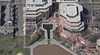 |
(#80004305) |
Address Restricted 38°48′50″N 77°02′19″W / 38.813856°N 77.038686°W |
|
| 2 | Alexandria City Hall | 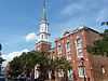 |
(#84003491) |
301 King St. 38°48′18″N 77°02′37″W / 38.805°N 77.043611°W |
|
| 3 | Alexandria Historic District | 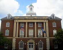 |
(#66000928) |
Bounded by 38°48′12″N 77°02′47″W / 38.803333°N 77.046389°W |
|
| 4 | Alexandria National Cemetery | 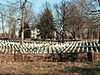 |
(#95000106) |
1450 Wilkes St. 38°48′07″N 77°03′30″W / 38.801944°N 77.058333°W |
part of the Civil War Era National Cemeteries Multiple Property Submission (MPS) |
| 5 | Alexandria Union Station | 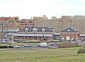 |
(#13000044) |
110 Callahan Dr. 38°48′23″N 77°03′44″W / 38.806419°N 77.062269°W |
|
| 6 | Alfred Street Baptist Church | 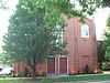 |
(#03001423) |
313 S. Alfred St. 38°48′09″N 77°03′00″W / 38.802594°N 77.049922°W |
part of the African American Historic Resources of Alexandria, Virginia MPS |
| 7 | Bank of Alexandria | 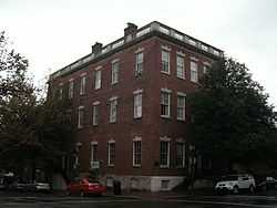 |
(#73002202) |
133 N. Fairfax St. 38°48′19″N 77°02′33″W / 38.805278°N 77.0425°W |
|
| 8 | Bayne-Fowle House | 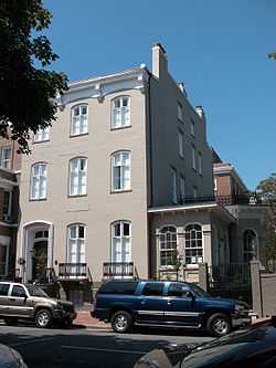 |
(#86003136) |
811 Prince St. 38°48′15″N 77°02′58″W / 38.804167°N 77.049444°W |
|
| 9 | Beulah Baptist Church | 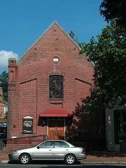 |
(#03001424) |
320 S. Washington St. 38°48′07″N 77°02′51″W / 38.801964°N 77.047422°W |
part of the African American Historic Resources of Alexandria, Virginia MPS |
| 10 | Bruin's Slave Jail | 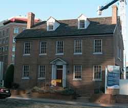 |
(#00000890) |
1707 Duke St. 38°48′15″N 77°03′32″W / 38.804167°N 77.058889°W |
|
| 11 | Carlyle House | 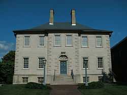 |
(#69000333) |
121 N. Fairfax St. 38°48′19″N 77°02′32″W / 38.805278°N 77.042222°W |
|
| 12 | Christ Church | .JPG) |
(#70000899) |
Southeast corner of Cameron and Columbus Sts. 38°48′23″N 77°02′51″W / 38.806314°N 77.047528°W |
|
| 13 | Contrabands and Freedmen Cemetery |  |
(#12000516) |
1001 S. Washington St. 38°47′40″N 77°02′59″W / 38.794567°N 77.049676°W |
|
| 14 | Davis Chapel | 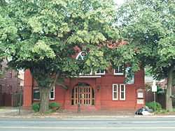 |
(#03001428) |
606-A S. Washington St. 38°47′56″N 77°02′52″W / 38.798842°N 77.047897°W |
part of the African American Historic Resources of Alexandria, Virginia MPS |
| 15 | Fairfax-Moore House |  |
(#90002113) |
207 Prince St. 38°48′12″N 77°02′34″W / 38.803333°N 77.042778°W |
|
| 16 | President Gerald R. Ford, Jr. House |  |
(#85003048) |
514 Crown View Dr. 38°48′48″N 77°04′47″W / 38.813378°N 77.079661°W |
|
| 17 | Fort Ward | .JPG) |
(#82004538) |
4301 W. Braddock Rd. 38°49′50″N 77°06′08″W / 38.830556°N 77.102222°W |
|
| 18 | Franklin and Armfield Office |  |
(#78003146) |
1315 Duke St. 38°48′14″N 77°03′17″W / 38.803889°N 77.054722°W |
|
| 19 | Gadsby's Tavern |  |
(#66000913) |
128 N. Royal St. 38°48′20″N 77°02′38″W / 38.805556°N 77.043889°W |
|
| 20 | Charles M. Goodman House | (#13000334) |
510 N. Quaker Ln. 38°48′51″N 77°05′23″W / 38.81409°N 77.08970°W |
||
| 21 | Moses Hepburn Rowhouses |  |
(#03001426) |
206-212 N. Pitt St. 38°48′23″N 77°02′40″W / 38.806344°N 77.044497°W |
part of the African American Historic Resources of Alexandria, Virginia MPS |
| 22 | Dr. Albert Johnson House |  |
(#03001422) |
814 Duke St. 38°48′10″N 77°02′57″W / 38.802897°N 77.049203°W |
part of the African American Historic Resources of Alexandria, Virginia MPS |
| 23 | Jones Point Lighthouse and District of Columbia South Cornerstone | 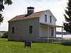 |
(#80000352) |
Jones Point Park 38°47′25″N 77°02′26″W / 38.790278°N 77.040556°W |
|
| 24 | Robert E. Lee Boyhood Home | 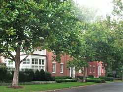 |
(#86001228) |
607 Oronoco St. 38°48′35″N 77°02′44″W / 38.809722°N 77.045556°W |
|
| 25 | Lee-Fendall House |  |
(#79003277) |
614 Oronoco St. 38°48′33″N 77°02′46″W / 38.809167°N 77.046111°W |
|
| 26 | Lloyd House | .jpg) |
(#76002222) |
220 N. Washington St. 38°48′25″N 77°02′49″W / 38.806944°N 77.046944°W |
|
| 27 | The Lyceum | .jpg) |
(#69000334) |
201 S. Washington St. 38°48′13″N 77°02′51″W / 38.803697°N 77.047442°W |
|
| 28 | Mount Vernon Memorial Highway | 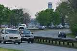 |
(#81000079) |
Washington St. and George Washington Memorial Pkwy. 38°46′35″N 77°03′13″W / 38.776389°N 77.053611°W |
|
| 29 | Odd Fellows Hall |  |
(#03001427) |
411 S. Columbus St. 38°48′05″N 77°02′56″W / 38.801467°N 77.049022°W |
part of the African American Historic Resources of Alexandria, Virginia MPS |
| 30 | Old Dominion Bank Building | 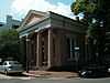 |
(#80004307) |
201 Prince St. 38°48′12″N 77°02′31″W / 38.803306°N 77.041867°W |
|
| 31 | Orange and Alexandria Railroad Hooff's Run Bridge | 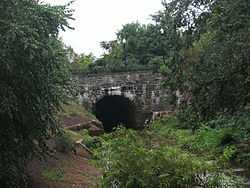 |
(#03000740) |
Jamieson Ave. at Hooff's Run 38°48′10″N 77°03′32″W / 38.802778°N 77.058889°W |
|
| 32 | Parkfairfax Historic District | 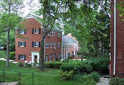 |
(#99000146) |
Bounded by Quaker Ln., US 395, Beverley Dr., Wellington Rd., Gunston Rd., Virginialley Dr., Glebe Rd. and Four-mile Run 38°50′12″N 77°04′48″W / 38.836667°N 77.08°W |
|
| 33 | Old Presbyterian Meeting House | 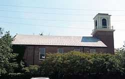 |
(#01000143) |
321 S. Fairfax St. 38°48′05″N 77°02′38″W / 38.801389°N 77.043889°W |
|
| 34 | Protestant Episcopal Theological Seminary | 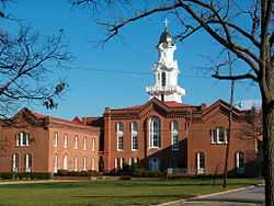 |
(#80004166) |
3737 Seminary Rd. 38°49′12″N 77°05′32″W / 38.82°N 77.092222°W |
|
| 35 | Rosemont Historic District | _02.JPG) |
(#92001275) |
Roughly bounded by Commonwealth AVe., W. Walnut St., Russell Rd., Rucker Pl. and King St. 38°48′38″N 77°03′50″W / 38.810556°N 77.063889°W |
|
| 36 | George Lewis Seaton House | 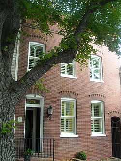 |
(#03001425) |
404 S. Royal St. 38°48′03″N 77°02′39″W / 38.800953°N 77.044289°W |
part of the African American Historic Resources of Alexandria, Virginia MPS |
| 37 | Southwest No. 1 Boundary Marker of the Original District of Columbia | 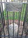 |
(#91000006) |
1220 Wilkes St. 38°48′05″N 77°03′15″W / 38.801317°N 77.054269°W |
part of the Boundary Markers of the Original District of Columbia MPS |
| 38 | Southwest No. 2 Boundary Marker of the Original District of Columbia | 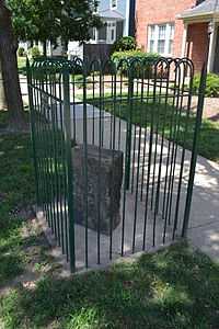 |
(#91000007) |
7 Russell Rd., on east side, north of the junction with King St. 38°48′32″N 77°03′45″W / 38.808889°N 77.0625°W |
part of the Boundary Markers of the Original District of Columbia MPS |
| 39 | Southwest No. 3 Boundary Marker of the Original District of Columbia | 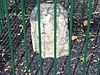 |
(#91000008) |
2952 King St. 38°49′14″N 77°04′46″W / 38.820643°N 77.079318°W |
part of the Boundary Markers of the Original District of Columbia MPS |
| 40 | Southwest No. 4 Boundary Marker of the Original District of Columbia |  |
(#91000009) |
King St. north of the junction with Wakefield St. 38°49′54″N 77°05′32″W / 38.831667°N 77.092222°W |
part of the Boundary Markers of the Original District of Columbia MPS |
| 41 | Southwest No. 5 Boundary Marker of the Original District of Columbia | 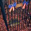 |
(#91000010) |
Northeast of the junction of King St. and Walter Reed Dr. 38°50′31″N 77°06′22″W / 38.841944°N 77.106111°W |
part of the Boundary Markers of the Original District of Columbia MPS |
| 42 | St. Paul's Episcopal Church | 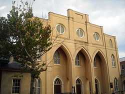 |
(#85000987) |
228 S. Pitt St. 38°48′09″N 77°02′43″W / 38.8025°N 77.045278°W |
|
| 43 | Stabler-Leadbeater Apothecary Shop | .jpg) |
(#82001796) |
105-107 S. Fairfax 38°48′15″N 77°02′35″W / 38.804167°N 77.043056°W |
|
| 44 | Town of Potomac |  |
(#92001186) |
Roughly bounded by Commonwealth Ave., US 1, E. Bellefonte Ave. and Ashby Ave. 38°49′37″N 77°03′24″W / 38.826944°N 77.056667°W |
|
| 45 | Uptown-Parker-Gray Historic District | 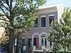 |
(#09001232) |
Roughly Cameron St. north to 1st St. and N. Columbus St.; west to the following streets forming west line: Buchanan St. and N. West St. 38°48′41″N 77°03′02″W / 38.811358°N 77.050675°W |
See also
| Wikimedia Commons has media related to National Register of Historic Places in Alexandria, Virginia. |
- National Register of Historic Places listings in Virginia
- National Register of Historic Places listings in Fairfax County, Virginia
- List of National Historic Landmarks in Virginia
References
- ↑ The latitude and longitude information provided in this table was derived originally from the National Register Information System, which has been found to be fairly accurate for about 99% of listings. For about 1% of NRIS original coordinates, experience has shown that one or both coordinates are typos or otherwise extremely far off; some corrections may have been made. A more subtle problem causes many locations to be off by up to 150 yards, depending on location in the country: most NRIS coordinates were derived from tracing out latitude and longitudes off of USGS topographical quadrant maps created under the North American Datum of 1927, which differs from the current, highly accurate WGS84 GPS system used by most on-line maps. Chicago is about right, but NRIS longitudes in Washington are higher by about 4.5 seconds, and are lower by about 2.0 seconds in Maine. Latitudes differ by about 1.0 second in Florida. Some locations in this table may have been corrected to current GPS standards.
- ↑ "National Register of Historic Places: Weekly List Actions". National Park Service, United States Department of the Interior. Retrieved on February 7, 2014.
- ↑ Numbers represent an ordering by significant words. Various colorings, defined here, differentiate National Historic Landmarks and historic districts from other NRHP buildings, structures, sites or objects.
- ↑ "National Register Information System". National Register of Historic Places. National Park Service. 2008-04-24.
- ↑ The eight-digit number below each date is the number assigned to each location in the National Register Information System database, which can be viewed by clicking the number.

This article is issued from Wikipedia. The text is available under the Creative Commons Attribution/Share Alike; additional terms may apply for the media files.