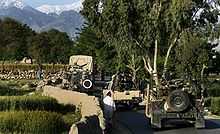
Nangarhar Province
| Nangarhar ننګرهار | |
|---|---|
| Province | |
 | |
| Coordinates (Capital): 34°15′N 70°30′E / 34.25°N 70.50°ECoordinates: 34°15′N 70°30′E / 34.25°N 70.50°E | |
| Country | Afghanistan |
| Capital | Jalalabad |
| Government | |
| • Governor | Mulawee Attaullah ludin |
| Area | |
| • Total | 7,727 km2 (2,983 sq mi) |
| Population (2010)[1] | |
| • Total | 1,283,900 |
| • Density | 170/km2 (430/sq mi) |
| Time zone | GMT+4:30 |
| ISO 3166 code | AF-NAN |
| Main languages | Pashto |
Nangarhar (Pashto: ننګرهار and Persian: ننگرهار ; Nangarhār) is one of the 34 provinces of Afghanistan in the east of the country. Its capital is the city of Jalalabad. The population of the province is 1,383,900,[1] consisting of ethnic Pashtuns, Arabs, Pashais, Tajiks and others.[2] Wahara means place of prayers and worship which is present in the name of a number of cities as a suffix such as Kandahar, Nangarhar, Binhar, etc. it comes from the Buddhist term for Vihara.
History
Song Yun, a Chinese monk visited Nangarhar in 520 A.D. The people were Buddhists. Song Yun saw in Nangarhar (Na-lka-lo-hu) the temple containing the skull of Buddha in Hadda, and the monastery of Kekalam (probably the Mehterlam of Laghman) where 13 pieces of the cloak of Buddha and his 18 feet long mast were preserved. In the city of Naki, a tooth and hair of Buddha were preserved and in the Kupala cave Buddha’s shadow reflected close to which he saw a stone tablet which was at that time considered to be related to Buddha[vi] (probably the stone tablet of Ashoka in Darunta).[3] The region was slowly Islamised by preachings and conquests.
Governors
Geopolitical and military situation

Nangarhar shares a border with neighboring Khyber Pakhtunkhwa in Pakistan, and the two regions share very close ties, with significant travel and commerce in both directions.
The United States armed forces and the multi-national coalition forces, ISAF, are active in the area. The Shinwar district of Nangarhar was the site of the 2007 Shinwar shootings and the Dih Bala district was the site of the Deh Bala wedding party bombing.
Incidents
The province was where Osama bin Laden was cornered in the 2001 Tora Bora campaign.[4] He ultimately escaped to Abottabad, Pakistan, where he was killed by members of the United States Navy SEALs in 2011.
Shinwar shooting
On March 4, 2007, F platoon of the US Marine Corps Special Operations Company killed as many as 19 civilians, and injured as many as 50, while fleeing the site of a bombing.[5]
Deh Bala wedding party bombing
On 6 July 2008, the United States military bombed a wedding in the Dih Bala district of Nangarhar province, killing 47 civilians.
Economy and poppy production
Once a major center of opium poppy production in Afghanistan, the province had reportedly decreased its production of poppy by up to 95% in 2005, one of the success stories of the Afghan eradication program. However, the eradication program has often left peasant farmers destitute and, in 2006, farmers were reported to have surrendered their children to opium dealers in payment on their debts.
Opium cultivation
The illicit poppy cultivation takes place in Khogiani, Ghanikhil, Chaparhar, and other remote districts. The farmers cite the lack of water and also poverty as the reasons for poppy cultivation. Poppy was also cultivated in Goshta District, Lalpura which borders Pakistan; but now the people just cultivate wheat and other legal crops.[citation needed]
Districts

Nangarhar province is administratively subdivided into 22 districts, these are:
| District | Capital | Population[6] | Area[7] | Notes |
|---|---|---|---|---|
| Dih Bala | 33,294 | 100% Pashtun, | ||
| Achin | 95,468 | |||
| Bihsud | 118,934 | 80% Pahtun, 20% Arab | ||
| Chaparhar | 57,339 | Pashtun | ||
| Dara-I-Nur | 98,202 | 30% pashtun, 70% Pashias | ||
| Bati Kot | 31,308 | Pashtun | ||
| Dur Baba | 13,479 | 100 % Pashtun | ||
| Goshta | 31,130 | |||
| Hisarak | 28,376 | 100% Pashtun | ||
| Jalalabad | 205,423 | Pashtun, Tajik, Arab, Pashias | ||
| Kama | 52,527 | 100 % pashtun | ||
| Khogyani | 111,479 | pashtun | ||
| Kot | 52,154 | Created in 2005 within Rodat District | ||
| Kuz Kunar | 42,823 | 80% Pashtun, 15% Pashias | ||
| Lal Pur | 18,997 | |||
| Momand Dara | 42,103 | |||
| Nazyan | 16,328 | |||
| Pachir Aw Agam | 40,141 | |||
| Rodat | 63,357 | Sub-divided in 2005 | ||
| Sherzad | 63,232 | |||
| Shinwar | 64,872 | |||
| Surkh Rod | 91,548 | 95% pashtun, 5% Tajik |
Sports
The province is represented in domestic cricket competitions by the Nangarhar province cricket team. National team member Hamid Hasan was born in the province and he currently represents Afghanistan in international cricket.
References
- ↑ 1.0 1.1 Afghanistan Statistical Yearbook 2010/11 (PDF), Central Statistics Office Afghanistan
- ↑ "Cultural and Conflict Studies, Nangarhar Province". Nps.edu. Retrieved 2013-03-13.
- ↑ Chinese Travelers in Afghanistan. Alamahabibi.com. Retrieved on 2013-07-12.
- ↑
- ↑ Stars and Stripes, Mideast edition, Friday, March 9, 2007
- ↑ "MRRD Provincial profile for Nangarhar Province". Mrrd.gov.af. 2013-02-28. Retrieved 2013-03-13.
- ↑ Andrew Ross. "Afghanistan Geographic & Thematic Layers". Fao.org. Retrieved 2013-03-13.
External links
| Wikimedia Commons has media related to Nangarhar Province. |
- Map of Nangarhar province (PDF)
- Nangarhar Province - (US) Naval Postgraduate School
- Nangarhar Provincial Profile, Ministry of Rural Rehabilitation and Development
- Nangahar Aerial Pictures
- Nangarhar.org
 |
Laghman Province | Kunar Province |  | |
| Kabul Province | |
|||
| ||||
| | ||||
| Logar Province | Federally Administered Tribal Areas, |
