Mystic River Reservation
| Mystic River Reservation | |
| Metropolitan Park System of Greater Boston | |
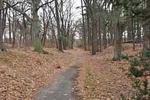
 A view of the park and the Mystic Valley Parkway in Arlington | |
| Country | United States |
|---|---|
| State | Massachusetts |
| Counties | Middlesex, Suffolk |
| Municipalities | Winchester Arlington Medford Somerville Everett Chelsea |
| Coordinates | 42°29′47.8″N 71°19′5.1″W / 42.496611°N 71.318083°W |
| Founded | 1893 |
| Management | Massachusetts Department of Conservation and Recreation |
 Location of Mystic River Reservation
| |
| Website: Mystic River Reservation | |

The Mystic River Reservation is a publicly owned nature preserve located along the Mystic River in eastern Massachusetts, United States. It forms part of the 75-square-mile (190 km2) Mystic River watershed, and runs through the towns of Winchester, Arlington, Medford, Somerville, Everett, and Chelsea.[1]
The reservation was established in 1893 by the newly formed Metropolitan Parks Commission (later renamed the Metropolitan District Commission),[2] making it one of the first official nature preserves in Massachusetts, and one of five designed by the commission in that year.[3] Of these five, three were planned as woodland river reservations: the Mystic River Reservation, Charles River Reservation, and Neponset River Reservation.[2] The Mystic River Reservation originally comprised a little over 100 hectares (250 acres) of land.[3]
By the early 20th century, most of the land along the Mystic River in Medford, Arlington, and Somerville had become public (i.e. state-owned) land.[1] The reservation is currently maintained by the Massachusetts Department of Conservation and Recreation (DCR) Bureau of Urban Parks and Recreation.[2]
The reservation includes four waterfront parks: Draw Seven Park in Somerville; Torbert MacDonald Park in Medford; the Mystic Lakes in Winchester, Arlington, and Medford; and Mary O'Malley Waterfront Park in Chelsea.[4] The reservation is open to the public year round, from dawn to dusk.[5]
In 2010, the DCR unveiled a plan for restoring and preserving the reservation, called the Mystic River Master Plan. Proposed projects include a partnership between the DCR and the City of Medford to restore the Condon Shell (an outdoor amphitheater located just outside Medford Square); restoration of the Amelia Earhart Dam Basin parklands; and a $3.6 million federally funded link between the reservation, the Minuteman Bikeway, and the Alewife "T" Station.[1]
References
- ↑ 1.0 1.1 1.2 Massachusetts Department of Conservation and Recreation (DCR) (2010-09-16). "State Releases Mystic River Master Plan" (Press release). InsideMedford.com. Retrieved 2011-05-28.
- ↑ 2.0 2.1 2.2 "Division of Urban Parks and Recreation History". Department of Conservation and Recreation. Archived from the original on 2013-03-10. Retrieved 2013-08-23.
- ↑ 3.0 3.1 Board of Paris Exposition Managers (Boston, Mass.); Massachusetts. Board of Metropolitan Park Commissioners (1900). A history and description of the Boston metropolitan parks. Published under the authority of the Metropolitan Park Commissioners by the Board of Paris Exposition Managers. pp. 1–. Retrieved 28 May 2011.
- ↑ "Mystic River Reservation". Somerville.patch.com Retrieved on 2011-05-28.
- ↑ "Mystic River Reservation". MassParks. Executive Office of Energy and Environmental Affairs, Department of Conservation and Recreation. Retrieved August 23, 2013.
External links
- Mystic River Reservation Department of Conservation and Recreation
- Map of Mystic River Reservation Department of Conservation and Recreation
- Reservation Bike Path Map Department of Conservation and Recreation
- Mystic River Watershed Organization
| |||||||||||||||||||||||||||||||||||||||||||||
| ||||||||||||||||||||