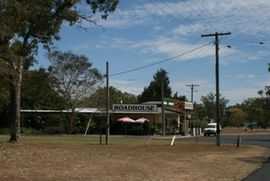
Mutchilba, Queensland
From Wikipedia, the free encyclopedia
| Mutchilba Queensland | |
|---|---|
 | |
 Mutchilba | |
| Coordinates | 17°08′S 145°13′E / 17.133°S 145.217°ECoordinates: 17°08′S 145°13′E / 17.133°S 145.217°E |
| Postcode(s) | 4872 |
| Elevation | 480 m (1,575 ft) |
| LGA(s) | Shire of Mareeba |
Mutchilba is a small farming settlement on the Atherton Tableland in Far North Queensland, Australia. It is within the local government area of Shire of Mareeba (between 2008 and 2013, it was within the Tablelands Region).
Geography
It is located on the Mareeba-Dimbulah Road 34 kilometres west of Mareeba. It is known for its large production of mangoes.
History
Established in 1923, the town was downgraded by the Mareeba Shire Council in 1999 and has been officially a part of Dimbulah, Queensland since then.[1]
On 12 October 2012 it was announced that the town is again officially recognised in the Queensland place names database.[2]
Mango Mardi Gras
Mutchilba is known for the "Mango Mardi Gras", which is a celebration of the many mango farms in the region.
References
- ↑ Wiped off the map, Mutchilba fights back stuff.co.nz, 11 July 2012
- ↑ Tony Moore, Mutchilba back on the map, The Age, 13 Oct 2012
| ||||||||||||||
This article is issued from Wikipedia. The text is available under the Creative Commons Attribution/Share Alike; additional terms may apply for the media files.