Muratlı Dam
From Wikipedia, the free encyclopedia
| Muratlı Dam | |
|---|---|
 | |
| Official name | Muratlı Barajı |
| Location | Muratlı village, Borçka, Artvin Province, Turkey |
| Coordinates | 41°28′6″N 41°42′48″E / 41.46833°N 41.71333°ECoordinates: 41°28′6″N 41°42′48″E / 41.46833°N 41.71333°E |
| Construction began | 1999 |
| Opening date | 2005 |
| Dam and spillways | |
| Impounds | Çoruh River |
| Height | 44 m (144 ft) |
| Reservoir | |
| Total capacity | 75 hm3 (61,000 acre·ft) |
| Surface area | 4 km2 (1.5 sq mi) |
| Power station | |
| Installed capacity | 115 MW |
| Annual generation | 444 GWh |
|
Website www.dsi.gov.tr | |
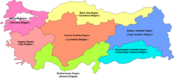
Muratlı Dam (Turkish: Muratlı Barajı) is a dam on the Çoruh River in Muratlı village, 12 km (7.5 mi) north east of Borçka in Artvin Province, Turkey. The development was backed by the Turkish State Hydraulic Works.[1]
See also
- Borçka Dam – upstream
- List of dams in Turkey
References
- ↑ "Muratlı Barajı" (in Turkish). Devlet Su İşleri Genel Müdürlüğü. Retrieved 2010-12-16.
This article is issued from Wikipedia. The text is available under the Creative Commons Attribution/Share Alike; additional terms may apply for the media files.
