Mumbra
| Mumbra | |
|---|---|
| suburb | |
 | |
 Mumbra | |
| Coordinates: 19°10′36″N 73°01′20″E / 19.176667°N 73.022222°ECoordinates: 19°10′36″N 73°01′20″E / 19.176667°N 73.022222°E | |
| Country | India |
| State | Maharashtra |
| District | Thane |
| Metro | Mumbai |
| Languages | |
| • Official | Marathi |
| Time zone | IST (UTC+5:30) |
| PIN | 400 612 |
| Telephone code | (022) 535, 549 and 546 |
| Vehicle registration | MH-04 |
| Lok Sabha constituency | Thane |
| Vidhan Sabha constituency | Kalwa - Mumbra |

Mumbra is a town and suburb of Thane district, in the state of Maharashtra, India. Within the greater Mumbai area, it is close to the cities of Thane and Diva.
History
Mumbra, it was named after Mumbra Devi, the prime deity of Koli and Agri tribes. The goddess temple is situated at the peak of the hill.[citation needed] During the 17th century Mumbra was small village of Koli and Agri (fishermen tribes).[citation needed]
Much of the land around Mumbra was agricultural land until 1975. Between 1968 and 1975, Mumbai experienced significant population growth and greater population density. Then, about 1975, Mumbra's agricultural land was urbanised. This signaled an expansion of the greater Mumbai area, which realized significant population growth in the 1980s.[2]
In 1991 there were about 44,000 people.[3] After the riots of 1992 many Muslims fled Mumbai and settled in Mumbra; there was also an influx of people from North India about that time.[1] According to Jitendra Ahwad, a Member of the Legislative Assembly (MLA), Mumbra's population is now more than 9 lakh (900,000) people.[3][nb 1] About 80% of Mumbra's residents are Muslim.[3][1]
Location
Mumbra is located 28 kilometres (17 mi) north east of Mumbai[4] on the western coast of India. It is near Thane - Navi Mumbai - Airoli node via the Old Mumbai Pune Highway, or National Highway 4.
Demographics
The population of mumbra is in thane urban aglomeration.
Transportation
Bus service is available through the Thane Municipal Transport (TMT), BEST Transport division and Navi Mumbai Municipal Transport (NMMT).[5][6] Rail service is available at the Mumbra railway station.[7] Mumbra is 29 kilometres (18 mi) from the Mumbai airport.[8]
Weather
Mumbra experiences typical coastal sultry and humid weather. The rainfall averages between 150 mm — 200 mm from the beginning of June through September. The temperature averages between 24–35 °C (75–95 °F) and the humidity ranges from 45% to 87%, the highest being in the month of August.[citation needed]
- See also: Thane district climate
Economy
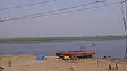
Mumbra's shipbuilding industry, the oldest in town, dates back to the Maratha era. Small ships, barges and tugboats are made and repaired in Mumbra. A larger employer is Bharat Gears Ltd, a Raunak Group enterprises, that makes gears for automobile companies. Scientific Devices makes measurement and control instruments for petroleum, chemical, food and cement industries. [citation needed]
The MEK Industrial Complex is an approved small industrial area with tax benefits. The Kausa-Sheel belt of Mumbra has medium-sized businesses.[citation needed]
There are a number of restaurants that cater to the Muslim community. There are also restaurants that serve Chinese, Arabic, grilled, and dessert foods. The increasing quality and range of foods is attracting people from neighboring cities and towns of Mumbai, Thane, Navi Mumbai, Kalwa, and Diva.[citation needed]
Media
Thane Plus is a daily hyperlocal newspaper, distributed with the Times of India, has about 1.3 lakh (130,000) readers. It covers – Thane, Kalwa and Mumbra. There are also several weekly local newspapers in Mumbra, including Mumbra Samachar, Buland Ujala, and Dhuandar Samachar.[citation needed]
National newspapers are circulated in the town, such as The Times Of India, Mid-Day, DNA, Hindustan Times, Indian Express, Urdu Times, and Inquilab.
Studies conducted on Mumbra
- Samant, Hrishikesh P. Subramanyan, V. (Guide), Geomorphic analysis of the Mumbai-Mumbra region and its applications using a geographic information system. - Ph.D.Thesis. (R) (Earth Science) Mumbai: IIT, 1996[citation needed]
- Investigation on landslides, Mumbra-Highway by pass (Mumbai, PWD).[citation needed]
- Environmental Monitoring Network of Maharashtra, Surface water locations for Thane Region, Mumbra (SWMP)[citation needed]
- Anas Parkar, Natural Therapy[citation needed]
- P.K. Shajahan, Social Topography article - Mumbra[citation needed]
- There Are Certain Colleges As A.E Kalsekar Degree College, D.R.T Junior College, S.N.M Girls Junior College, M.S College Of Law & Junior College, National College, ST. Mary's College and G.R patil College etc.
- Many Tutorials Are Available In Mumbra Such As Vision Tutorials Commerce (V.T.C) , Brilliant Classes Etc.
Gallery
-
Mumbra Sunset
-

The Green Side
-

Kausa Talao at Mumbra
-

The peak that stands uniquely tall
-

Amrut Nagar at Night
-

Ship Building Yard
See also
- 2013 Thane building collapse, which occurred in Shil Phata area
- Shil Phata, an area of Mumbra
Notes
References
- ↑ 1.0 1.1 1.2 "Lesson from Mumbra". Hindustan Times. 24 November 2011.
- ↑ United Nations Centre for Human Settlements (contributor) (1993). Metropolitan planning and management in the developing world: spatial decentralization policy in Bombay and Cairo. UN-HABITAT. pp. 39–40. ISBN 9211312337.
- ↑ 3.0 3.1 3.2 "Thane building collapse: Mumbra tragedy a fallout of illegal construction boom". Indian Express. 9 April 2013. Retrieved 9 April 2013.
- ↑ "Mumbra Mumbai Distance". Distances Between. Retrieved 9 April 2013.
- ↑ "New BEST service from Mumbra to Kurla station". Mumbra Mirror. 5 September 2010. Retrieved 9 April 2013.
- ↑ "Direct Mumbra-Vashi bus service from today". Times of India. 5 October 2008. Retrieved 8 April 2013.
- ↑ "Mumbra Local Station Information". Mumba Life Life. Retrieved 9 April 2013.
- ↑ "Distance from Mumbra to domestic airport at Mumbai". Distances Between. Retrieved 9 April 2013.
External links
| Wikimedia Commons has media related to Mumbra. |
| ||||||||||||||||||||||||||||||||||||||||
