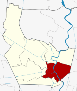
Mueang Nonthaburi District
| Mueang Nonthaburi เมืองนนทบุรี | |
|---|---|
| Amphoe | |
 | |
| Coordinates: 13°51′44″N 100°30′48″E / 13.86222°N 100.51333°ECoordinates: 13°51′44″N 100°30′48″E / 13.86222°N 100.51333°E | |
| Country |
|
| Province | Nonthaburi |
| Seat | Bang Kraso |
| Tambon | 10 |
| Muban | 26 (administrative) |
| Area | |
| • Total | 77.01 km2 (29.73 sq mi) |
| Population (2008) | |
| • Total | 353,923 |
| • Density | 4,591.33/km2 (11,891.5/sq mi) |
| Time zone | THA (UTC+7) |
| Postal code | 11000 |
| Geocode | 1201 |
Mueang Nonthaburi (Thai: เมืองนนทบุรี; IPA: [mɯ̄aŋ nōntʰáʔbūrīː]) is the capital district (amphoe mueang) of Nonthaburi province in Thailand. The city of Nonthaburi has 267,001 inhabitants, while the whole district has 348,553.
History
The district was originally named Talat Khwan. Simon de la Loubère, who was a French envoy extraordinary to the king of Ayutthaya, wrote in his book about Talat Khwan (Talacoan) as a principal place of the Chaophraya river side.[1] However, it is unknown what year it was established. In 1917, the provincial administration of Nonthaburi was moved into the district, and thus the district was renamed to Mueang Nonthaburi. From January 1, 1943 till May 9, 1946, the province Nonthaburi was abolished and split between Thonburi and Phra Nakhon province, thus the district, which was then under Phra Nakhon province, was renamed to simply Nonthaburi.[2] After the recreation of the province, it changed back to be Mueang Nonthaburi.[3]
Administration
The district is subdivided into 10 subdistricts (tambon), which are further subdivided into 70 villages (muban). The city (thesaban nakhon) of Nonthaburi covers the tambon Suan Yai, Talat Khwan, Bang Khen, Bang Kraso and Tha Sai. Bang Si Mueang has town status (thesaban mueang) and covers the tambon Bang Si Mueang and Bang Krang. Sai Ma has township status (thesaban tambon) and covers the same-named tambon.
| No. | Name | Thai | Inh. | Villages |
|---|---|---|---|---|
| 1. | Suan Yai | สวนใหญ่ | 39,270 | 9 |
| 2. | Talat Khwan | ตลาดขวัญ | 55,298 | 11 |
| 3. | Bang Khen | บางเขน | 42,819 | 9 |
| 4. | Bang Kraso | บางกระสอ | 55,574 | 9 |
| 5. | Tha Sai | ท่าทราย | 73,827 | - |
| 6. | Bang Phai | บางไผ่ | 8,027 | 5 |
| 7. | Bang Si Mueang | บางศรีเมือง | 21,986 | 5 |
| 8. | Bang Krang | บางกร่าง | 22,095 | 10 |
| 9. | Sai Ma | ไทรม้า | 17,261 | 6 |
| 10. | Bang Rak Noi | บางรักน้อย | 15,344 | 6 |
References
- ↑ La Loubére, Simon de: A New Historical Relation of the Kingdom of Siam, London: 1693, p. 4
- ↑ "พระราชกฤษฎีกาเปลี่ยนชื่ออำเภอบางแห่ง พุทธศักราช ๒๔๘๖" (PDF). Royal Gazette (in Thai) 60 (3 ก): 103–105. January 12, 1943.
- ↑ "พระราชกฤษฎีกาเปลี่ยนชื่ออำเภอบางแห่ง พ.ศ. ๒๔๘๙" (PDF). Royal Gazette (in Thai) 63 (63 ก): 486–488. September 28, 1946.
External links
| |||||||||||||||||||
